Marion in McDowell County, North Carolina — The American South (South Atlantic)
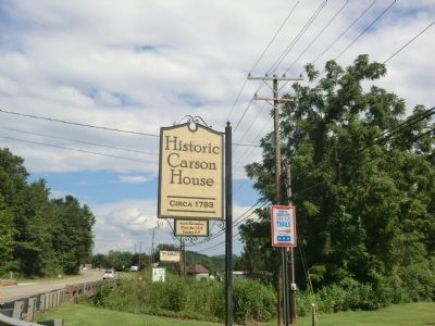
Carson House
"Horrid Blue Coats"
— Stoneman's Raid —
(preface)
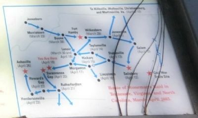
On March 24, 1865, Union Gen. George Stoneman led 6,000 cavalrymen from Tennessee into southwestern Virginia and western North Carolina to disrupt the Confederate supply line by destroying sections of the Virginia and Tennessee Railroad, the North Carolina Railroad, and the Piedmont Railroad. He struck at Boone on March 28, headed into Virginia on April 2, and returned to North Carolina a week later. Stoneman’s Raid ended at Asheville on April 26, the day that Confederate Gen. Joseph E. Johnston surrendered to Union Gen. William T. Sherman near Durham.
(main text)
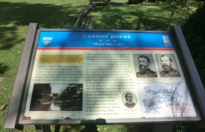
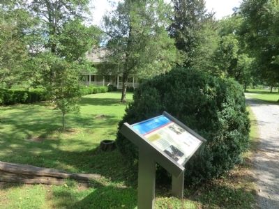
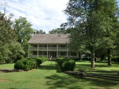
Union Gen. Alvan C. Gillem led two brigades of Gen. George Stoneman’s raiders here to the Jonathan Logan Carson house on April 19, 1865. News of the cavalry’s approach arrived before the Federals. The family buried some of its valuables in the forest and concealed others in a nearby cabin. Fearing for her husband’s life, Carson’s wife persuaded him to hide in the woods; loyal slaves remained here to protect the women and children.
To your left front, the raiders skirmished briefly with a few Confederate home guards, who quickly fled. Some of Gillem’s men rode into the house and plundered it, but one of the officers prevented the soldiers from burning the dwelling. The cavalrymen than camped here, receiving word of Gen. Robert E. Lee’s surrender in Virginia. They frightened the Carson family, as well as Emma Lydia Rankin, a schoolteacher boarding here. She later wrote, “By the time the little skirmish was over the horrid blue coats were swarming in and through and around the house.” At times it seemed that “there were about a million of them” roaming the grounds. Soon, however, they were gone, riding toward Asheville. Blocked at Swannanoa Gap, Gillem turned south to Rutherfordton.
(captions)
(lower left) Buck Creek Ford and road, where Stoneman’s Raiders crossed, ca. 1908. Courtesy Carson House
(lower center) Emma Lydia Rankin, ca.1908 Courtesy Carson House
(upper right) Gen. George Stoneman Courtesy Library of Congress; Gen. Alvan C. Gillem Courtesy Library of Congress
(lower right) Route of Stoneman’s Raid in Tennessee, Virginia, and North Carolina, March-April 1865.
Erected by North Carolina Civil War Trails.
Topics and series. This historical marker is listed in this topic list: War, US Civil. In addition, it is included in the North Carolina Civil War Trails series list. A significant historical month for this entry is March 1769.
Location. 35° 41.466′ N, 82° 3.448′ W. Marker is in Marion, North Carolina, in McDowell County. Marker can be reached
from U.S. 70, 0.2 miles east of Lake Tahoma Road (North Carolina Highway 80), on the right when traveling east. Touch for map. Marker is at or near this postal address: 1805 US 70W, Marion NC 28752, United States of America. Touch for directions.
Other nearby markers. At least 8 other markers are within 3 miles of this marker, measured as the crow flies. A different marker also named Carson House (about 400 feet away, measured in a direct line); Pleasant Gardens (approx. 1.6 miles away); Lone Beech (approx. 2½ miles away); First Presbyterian Church (approx. 2.6 miles away); Roy Williams (approx. 2.7 miles away); M/Sgt. Shufford Cline Rowe (approx. 2.8 miles away); McDowell County War Memorial (approx. 2.8 miles away); McDowell County Courthouse (approx. 2.8 miles away). Touch for a list and map of all markers in Marion.
Also see . . . Historic Carson House. (Submitted on September 26, 2014.)
Credits. This page was last revised on October 30, 2022. It was originally submitted on September 25, 2014, by Don Morfe of Baltimore, Maryland. This page has been viewed 670 times since then and 21 times this year. Last updated on October 29, 2022, by Carl Gordon Moore Jr. of North East, Maryland. Photos: 1, 2, 3, 4, 5. submitted on September 25, 2014, by Don Morfe of Baltimore, Maryland. • Bernard Fisher was the editor who published this page.
