Merriam in Johnson County, Kansas — The American Midwest (Upper Plains)
Shawnee Friends Mission
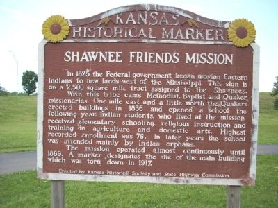
With this tribe came Methodist, Baptist and Quaker missionaries. One mile east and a little north the Quakers erected buildings in 1836 and opened a school the following year. Indian students, who lived at the mission received elementary schooling, religious instruction and training in agriculture and domestic arts. Highest recorded enrollment was 76. In later years the school was attended by Indian orphans.
The mission operated almost continously until 1869. A marker designates the site of the main building which was torn down in 1917.
Erected 1938 by Kansas Historical Society and State Highway Commission. (Marker Number 1.)
Topics and series. This historical marker is listed in these topic lists: Agriculture • Churches & Religion • Education • Native Americans • Notable Places. In addition, it is included in the Kansas Historical Society, and the Quakerism series lists. A significant historical year for this entry is 1825.
Location. 39° 0.86′ N, 94° 41.912′ W. Marker is in Merriam, Kansas, in Johnson County. Marker is on 63rd Terrace, 0.1 miles west of Carter Avenue, on the right when traveling west. Touch for map. Marker is in this post office area: Shawnee KS 66203, United States of America. Touch for directions.
Other nearby markers. At least 8 other markers are within walking distance of this marker. The People of the South Wind & the Coming of the Shawnee (approx. 0.4 miles away); a different marker also named Shawnee Friends Mission (approx. 0.4 miles away); The Overland Trails (approx. 0.4 miles away); The Founding of Campbellton (approx. 0.4 miles away); Merriam Park & George Kessler (approx. 0.4 miles away); The Trolley Line & Hocker Grove Amusement Park (approx. 0.4 miles away); Westport - Santa Fe Trail - Oregon / California Trail (approx. 0.4 miles away); The Bear Pit (approx. 0.4 miles away). Touch for a list and map of all markers in Merriam.
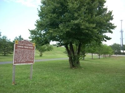
More about this marker. Park at Chatlain Park and cross 63rd Terrace to the marker.
Also see . . .
1. Explore Merriam, Kansas. Replaced broken link; 01/06/2022 LPG. (Submitted on January 6, 2022, by Larry Gertner of New York, New York.)
2. Kansas Historical Markers. Link to the Offical Kansas State Website to the Historical Markers. Listed is the Shawnee Indian Mission with a link to this site. (Submitted on July 17, 2009, by Thomas Onions of Olathe, Kansas.)
Credits. This page was last revised on January 6, 2022. It was originally submitted on July 17, 2009, by Thomas Onions of Olathe, Kansas. This page has been viewed 1,456 times since then and 83 times this year. Photos: 1, 2. submitted on July 17, 2009, by Thomas Onions of Olathe, Kansas. • Syd Whittle was the editor who published this page.

