Toms River in Ocean County, New Jersey — The American Northeast (Mid-Atlantic)
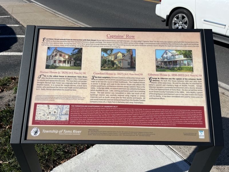
Captains' Row
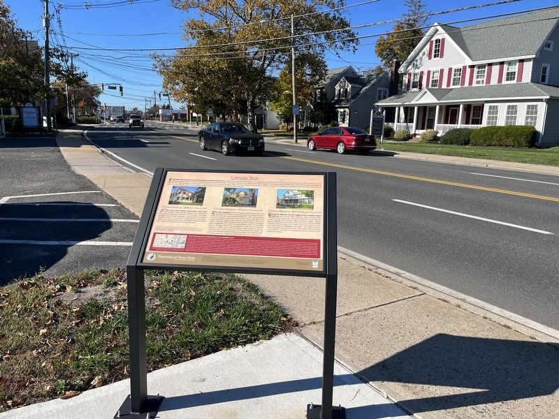
East Water Street extends from its intersection with Main Street (Route 166) to Dock Street, one half mile east. It is also called "Captain's Row" for the many sea captains who built their homes here in the 1800s so they would be near their docked schooners, sloops, and brigs. This street is located in the oldest section of the village. It encompasses both architecturally and historically significant buildings that date from 1824 to 1916. During that time, Toms River grew from a small maritime village into a flourishing county seat and a Victorian summer resort. Despite the rapid development of this area in the last half of the 20th century, many of the buildings along this street still maintain their architectural integrity.
Horner House (c. 1824) [44 E. Water St.] NR
this is the oldest house in downtown Toms River. After the British destroyed the village in 1782, it took years to rebuild and repopulate the area. This two-story vernacular1 Georgian Revival style house was originally built for Captain Stephen Gulick. It is named for Joseph Horner, a local store owner, who purchased the house and made several additions to it. Sadly, Horner died before he could live here.
1 Vernacular is an architectural term which refers to houses that are relatively plain in construction but embellished with decorative trim and constructed using local materials. Many Victorian houses dating from the mid 1800s into the early 1900s were built from "plan books" provided by architectural companies.
Crawford House (c. 1827) [46 E. Water Street] NR
Like their neighbors, Richard Crawford and Barzillar Grover were sea captains who built the second house on East Water Street in order to be near the source of their livelihoods. The Crawford House is similar in design and scale to the Horner House and reflects the simple wood frame architecture common along Captains' Row in the 1830s. In the late 1800s, an eastern extension was added to the house which doubled its size. Later, visiting yachtsmen used it as a rooming house. The east section was remodeled in 1929, but much of the building's interior was carefully restored using original or similar materials such as South Jersey pine for floor planks and beams. All new wood materials were cut and purchased from the Double Trouble Company (now a N.J. State Park in Berkeley and Lacey Townships).
Giberson House (c. 1850-1853) [54 E. Water St.] NR
George W. Giberson was the captain of the schooner North America. He built this house between 1850 and 1853 from Atlantic white cedar trees. He sold his
The Formation and Disappearance of Cranberry Inlet
Coastal maps of the New Jersey shoreline drawn before 1750 do not show an inlet that appears on later coastal maps. NO one is sure what caused an inlet to form, but after searching historical data, researchers have theorized that a violent storm broke through the barrier island, known now as Island Beach, shortly after 1750. The storm created an inlet (between today's Ortley Beach and Seaside Heights) across from the mouth of the Toms River where it flowed into Barnegat Bay. New Inlet, as it was named at that time, was a major reason for the growth of the tiny colonial village of Toms' River and its protected river harbor located six miles west of the bay. The harbor provided as safe haven for cargo ships transporting goods along the Atlantic seaboard. The breach, renamed Cranberry Inlet, was considered one of the best places to enter Barnegat Bay from the Atlantic Ocean. During the Revolutionary War, the inlet was a significant convenience to ships' captains engaged in coastal trade and to other seamen, known as privateers. Privateers sailed vessels that were commissioned and armed as lookouts to watch for British merchant ships entering the bay and were authorized to capture their cargos. Sixty years later, the inlet closed in the same way that it had been created — from another fierce storm. Although there were many attempts to dig out Cranberry Inlet, all efforts failed to maintain it as a usable opening to and from the ocean. Its closing was a major inconvenience to those engaged in coastal trade. Ships were forced to sail miles out of their way to the more dangerous Barnegat Inlet at the southern end of Island Beach. While this may have been a nuisance and slowed the growth of Toms River, the village was not abandoned even during the years following its tragic destruction in 1782 at the end of the Revolutionary War and the inlet's disappearance in 1812.
Erected 2019 by Township of Toms River Historic Preservation Commission.
Topics. This historical marker is listed in these topic lists: Architecture • Industry & Commerce • Settlements & Settlers • War, US Revolutionary • Waterways & Vessels. A significant historical year for this entry is 1824.
Location. 39° 57.051′ N, 74° 11.746′ W. Marker is in Toms River, New Jersey, in Ocean County. Marker is at the intersection of East Water Street and Allen Street, on the right when traveling east on East Water Street. Touch for map. Marker is at or near this postal address: 67 E Water St, Toms River NJ 08753, United States of America. Touch for directions.
Other nearby markers. At least 8 other markers are within walking distance of this marker. More Maritime Legacies (here, next to this marker); Anchor from the Aircraft Carrier USS Randolph CV-15 (about 400 feet away, measured in a direct line); Captain Joshua Huddy (about 500 feet away); The Industrial Age Transforms the Colonial Village (about 500 feet away); Historic Site (about 600 feet away); Toms River Block House (about 600 feet away); Preserving Baymen Heritage (about 600 feet away); Welcome to Joshua Huddy Park (about 600 feet away). Touch for a list and map of all markers in Toms River.
Credits. This page was last revised on November 2, 2022. It was originally submitted on November 2, 2022, by Devry Becker Jones of Washington, District of Columbia. This page has been viewed 119 times since then and 38 times this year. Photos: 1, 2. submitted on November 2, 2022, by Devry Becker Jones of Washington, District of Columbia.

