Monroe in Monroe County, Michigan — The American Midwest (Great Lakes)
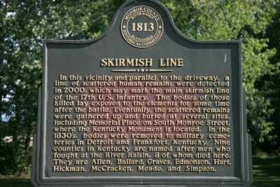
Skirmish Line
Erected by Monroe County Historical Commission.
Topics. This historical marker is listed in these topic lists: Cemeteries & Burial Sites • War of 1812. A significant historical year for this entry is 2000.
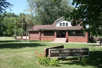
Location. 41° 54.687′ N, 83° 22.516′ W. Marker is in Monroe, Michigan, in Monroe County. Marker can be reached from East Elm Street, 0.1 miles west of Detroit Avenue. To view this historical marker exit Interstate 75 at Elm Street Monroe, Michigan exit on the north side of the River Raisin. Proceed west on East Elm Street for 0.5 mile and you should arrive at the River Raisin Battlefield Visitor Center, on your right (the north side of the road). This historical marker, along with several others, is located behind the visitor center in the parking lot area. Touch for map. Marker is at or near this postal address: 1403 East Elm Street, Monroe MI 48162, United States of America. Touch for directions.
Other nearby markers. At least 8 other markers are within walking distance of this marker. Battle of the River Raisin Memorial Bench (within shouting distance of this marker); Roundhead (within shouting distance of this marker); After the Battle (within shouting distance of this marker); U.S. 17th Infantry Campsite (within shouting distance of this marker); a different marker also named Battle of the River Raisin Memorial Bench (about 300 feet away, measured in a direct line); a different marker also named Battle of the River Raisin Memorial Bench (about 300 feet away); a different marker also named Battle of the River Raisin Memorial Bench (about 300 feet away); Battles of the River Raisin (about 300 feet away). Touch for a list and map of all markers in Monroe.
Also see . . .
1. Battle of Frenchtown. (Submitted on July 18, 2009, by Dale K. Benington of Toledo, Ohio.)
2. Remember the River Raisin. This web link is published by "Michigan History Magazine." (Submitted on July 18, 2009, by Dale K. Benington of Toledo, Ohio.)
3. Battle of Frenchtown. This web link is published and made available by "Friends of the River Raisin

Photographed By Dale K. Benington, July 16, 2009
2. Skirmish Line Marker
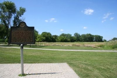
View of historical marker in the left foreground and a view, looking to the north, of where the U.S. 17th Infantry was encamped (probably just beyond the rail fence) and where the British launched their surprise counterattack (probably from the area of the trees beyond the open field).

Photographed By Dale K. Benington, July 16, 2009
3. Skirmish Line Marker
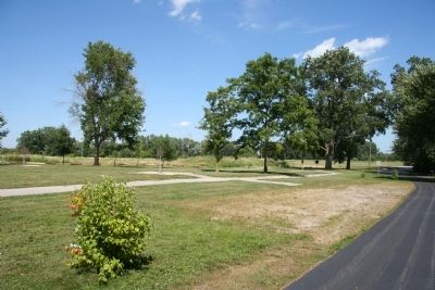
View of the historical marker (seen in the distant center of picture) and the probable skirmish line set up by the U.S. 17th Infantry to resist their attackers, probably stretching out in the area between the sidewalk and the driveway.
Credits. This page was last revised on June 16, 2016. It was originally submitted on July 18, 2009, by Dale K. Benington of Toledo, Ohio. This page has been viewed 1,422 times since then and 21 times this year. Photos: 1, 2, 3, 4. submitted on July 18, 2009, by Dale K. Benington of Toledo, Ohio. • Craig Swain was the editor who published this page.

