Surf City in Ocean County, New Jersey — The American Northeast (Mid-Atlantic)
Surf City
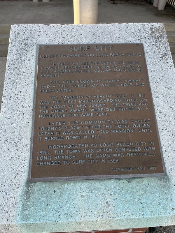
Oldest Community on Long Beach Island
To hunt whales the Soper and Inman families settled here in 1690 followed by the Cranmer, Rutter, Mullins and Stevens families.
This area known as "Great Swamp" had a tall forest of white cedar and fresh water.
The "Mansion of Health" built in 1821 was the first major boarding hotel on the coast of New Jersey. The trees and the Great Swamp was destroyed by a hurricane that same year.
Later the community was called "Buzby's Place" after the hotel owner. Later it was called "Old Mansion" until it burned down in 1874.
Incorporated as Long Beach City in 1875, the town was often confused with Long Branch. The name was officially changed to Surf City in 1894.
Erected 1989 by Taxpayers Association.
Topics. This historical marker is listed in these topic lists: Animals • Industry & Commerce • Natural Features • Settlements & Settlers • Waterways & Vessels. A significant historical year for this entry is 1690.
Location. 39° 39.621′ N, 74° 10.039′ W. Marker is in Surf City, New Jersey, in Ocean County. Marker is on Long Beach Boulevard (County Road 607) just south of North 9th Street, on the right when traveling south. Touch for map. Marker is at or near this postal address: 813 Long Beach Blvd, Beach Haven NJ 08008, United States of America. Touch for directions.
Other nearby markers. At least 8 other markers are within 6 miles of this marker, measured as the crow flies. USS Murphy (about 700 feet away, measured in a direct line); John L. Gutbrod, 1st Sgt., U.S. Army/Air Force (Ret.) (about 700 feet away); Borough of Surf City Veterans' Memorial Park (about 800 feet away); Louis D. Bonanni, Capt., USMC (Ret.) (about 800 feet away); Paul Carlock (about 800 feet away); Manahawkin Methodist Episcopal Church (approx. 5.2 miles away); Map of Manahawkin (1878) (approx. 5.2 miles away); Cavalry Cottage (C. 1740) (approx. 5.2 miles away). Touch for a list and map of all markers in Surf City.

Photographed By Devry Becker Jones (CC0), October 29, 2022
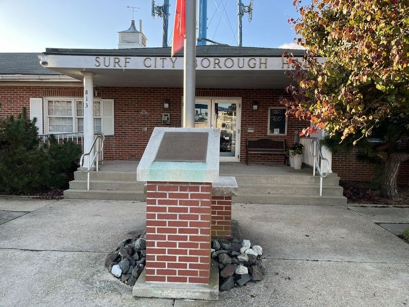
2. Surf City Marker in front of Surf City Borough Hall
Credits. This page was last revised on November 2, 2022. It was originally submitted on November 2, 2022, by Devry Becker Jones of Washington, District of Columbia. This page has been viewed 193 times since then and 60 times this year. Photos: 1, 2. submitted on November 2, 2022, by Devry Becker Jones of Washington, District of Columbia.
