Portland in San Patricio County, Texas — The American South (West South Central)
Reef Road
Inscription.
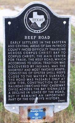
Early settlers in the eastern and central areas of San Patricio County faced difficulty traveling across Corpus Christi Bay to Corpus Christi, the main center for trade. The Reef Road, which according to local tradition was discovered by Indians, was the shortest and most favored route. Consisting of oyster shell reefs close to the water's surface, the road was passable only at low tide. Construction of the railroad (1887) and first causeway (1915) across the bay signalled a decline in usage of the road, but it remains an important part of the county's history.
Erected 1989 by Texas Historical Commission. (Marker Number 4225.)
Topics. This historical marker is listed in these topic lists: Environment • Settlements & Settlers • Waterways & Vessels.
Location. 27° 51.347′ N, 97° 21.189′ W. Marker is in Portland, Texas, in San Patricio County. Marker is at the intersection of U.S. 181 and Indian Point Pier, on the left when traveling south on U.S. 181. Touch for map. Marker is in this post office area: Portland TX 78374, United States of America. Touch for directions.
Other nearby markers. At least 8 other markers are within 4 miles of this marker, measured as the crow flies. Site of Indian Point Mass Grave of 1919 Hurricane Victims (approx. 0.2 miles away); Site of Bay View College (approx. 2.1 miles away); 1919 Storm (approx. 3.1 miles away); USS Lexington CV-16 (approx. 3.6 miles away); Rising Sun (approx. 3.6 miles away); Kamikaze (approx. 3.6 miles away); Chat Work Club (approx. 3.9 miles away); Nueces County (approx. 4 miles away). Touch for a list and map of all markers in Portland.
Credits. This page was last revised on November 12, 2022. It was originally submitted on November 3, 2022, by Dave W of Co, Colorado. This page has been viewed 129 times since then and 34 times this year. Photo 1. submitted on November 3, 2022, by Dave W of Co, Colorado. • Michael Herrick was the editor who published this page.
Editor’s want-list for this marker. A wide view photo of the marker and its surroundings. • Can you help?
