Near Dallas in Paulding County, Georgia — The American South (South Atlantic)
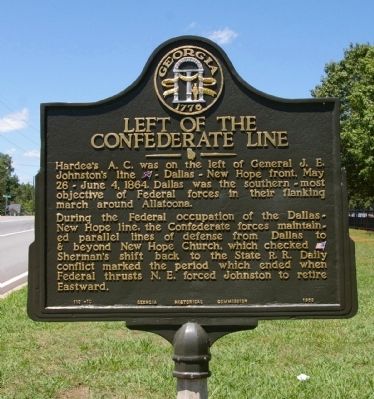
Left of the Confederate Line
During the Federal occupation of the Dallas - New Hope line, the Confederate forces maintained parallel lines of defense from Dallas to & beyond New Hope Church, which checked [US] Sherman’s shift back to the State R.R. Daily conflict marked the period which ended when Federal thrusts N.E. forced Johnston to retire Eastward.
Erected 1953 by Georgia Historical Commission. (Marker Number 110-10.)
Topics and series. This historical marker is listed in this topic list: War, US Civil. In addition, it is included in the Georgia Historical Society series list. A significant historical year for this entry is 1864.
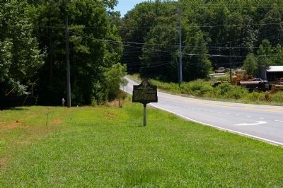
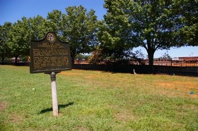
Location. 33° 53.515′ N, 84° 50.156′ W. Marker is near Dallas, Georgia, in Paulding County. Marker is on Villa Rica Highway (Georgia Route 61) 0 miles south of Aiken Drive, on the left when traveling south. The marker is in front of the Paulding County High School. Touch for map. Marker is at or near this postal address: 1297 Villa Rica Highway, Dallas GA 30157, United States of America. Touch for directions.
Other nearby markers. At least 8 other markers are within 3 miles of this marker, measured as the crow flies. Rt. of Federal Line May 26 -June 1, 1864 (approx. 0.8 miles away); Armstrong's Advance (approx. 1.1 miles away); Federal Line (approx. 1.6 miles away); Confederate Line (approx. 1.6 miles away); The Orphan Brigade at Dallas (approx. 2 miles away); Dallas (approx. 2 miles away); Paulding County (approx. 2.2 miles away); A. Lafayette Bartlett (approx. 2.3 miles away). Touch for a list and map of all markers in Dallas.
Credits. This page was last revised on June 16, 2016. It was originally submitted on July 19, 2009, by David Seibert of Sandy Springs, Georgia. This page has been viewed 1,267 times since then and 37 times this year. Photos: 1, 2, 3. submitted on July 19, 2009, by David Seibert of Sandy Springs, Georgia. • Craig Swain was the editor who published this page.


