Near Doswell in Hanover County, Virginia — The American South (Mid-Atlantic)
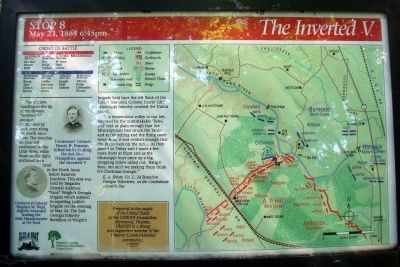
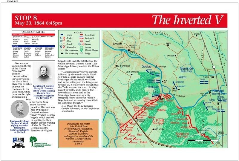
The Inverted V
May 23, 1864 6:45pm
| — | Gray Trail | — |
Photographed by Bernard Fisher, July 18, 2009
1. The Inverted V Marker
“...a tremendous volley to our left, followed by the unmistakable ‘Rebel yell’ told us plain enough that the Mississippians had struck the Yanks and as the yelling and the firing came towards us, it was evident enough that the Yanks were on the run.... As they passed us Tinley and I made a few more shots at them and as the Mississippi boys came up a big strapping fellow called out, ‘Bang it Boys, but ain’t we making them think it’s Christmas though.’” E. A. Shiver, Co. C, 2d Battalion Georgia Volunteers, on the Confederate skirmish line
(sidebar)
Presented
this page online
(captions)
Lieutenant Colonel Stephen M. Weld, slightly wounded leading the 56th Massachusetts at Ox Ford
Lieutenant Colonel Henry H. Pearson, killed while leading the 6th New Hampshire against the Inverted V
Erected 1998 by Blue & Gray Education Society, Hanover County Parks and Recreation Department. (Marker Number Stop 8.)
Topics. This historical marker is listed in this topic list: War, US Civil. A significant historical date for this entry is May 23, 1864.
Location. 37° 53.24′ N, 77° 29.601′ W. Marker is near Doswell, Virginia, in Hanover County. It can be reached from Verndon Road (Virginia Route 684) 0.2 miles west of New Market Mill Road ( Route 685), on the right when traveling west. Located along the "Gray Trail" in North Anna Battlefield Park. Touch for map. Marker is at or near this postal address: 11576 Verdon Rd, Doswell VA 23047, United States of America. Touch for directions.

Regionally, this marker is in the Piedmont, in Central Virginia, and in the Richmond
Photographed by Blue & Gray Education Society
2. The Inverted V Marker
Other nearby markers. At least 8 other markers are within walking distance of this marker: "Save yourselves if you can" (about 300 feet away, measured in a direct line); "Come on to Richmond" (about 500 feet away); One More River to Cross (about 500 feet away); Grant Reacts (about 600 feet away); Men From Massachusetts (about 600 feet away); Like the Coming of a Cyclone (about 600 feet away); Artillery Duel (about 700 feet away); Run for Safety (approx. 0.2 miles away). Touch for a list and map of all markers in Doswell.
Related markers. Click here for a list of markers that are related to this marker. North Anna Battlefield Park "Gray Trail" Markers
Also see . . .
1. North Anna Battlefield Park.
Photographed by Bernard Fisher, July 18, 2009
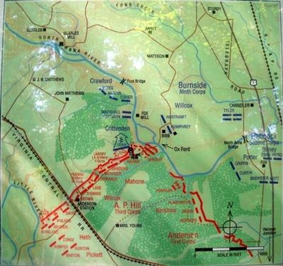
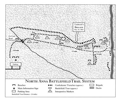
3. Stop 8 Map
2. The Battle of North Anna. Fredericksburg & Spotsylvania National Military Park (Submitted on July 19, 2009.)
3. North Anna. American Battlefield Trust (Submitted on July 19, 2009.)
4. North Anna Battlefield Park Sign Project. Blue & Gray Education Society (Submitted on February 25, 2020.)
Photographed by Bernard Fisher, July 18, 2009
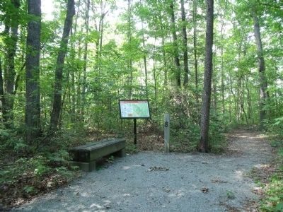
4. Stop 8
Photographed by Bernard Fisher, July 18, 2009
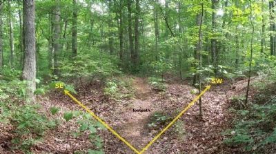
5. The tip of the the "Inverted V" (facing south).
The trenches on the right continued southwest to the Little River, while those on the left ran southeast towards Hanover Junction. The North Anna River and Ox Ford are to the rear of this vantage point.
Photographed by Bernard Fisher, July 18, 2009
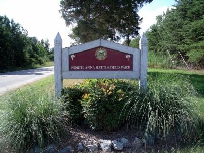
6. North Anna Battlefield Park Entrance (Verdon Rd)
The General Crushed Stone Company
7. North Anna Battlefield Park "Gray" Trail.
Credits. This page was last revised on August 14, 2021. It was originally submitted on July 19, 2009, by Bernard Fisher of Richmond, Virginia. This page has been viewed 1,645 times since then and 56 times this year. Photos: 1. submitted on July 19, 2009, by Bernard Fisher of Richmond, Virginia. 2. submitted on February 25, 2020. 3, 4, 5, 6, 7. submitted on July 19, 2009, by Bernard Fisher of Richmond, Virginia.
