Winslow in Navajo County, Arizona — The American Mountains (Southwest)
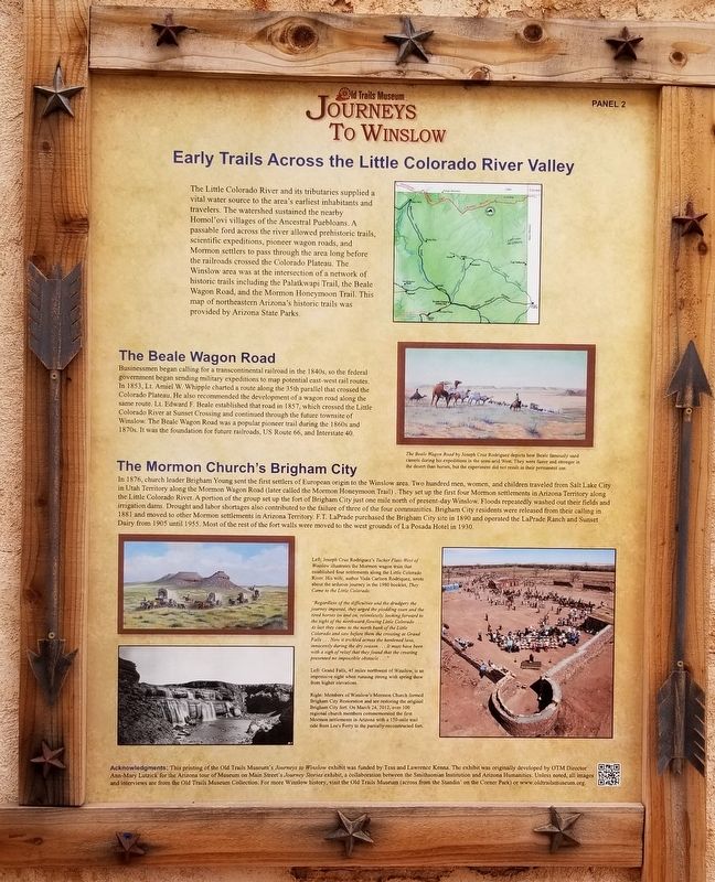
Early Trails Across the Little Colorado River Valley
Journeys to Winslow
Inscription.
The Little Colorado River and its tributaries supplied a vital water source to the area's earliest inhabitants and travelers. The watershed sustained the nearby Homol'ovi villages of the Ancestral Puebloans. A passable ford across the river allowed prehistoric trails, scientific expeditions, pioneer wagon roads, and Mormon settlers to pass through the area long before the railroads crossed the Colorado Plateau. The Winslow area was at the intersection of a network of historic trails including the Palatkwapi Trail, the Beale Wagon Road, and the Mormon Honeymoon Trail. This map of northeastern Arizona's historic trails was provided by Arizona State Parks.
The Beale Wagon Road
Businessmen began calling for a transcontinental railroad in the 1840s, so the federal government began sending military expeditions to map potential east-west rail routes. In 1853, Lt. Amiel W. Whipple charted a route along the 35th parallel that crossed the Colorado Plateau. He also recommended the development of a wagon road along the same route. Lt. Edward F. Beale established that road in 1857, which crossed the Little Colorado River at Sunset Crossing and continued through the future townsite of Winslow. The Beale Wagon Road was a popular pioneer trail during the 1860s and 1870s. It was the foundation for future railroads, US Route 66, and Interstate 40.
The Mormon Church's Brigham City
In 1876, church leader Brigham Young sent the first settlers of European origin to the Winslow area. Two hundred men, women, and children traveled from Salt Lake City in Utah Territory along the Mormon Wagon Road (later called the Mormon Honeymoon Trail). They set up the first four Mormon settlements in Arizona Territory along the Little Colorado River. A portion of the group set up the fort of Brigham City just one mile north of present-day Winslow. Floods repeatedly washed out their fields and irrigation dams. Drought and labor shortages also contributed to the failure of three of the four communities. Brigham City residents were released from their calling in 1881 and moved to other Mormon settlements in Arizona Territory. F.T. LaPrade purchased the Brigham City site in 1890 and operated the LaPrade Ranch and Sunset Dairy from 1905 until 1955. Most of the rest of the fort walls were moved to the west grounds of La Posada Hotel in 1930.
Captions
Upper Right: The Beale Wagon Road by Joseph Cruz Rodriguez depicts how Beale famously used camels during his expeditions in the semi-arid West. They were faster and stronger in the desert than horses, but the experiment did not result in their permanent use.
Middle Left: Left: Joseph Cruz Rodriguez's Tucker
Flats-West of Winslow illustrates the Mormon wagon train that established four settlements along the Little Colorado River. His wife, author Vada Carlson Rodriquez, wrote about the arduous journey in the 1980 booklet, They Came to the Little Colorado:
"Regardless of the difficulties and the drudgery the journey imposed, they urged the plodding oxen and the tired horses on and on, relentlessly, looking forward to the sight of the northward-flowing Little Colorado... At last they came to the north bank of the Little Colorado and saw before them the crossing at Grand Falls. Now it trickled across the hardened lava, innocently during the dry season... It must have been with a sigh of relief that they found that the crossing presented no impossible obstacle..."
Lower Left: Left: Grand Falls, 45 miles northwest of Winslow, is an impressive sight when running strong with spring thaw from higher elevations.
Lower Right: Right: Members of Winslow's Monnon Church formed Brigham City Restoration and are restoring the original Brigham City fort. On March 24, 2012, over 100 regional church members commemorated the first Mormon settlements in Arizona with a 150-mile trail ride from Lee's Ferry to the partially-reconstructed fort.
Acknowledgments: This printing of the Old Trails Museum's Journeys to Winslow exhibit was funded by Tess and Lawrence Kenna. The exhibit was originally developed by OTM Director Ann-Mary Lutzick for the Arizona tour of Museum on Main Street's Journey Stories exhibit, a collaboration between the Smithsonian Institution and Arizona Humanities. Unless noted, all images and interviews are from the Old Trails Museum Collection. For more Winslow history, visit the Old Trails Museum (across from the Standin' on the Corner Park) or www.oldtrailsmuseum.org.
Erected 2017 by Old Trails Museum - Winslow Historical Society. (Marker Number 2.)
Topics. This historical marker is listed in these topic lists: Churches & Religion • Immigration • Railroads & Streetcars • Roads & Vehicles. A significant historical year for this entry is 1853.
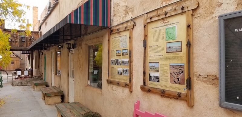
Location. 35° 1.39′ N, 110° 41.84′ W. Marker is in Winslow, Arizona, in Navajo County. Marker can be reached from East 2nd Street, 0.1 miles east of North Kinsley Avenue. The marker is located in an alley way between two buildings. Touch for map. Marker is at or near this postal address: 116 East 2nd Street, Winslow AZ 86047, United States of America. Touch for directions.
Other nearby markers. At least 8 other markers are within walking distance of this marker. The First Peoples of the Southwestern Colorado Plateau (here, next to this marker); The Railroads Build a Town: Early Days (a few steps from this marker); The Railroads Build a Town: Early Industry (a few steps from this marker); A City in Motion: The Heyday of the Santa Fe Railway (a few steps from this marker); A City in Motion: Modern Modes (a few steps from this marker); Winslow Today: Commerce and Employment (a few steps from this marker); Winslow Today: Downtown Renaissance and Tourism (a few steps from this marker); Standin’ on the Corner Park, Winslow, Arizona (within shouting distance of this marker). Touch for a list and map of all markers in Winslow.
Also see . . . Journeys to Winslow. Old Trails Museum - Winslow Historical Society
The Old Trails Museum debuted the Journeys to Winslow exhibit in October 2017 in the Skylark Courtyard, which is a stop along the Journey Through Winslow Pathway. Developed by Tess and Lawrence Kenna, the Pathway is a trail for residents and visitors to explore Winslow’s history and current downtown revitalization, and its other stops include the World’s Smallest Church on Route 66 and historic facades and murals throughout the downtown historic district. The Kennas funded the reprinting of Journeys to Winslow, which was originally developed by the Old Trails Museum for the Winslow stop on the Arizona tour of the Smithsonian’s Journey Stories exhibition (above at the Grand Opening at La Posada Hotel in June 2013).(Submitted on November 8, 2022, by James Hulse of Medina, Texas.)
Credits. This page was last revised on November 8, 2022. It was originally submitted on November 6, 2022, by James Hulse of Medina, Texas. This page has been viewed 169 times since then and 28 times this year. Photos: 1, 2. submitted on November 8, 2022, by James Hulse of Medina, Texas.

