Robbinsville in Graham County, North Carolina — The American South (South Atlantic)
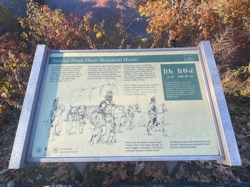
Forced From Their Mountain Home
Photographed by Darren Jefferson Clay, October 26, 2022
1. Forced From Their Mountain Home Marker
During the winter of 1838-39, nearly 4000 Indians succumbed to starvation, disease, exposure, and even murder. Many were children. This tragic removal of the Cherokee Indians from their beloved homeland is referred to as the "Trail of Tears."
Prior to their forced exodus, Cherokee leaders fortified their people with a prayer. It began: "I will lift my eyes unto these hills, whence comes my strength." (Psalm 121:1)
Nearly one thousand escapees and refugees hid in the dense forests of these rugged mountains. Cherokees currently living in western North Carolina are descended from those who avoided removal and remained in their ancient, native homeland.
(sidebar)
As
this page online
Topics. This historical marker is listed in this topic list: Indigenous Peoples and Communities. A significant historical year for this entry is 1838.
Location. 35° 19.792′ N, 83° 56.815′ W. Marker is in Robbinsville, North Carolina, in Graham County. It is on Cherohala Skyway (State Highway 143) 4 miles west of Santeelah Raod, on the right when traveling west. Touch for map. Marker is in this post office area: Robbinsville NC 28771, United States of America. Touch for directions.

Regionally, this marker is in the Mountains. It is also in the American South, specifically in the Upper South, in Appalachia, and specifically in Southern Appalachia. Globally, it is in North America, the Western Hemisphere, the Western World, and the Anglosphere. Historically, it finds itself in what was once the original Cherokee Nation, the territory of the Mississippian Culture, one of the original Thirteen Colonies, one

Photographed by Darren Jefferson Clay, October 26, 2022
2. Forced From Their Mountain Home Marker
Other nearby markers. At least 8 other markers are within 8 miles of this marker, measured as the crow flies: Joyce Kilmer Memorial Forest (approx. 1.9 miles away); Unega (approx. 5.1 miles away); Shaping the Flow of the Cheoah River (approx. 5.9 miles away); a different marker also named Shaping the Flow of the Cheoah River (approx. 6.4 miles away); a different marker also named Shaping the Flow of the Cheoah River (approx. 7.4 miles away); Junaluska's Birth Site (approx. 7.8 miles away); Junaluska's Names (approx. 7.8 miles away); Junaluska's Distingusihed Service (approx. 7.8 miles away). Touch for a list and map of all markers in Robbinsville.
Credits. This page was last revised on November 9, 2022. It was originally submitted on November 7, 2022, by Darren Jefferson Clay of Duluth, Georgia. This page has been viewed 315 times since then and 22 times this year. Photos: 1, 2. submitted on November 8, 2022, by Darren Jefferson Clay of Duluth, Georgia. • Bernard Fisher was the editor who published this page.
