Mott Haven in the Bronx in Bronx County, New York — The American Northeast (Mid-Atlantic)
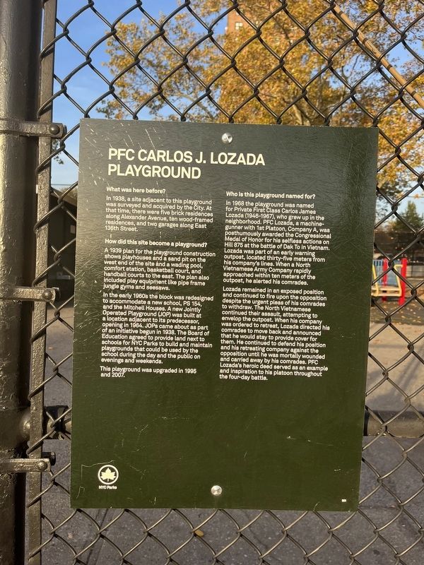
PFC Carlos J. Lozada Playground

Photographed By Devry Becker Jones (CC0), November 4, 2022
1. PFC Carlos J. Lozada Playground Marker
What was here before?
In 1938, a site adjacent to this playground was surveyed and acquired by the City. At that time, there were five brick residences along Alexander Avenue, ten wood-framed residences, and two garages along East 136th Street.
How did this site become a playground?
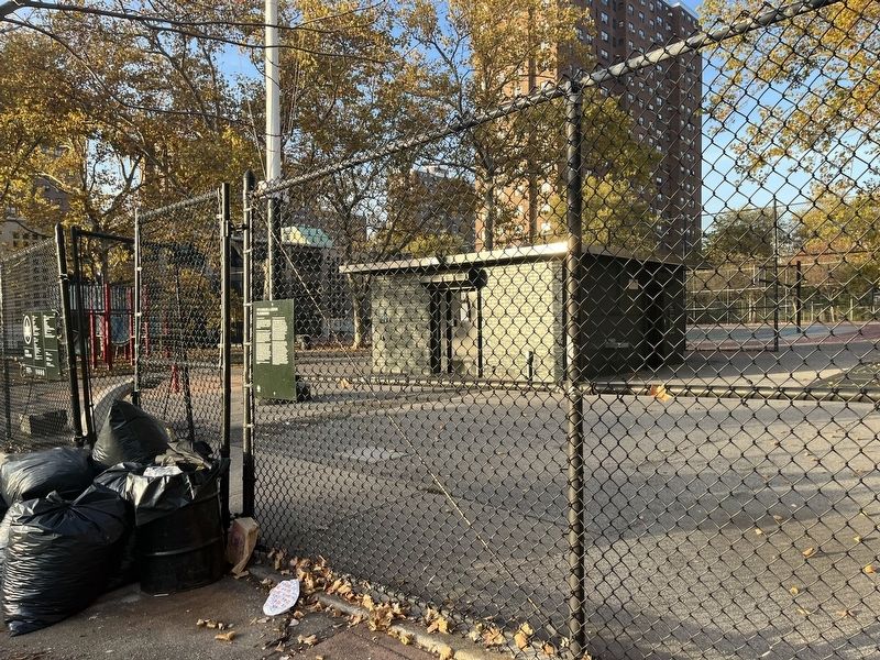
A 1939 plan for the playground construction shows playhouses and a sand pit on the west end of the site and a wading pool, comfort station, basketball court, and handball courts to the east. The plan also included play equipment like pipe frame jungle gyms and seesaws.
In the early 1960's the block was redesigned to accommodate a new school, PS 154, and the Mitchell Houses. A new Jointly Operated Playground (JOP) was built at a location adjacent to its predecessor, opened in 1964. JOPs came about as part of an initiative begun in 1938. The Board of Education agreed to provide land next to schools for NYC Parks to build and maintain playgrounds that could be used by school during the day and the public on evenings and weekends.
This playground was upgraded in 1995 and 2007.
Who is this playground named for?
In 1968 the playground was named for Private First Class Carlos James Lozada (1946-1967), who grew up in the neighborhood. PFC Lozada, a machine-gunner with 1st Platoon, Company A, was posthumously awarded the Congressional Medal of Honor for his selfless actions on Hill 875 at the battle of Dak To in Vietnam. Lozada was part of an early warning outpost, located thirty-five meters from his company's lines. When a North Vietnamese Army Company rapidly approached within ten meters of the outpost, he alerted his comrades.
Lozada remained in an exposed position and continued to fire upon the opposition despite the urgent pleas of his comrades to withdraw. The North Vietnamese continued their assault, attempting to envelop the outpost. When his company was ordered to retreat, Lozada directed his comrades to move back and announced that he would stay to provide cover for them. He continued to defend his position and his retreating company against the opposition until he was mortally wounded and carried away by his comrades. PFC Lozada's heroic deed served as an example and inspiration to his platoon throughout the four-day battle.
Erected by NYC Parks. (Marker Number 301.)
Topics and series. This historical marker is listed in these topic lists: Education • Heroes • Hispanic Americans • Parks & Recreational Areas • War, Vietnam. In addition, it is included in the Medal of Honor Recipients, and the NYC Parks series lists. A significant historical year for this entry is 1938.
Location.

Photographed By Devry Becker Jones (CC0), November 4, 2022
2. PFC Carlos J. Lozada Playground Marker
Other nearby markers. At least 8 other markers are within walking distance of this marker. Carlos James Lozada (a few steps from this marker); Roundhouse (approx. 0.2 miles away); Swing Bridges (approx. 0.3 miles away); Saw Mill Playground (approx. 0.3 miles away); Brook Restoration (approx. 0.4 miles away); Willis Avenue Bridge (approx. 0.4 miles away); Padre Plaza (approx. 0.4 miles away); St. Ann's Shrine (approx. 0.4 miles away). Touch for a list and map of all markers in Bronx.
Credits. This page was last revised on July 24, 2023. It was originally submitted on November 7, 2022, by Devry Becker Jones of Washington, District of Columbia. This page has been viewed 83 times since then and 17 times this year. Photos: 1, 2. submitted on November 7, 2022, by Devry Becker Jones of Washington, District of Columbia.