Black Mountain in Buncombe County, North Carolina — The American South (South Atlantic)
Geologic Time
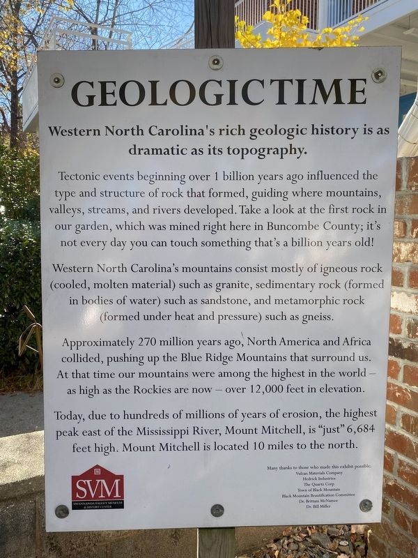
Western North Carolina's rich geologic history is as dramatic as its topography
Photographed by Darren Jefferson Clay, October 24, 2022
1. Geologic Time Marker
Western North Carolina's mountains consist mostly of igneous rock (cooled, molten material) such as granite, sedimentary rock (formed in bodies of water) such as sandstone, and metamorphic rock (formed under heat and pressure) such as gneiss.
Approximately 270 million years ago, North America and Africa collided, pushing up the Blue Ridge Mountains that surround us. At that time our mountains were among the highest in the world - as high as the Rockies are now - over 12,000 feet in elevation.
Today, due to hundreds of millions of years of erosion, the highest peak east of the Mississippi River, Mount Mitchell, is "just” 6,684 feet high. Mount Mitchell is located 10 miles to the north.
Topics. This historical marker is listed in this topic list: Natural Features.
Location. 35° 36.972′ N,
this page online

Regionally, this marker is in the Mountains and in Greater Asheville. It is also in the American South, specifically in the Upper South, in Appalachia, and specifically in Southern Appalachia. Globally, it is in North America, the Western Hemisphere, the Western World, and the Anglosphere. Historically, it finds itself in what was once the original Cherokee Nation, the territory of the Mississippian Culture, one of the original Thirteen Colonies, one of the Confederate States of America, and the Antebellum South.
Other nearby markers. At least 8 other markers are within walking distance of this marker: Granulitic Gneiss (here, next to this marker); Migmatitic Gneiss (here, next to this marker); Amphibolite (here, next to this marker); Mylonitic Gneiss (here, next to this marker); Pegmatitic Granodiorite (a few steps from this marker);

Photographed by Darren Jefferson Clay, October 24, 2022
2. Geologic Time Marker
Credits. This page was last revised on November 22, 2022. It was originally submitted on November 9, 2022, by Darren Jefferson Clay of Duluth, Georgia. This page has been viewed 248 times since then and 28 times this year. Photos: 1, 2. submitted on November 10, 2022, by Darren Jefferson Clay of Duluth, Georgia. • Bill Pfingsten was the editor who published this page.
