Cearfoss in Washington County, Maryland — The American Northeast (Mid-Atlantic)
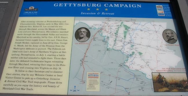
Gettysburg Campaign
Invasion & Retreat
Photographed by Craig Swain, August 16, 2008
1. Gettysburg Campaign Marker
To follow in their footsteps and to discover their stories, stop by any Welcome Center or local Visitor Center to pick up a Gettysburg: Invasion & Retreat Civil War Trail map-guide. Please drive carefully as you enjoy the history and beauty of Maryland Civil War Trails.
Erected by Maryland Civil
this page online
Topics and series. This historical marker is listed in this topic list: War, US Civil. In addition, it is included in the Maryland Civil War Trails series list. A significant historical month for this entry is May 1863.
Location. 39° 41.999′ N, 77° 46.622′ W. Marker is in Cearfoss, Maryland, in Washington County. It is at the intersection of Fairview Road (County Route 494) and Greencastle Pike (Maryland Route 63), on the right when traveling east on Fairview Road. Touch for map. Marker is at or near this postal address: 17035 Fairview Road, Hagerstown MD 21740, United States of America. Touch for directions.

Regionally, this marker is in Western Maryland. It is also in the American Mid-Atlantic, in Appalachia, and specifically in Northern Appalachia. Globally, it is in North America, the Western Hemisphere, the Western World, and the Anglosphere. Historically, it finds itself in what was once one of the original Thirteen Colonies.
Other nearby markers. At least 8 other markers are within 5 miles of this marker, measured as the crow flies: Crossing the Mason and Dixon (here, next to this marker); Mason and Dixon Line
Photographed by Bill Coughlin, August 22, 2012
2. Civil War Trails Markers
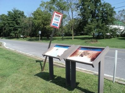
Two Civil War Trails markers are found at this location. The Gettysburg Campaign marker is seen here on the left.
Another marker is no longer nearby. Shielding the Army (was approx. 4.1 miles away but has been confirmed missing).
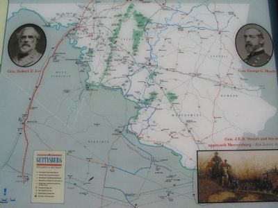
More about this marker. This is one of the standard Gettysburg Campaign markers used throughout Maryland and Virginia, and is duplicated at other locations. The maker features a map of depicting unit movements during the campaign and other Civil War Trails locations. The map has portraits of Gens. Robert E. Lee and George G. Meade. A painting depicts a scene from the campaign with the caption, Gen. J.E.B. Stuart and his staff approach Mercerburg.
Also see . . . Gettysburg Campaign. Wikipedia entry (Submitted on December 30, 2020, by Larry Gertner of New York, New York.)
Photographed by Craig Swain, August 16, 2008
3. Gettysburg Campaign Map
Double click on photo for a detailed view.
Photographed by Craig Swain
4. A Civil War Trails Wayside
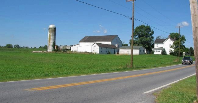
Photographed by Craig Swain, August 16, 2008
5. Ambush Site
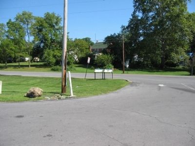
Just to the west of Cunningham’s Crossroads (the modern day round-about in Cearfoss), stands a white farm house and barn. Captain Abram Jones’ detachment of Federal Cavalry used the barn as cover for an ambush of the Confederate wagon train on July 5, 1863, during the retreat from Gettysburg.
Credits. This page was last revised on November 14, 2022. It was originally submitted on September 20, 2008, by Craig Swain of Leesburg, Virginia. This page has been viewed 1,965 times since then and 35 times this year. Last updated on November 10, 2022, by Carl Gordon Moore Jr. of North East, Maryland. Photos: 1. submitted on September 20, 2008, by Craig Swain of Leesburg, Virginia. 2. submitted on August 22, 2012, by Bill Coughlin of Woodland Park, New Jersey. 3, 4, 5. submitted on September 20, 2008, by Craig Swain of Leesburg, Virginia. • Bernard Fisher was the editor who published this page.
