
Cearfoss in Washington County, Maryland — The American Northeast (Mid-Atlantic)
Crossing the Mason and Dixon
Pennsylvania, at Last!
| — | Gettysburg Campaign | — |
Photographed by Craig Swain, August 16, 2008
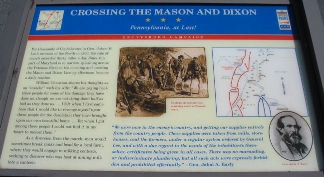
1. Crossing the Mason and Dixon Marker
William Christian shares his thoughts as an "invader" with his wife: "We are paying back these people for some of the damage they have done to us, though we are not doing them half as bad as they done us. ... I felt when I first came here that I would like to revenge myself upon these people for the desolation they have brought upon our own beautiful home. ... Yet when I got among these people I could not find it in my heart to molest them."
As a diversion from the march, men would sometimes break ranks and head for a local farm, where they would engage in milking contests, seeking to discover who was best at aiming milk into a canteen.
"We were now in the enemy's country, and getting our supplies entirely from the country people. These supplies were taken from mills, storehouses, and the farmers, under a regular system ordered
this page online
-Gen. Jubal A. Early
Erected by Maryland Civil War Trails.
Topics and series. This historical marker is listed in this topic list: War, US Civil. In addition, it is included in the Maryland Civil War Trails series list. A significant historical year for this entry is 1863.
Location. 39° 41.999′ N, 77° 46.622′ W. Marker is in Cearfoss, Maryland, in Washington County. It is at the intersection of Fairview Road (County Route 494) and Greencastle Pike (Maryland Route 63), on the right when traveling east on Fairview Road. Located in a parking lot of a convenience store, in the southwest corner of the intersection. Touch for map. Marker is at or near this postal address: 17035 Fairview Road, Hagerstown MD 21740, United States of America. Touch for directions.

Regionally, this marker is in the Baltimore Metro Region and in Western Maryland. It is also in the American Mid-Atlantic, in Appalachia,
Photographed by Bill Coughlin, August 22, 2012
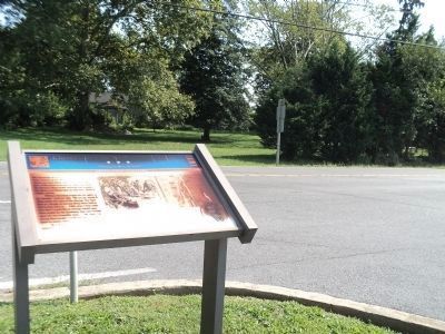
2. Crossing the Mason and Dixon Marker
The marker appears to have been damaged since the original photo 4 years prior.
Other nearby markers. At least 8 other markers are within 5 miles of this marker, measured as the crow flies: Gettysburg Campaign (here, next to this marker); Mason and Dixon Line (approx. 1½ miles away); Maugansville War Memorial (approx. 1.8 miles away); Veterans Memorial (approx. 2.1 miles away); a different marker also named Gettysburg Campaign (approx. 3.6 miles away in Pennsylvania); Paradise Manor (approx. 4.1 miles away); Shielding the Army (approx. 4.1 miles away); Hagerstown & The National Road (approx. 4.3 miles away). Touch for a list and map of all markers in Cearfoss.
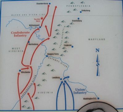
More about this marker. In the upper center is a drawing of Confederate infantrymen marching north to Pennsylvania. A map in the upper right shows the routes taken by the elements of both armies passing through Maryland. To the lower right is a portrait of General Early.
Photographed by Bill Coughlin, August 22, 2012
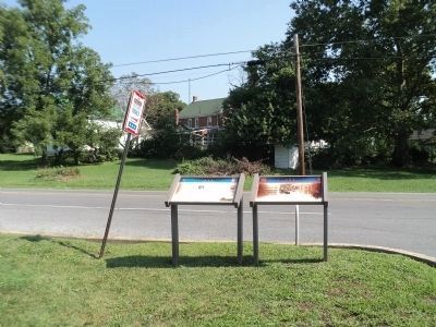
3. Civil War Trails Markers
Two Civil War Trails markers are found at this location. The Crossing the Mason and Dixon marker is seen here on the right.
Photographed by Craig Swain, August 16, 2008
4. Map of the Route of Advancing Armies
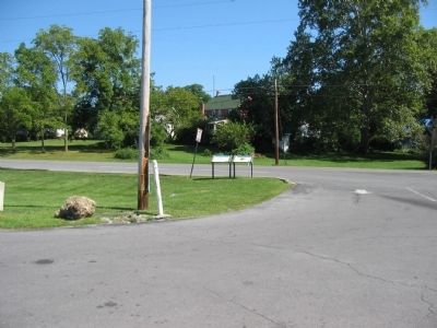
Photographed by Craig Swain, August 16, 2008
5. A Civil War Trails Wayside
Credits. This page was last revised on November 14, 2022. It was originally submitted on September 20, 2008, by Craig Swain of Leesburg, Virginia. This page has been viewed 2,503 times since then and 39 times this year. Last updated on November 10, 2022, by Carl Gordon Moore Jr. of North East, Maryland. Photos: 1. submitted on September 20, 2008, by Craig Swain of Leesburg, Virginia. 2, 3. submitted on August 22, 2012, by Bill Coughlin of Woodland Park, New Jersey. 4, 5. submitted on September 20, 2008, by Craig Swain of Leesburg, Virginia. • Bernard Fisher was the editor who published this page.
