Coketon in Tucker County, West Virginia — The American South (Appalachia)
Mine Portal No. 29
Contemporary Drainage Issues Highlight Historic Engineering Practices
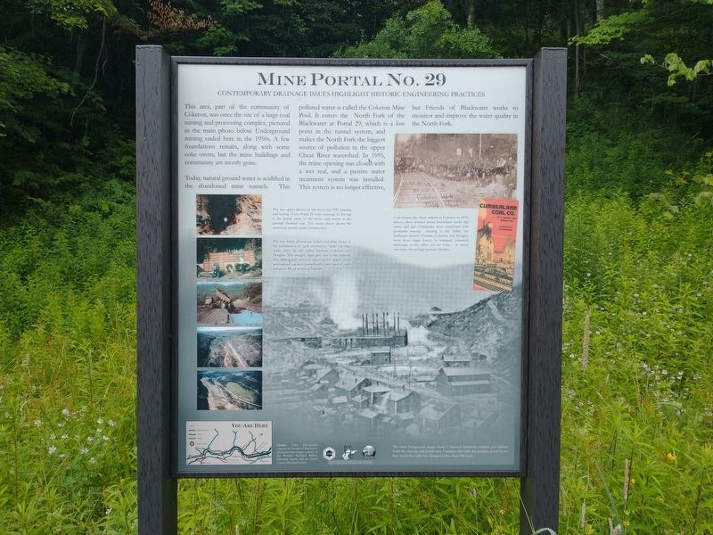
This area, part of the community of Coketon, was once the site of a large coal mining and processing complex, pictured in the main photo below. Underground mining ended here in the 1950s. A few foundations remain, along with some coke ovens, but the mine buildings and community are mostly gone.
Today, natural ground water is acidified in the abandoned mine tunnels. This polluted water is called Coketon Mine Pool. It enters the North Fork of the Blackwater at Portal 29, which is a low point in the tunnel system, and makes the North Fork the biggest source of pollution in the upper Cheat River watershed. In 1995, the mine opening was closed with a wet seal, and a passive water treatment system was installed. This system is no longer effective, but Friends of Blackwater works to monitor and improve the water quality in the North Fork.
[Captions:]
The two upper photos at left show the 1995 cleanup and sealing of the Portal 29 mine opening. At the top is the portal prior to the work, and below is the partially finished seal. The center photo shows the treatment system under construction.
The two lower photos are before-and-after views of the reclamation of land covered by “gob”, or mine waste piles, in the valley between Coketon and Douglas. The straight, light grey line is the railroad. The darker gray piles of waste in the upper photo were spread out and covered with a new layer of earth and grass fill, as shown at bottom.
Coal miners, like these strikers in Coketon in 1894, above, often worried about immediate needs like safety and pay. Companies were concerned with profitable mining. Starting in the 1880s, the landscape around Thomas, Coketon, and Douglas went from virgin forest, to stripped, industrial landscape, to the valley you see today – in about two times the average person’s lifetime.
The main background image shows Coketon's industrial complex just upriver from the cleanup and portal sites. Compare this with the pictures at left to see how much the valley has changed in less than 100 years.
Credit: Color photographs courtesy of Friends of Blackwater. Black and white images courtesy of the Western Maryland Railway Historical Society and the Tucker County Historical Society.
Erected by Friends of Blackwater.
Topics. This historical marker is listed in these topic lists: Environment • Industry & Commerce • Waterways & Vessels. A significant historical year for this entry is 1995.
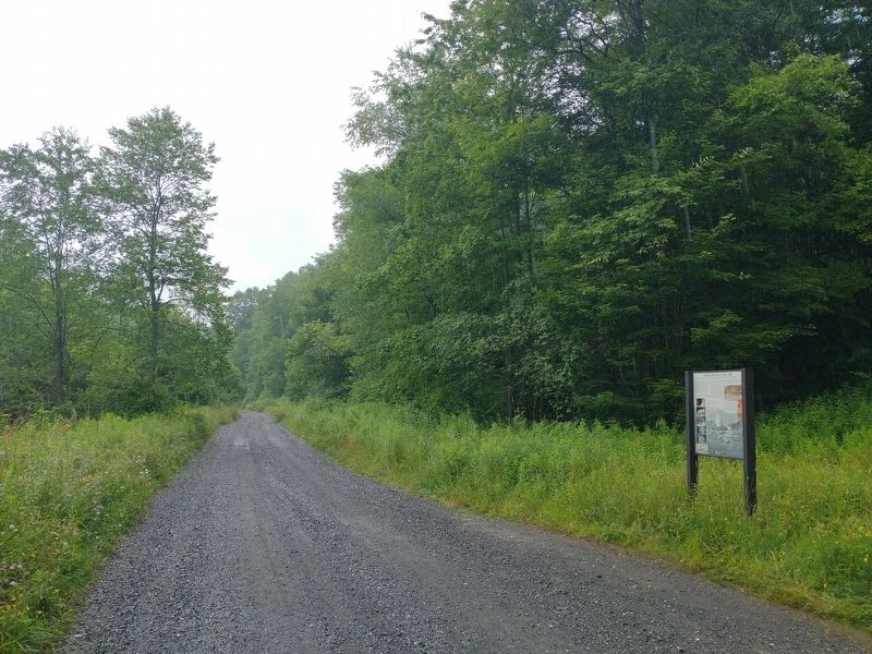
Location. 39° 8.2′ N, 79° 30.735′ W. Marker is in Coketon, West Virginia, in Tucker County. Marker is on Rail Falls Road (County Road 27/3) 0.2 miles south of Douglas Road (County Road 27), on the right when traveling south. Touch for map. Marker is at or near this postal address: 1174 Douglas Rd, Thomas WV 26292, United States of America. Touch for directions.
Other nearby markers. At least 8 other markers are within walking distance of this marker. From Coal to Coke (approx. 0.3 miles away); Creating Coke, Created More Than Smoke (approx. 0.4 miles away); Reclaiming the Future (approx. 0.4 miles away); Coketon Colored School (approx. half a mile away); Engineering Building (approx. half a mile away); The Company Store (approx. half a mile away); Douglas, W. Va. (approx. ¾ mile away); Black Fork Grade (approx. 0.8 miles away). Touch for a list and map of all markers in Coketon.
Credits. This page was last revised on November 15, 2022. It was originally submitted on November 11, 2022, by Tom Bosse of Jefferson City, Tennessee. This page has been viewed 139 times since then and 36 times this year. Photos: 1, 2. submitted on November 11, 2022, by Tom Bosse of Jefferson City, Tennessee. • Devry Becker Jones was the editor who published this page.

