Saint Anthony Main in Minneapolis in Hennepin County, Minnesota — The American Midwest (Upper Plains)
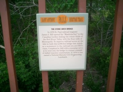
The Stone Arch Bridge
— Saint Anthony Falls Heritage Trail —
Topics and series. This historical marker is listed in these topic lists: Bridges & Viaducts • Industry & Commerce • Railroads & Streetcars • Waterways & Vessels. In addition, it is included in the ASCE Civil Engineering Landmarks series list. A significant historical year for this entry is 1879.
Location. 44° 58.873′ N, 93° 15.052′ W. Marker is in Minneapolis, Minnesota, in Hennepin County. It is in Saint Anthony Main. Marker is located at the Father Hennepin Bluffs Park. Touch for map. Marker is at or near this postal address: 4 6th Avenue SE, Minneapolis MN 55414, United States of America. Touch for directions.
Other nearby markers. At least 8 other markers are within walking distance of this marker. Layers of History (a few steps from this marker); Marcy~Holmes (a few steps from this marker); Father Hennepin Bluffs (a few steps from this marker); Portaging Around the Falls (within shouting distance of this marker); Lucy Wilder Morris (within shouting distance of this marker); Pettingill's Wonderful Water (about 300 feet away, measured in a direct line); Sawmilling: The City's First Industry (about 300 feet away); The Pillsbury A Mill (about 700 feet away). Touch for a list and map of all markers in Minneapolis.
More about this marker. This bridge spans the Mississippi River at St. Anthony Falls.
Also see . . . St. Anthony Falls Heritage Trail Information. (Submitted on July 23, 2009.)
Credits. This page was last revised on February 12, 2023. It was originally submitted on July 23, 2009, by Joseph Cavinato of Fountain Hills, Arizona. This page has been viewed 1,470 times since then and 19 times this year. Photos: 1, 2, 3, 4. submitted on July 23, 2009, by Joseph Cavinato of Fountain Hills, Arizona. • Syd Whittle was the editor who published this page.


