Near Pickens in Pickens County, South Carolina — The American South (South Atlantic)
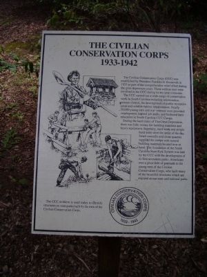
The Civilian Conservation Corps
1933 - 1942
The CCC carried out a wide range of conservation work in South Carolina including reforestation, erosion control, the development of public recreation areas and wildlife habitat improvement. Nearly 50,000 young men and war veterans were provided employment, learned job skills, and furthered their education in South Carolina CCC Camps.
During the hard times of The Great Depression, there was little money for building materials and heavy equipment. Ingenuity, hard work and simple hand tools were the order of the day. Small sawmills and stone quarries supplied the camps with natural building materials located near at hand. The foundation of the South Carolina State Park System was laid by the CCC with the development of its first seventeen parks.
Americans owe a great debt of gratitude to the young men of the Civilian Conservation Corps, who built many of the beautiful structures which are enjoyed at our state and national parks.
Erected by Civilian Conservation Corps.
Topics and series. This historical marker is listed in these topic lists: Charity & Public Work • Man-Made Features. In addition, it is included in the Civilian Conservation Corps (CCC) series list. A significant historical year for this entry is 1933.
Location. 35° 1.913′ N, 82° 42.023′ W. Marker is near Pickens, South Carolina, in Pickens County. Marker is on Table Rock State Park Road. Marker is in Table Rock State Park. Touch for map. Marker is in this post office area: Pickens SC 29671, United States of America. Touch for directions.
Other nearby markers. At least 8 other markers are within 4 miles of this marker, measured as the crow flies. Parkitecture (approx. 0.2 miles away); a different marker also named Civilian Conservation Corps (approx. 0.4 miles away); A CCC Classic (approx. 0.4 miles away); Beliefs Set in Stone (approx. half a mile away); Table Rock State Park (approx. 0.6 miles away); Granite and Gravity (approx. 0.9 miles away); Pumpkintown (approx. 3.4 miles away); Cornelius Keith - 1715-1808 (approx. 3.7 miles away). Touch for a list and map of all markers in Pickens.
Additional commentary.
1. The Civilian Conservation Corps located on Oil Camp Creek, upper Greenville County
I am in the process of writing a book about The Civil Conservation Corps Camp located
Photographed By Stanley and Terrie Howard, July 19, 2009
2. Pre-Park History
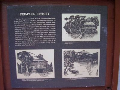
The first white men moved into the Table Rock area soon after the treaty with the Cherokees. The Keith and Sutherland families settled in the Oolenoy Valley at a place called Pumpkintown, this name alluding to the unusually large pumpkins grown there. There were no other permanent residents for many years, but many visitors were attracted to the area. William Sutherland and James Keith operated a wayside lodge for these visitors and around 1840 they constructed a hotel. The hotel prospered until the Civil War when few visitors came. It regained its prosperity toward the end of the century and E.Foster Keith started a new hotel in 1899 at the present site of the White Oaks Picnic Shelter. The first hotel was later destroyed and prior to 1920 the second hotel was moved into the Saluda Valley for use as a summer lodge. By the beginning of the twentieth century several families, mostly farmers, were living in the Table Rock area.
Editor's Note: If you wish to provide information about the Oil Creek CCC Camp, please include it as additional commentery using the link provided at the top and bottom of this page.
Thank you.
— Submitted August 10, 2010, by E. Kathleen Nelson of Apex, North Carolina.
Photographed By Stanley and Terrie Howard, July 19, 2009
3. Park Construction
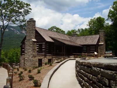
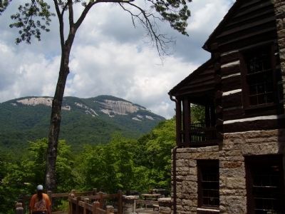
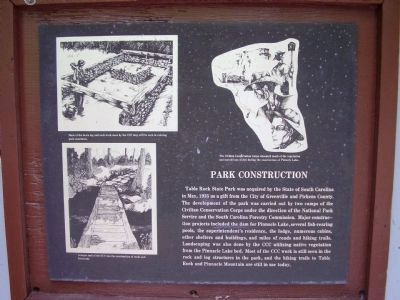
Table Rock State Park was acquired by the State of South Carolina in May, 1935 as a gift from the City of Greenville and Pickens County. The development of the park was carried out by two camps of the Civilian Conservation Corps under the direction of the National Park Service and the South Carolina Forestry Commission. Major construction projects included the dam for Pinnacle Lake, several fish-rearing pools, the superintendent's residence, the lodge, numerous cabins, other shelters and buildings, and miles of roads and hiking trails. Landscaping was also done by the CCC utilizing native vegetation from the Pinnacle Lake bed. Most of the CCC work is still seen in the rock and log structures in the park, and the hiking trails to Table Rock and Pinnacle Mountain are still in use today.
Photographed By Stanley and Terrie Howard, July 19, 2009
4. Indian History
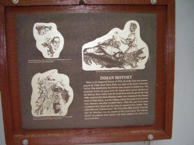
Prior to the Hopewell Treaty of 1785, all of the area now encompassed by Table Rock State Park was part of the Lower Cherokee Nation. This in habitation has left the area steeped in Indian lore. The mountain derives its name from the legend that a great chieftain in the Oolenoy River Valley took his meals from atop the great flat rock while seated on the Stool. Hunting camps were common in the Dismal, north of Table Rock, and the Indians visited the great rock between wars, illnesses, and other troubled times. Here the cool, fresh water revitalized their blood and the crisp air renewed their spirits. They called this area "Sah-ka-na-ga," the Great Blue Hills of God, believing that the blue haze was the shadow of the Great Spirit. The Indians hunted throughout these forests and many artifacts are still to be uncovered here.
Photographed By Stanley and Terrie Howard, July 19, 2009
5. The Changing Forest
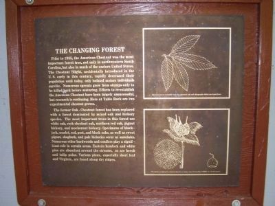
Prior to 1935, the American Chestnut was the most important forest tree, not only in northwestern South Carolina, but also in much of the eastern United States. The Chestnut Blight, accidentally introduced in the U.S. early in this century, rapidly decreased their population until today, only isolated mature individuals survive. Numerous sprouts grow from stumps only to be killed back before maturing. Efforts to re-establish the American Chestnut have been largely unsuccessful, but research is continuing. Here at Table Rock are two experimental chestnut groves.
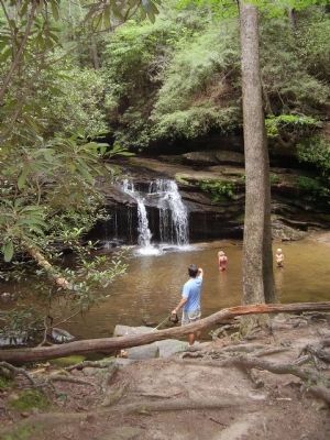
The former Oak-Chestnut forest has been replaced with a forest dominated by mixed oak and hickory species. The most important trees in this forest are white oak, rock chestnut oak, northern red oak, pignut hickory, and mockernut hickory. Specimens of blackjack, scarlet, red, post, and black oaks, as well as sweet pignut, shagbark, and pale hickories occur as associates. Numerous other hardwoods and conifers play a significant role in certain areas. Eastern hemlock and white pine ate abundant around the streams, as are beech and tulip polar. Various pines, especially short leaf and Virginia, are found along dry ridges.
Photographed By Stanley and Terrie Howard, July 19, 2009
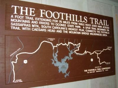
6. The Foothills Trail
A Foot Trail extending for 76 miles from Table Rock State Park across mountains and rivers to Oconee State Park. A Spur trail beginning on Sassafras Mtn., South Carolina's highest peak, connects the Foothills Trail with Caesars Head and the Mountain Bridge Wilderness Area.
Photographed By Stanley and Terrie Howard, July 19, 2009
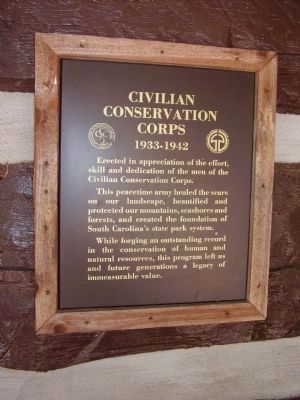
7. The Civilian Conservation Corps Marker
1933-1942
Erected in appreciation of the effort, skill and dedication of the men of the Civilian Conservation Corps.
This peacetime army healed the scars on our landscape, beautified and protected our mountains, seashores and forests, and created the foundation of South Carolina's state park system.
While forging an outstanding record in the conservation of human and natural resources, this program left us and future generations a legacy of immeasurable value.
Credits. This page was last revised on June 16, 2016. It was originally submitted on July 24, 2009, by Stanley and Terrie Howard of Greer, South Carolina. This page has been viewed 1,526 times since then and 50 times this year. Photos: 1, 2, 3, 4, 5, 6, 7, 8, 9, 10. submitted on July 24, 2009, by Stanley and Terrie Howard of Greer, South Carolina. • Craig Swain was the editor who published this page.
