Bos en Lommer in Amsterdam, North Holland, Netherlands — Northwestern Europe
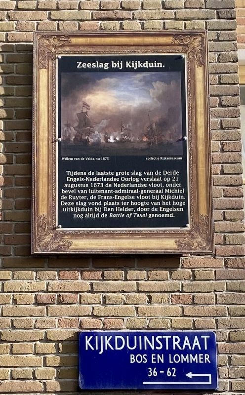
Zeeslag bij Kijkduin
⎯⎯⎯
Battle of Texel
Photographed by Andrew Ruppenstein, November 3, 2022
1. Zeeslag bij Kijkduin / Battle of Texel Marker

(English translation:)
During the last major battle of the Third Anglo-Dutch War on August 21, 1673, the Dutch fleet, commanded by Lieutenant-Admiral-General Michiel de Ruyter, defeated the Franco-English fleet at Kijkduin. This battle took place near the high lookout dune near Den Helder, and is called the Battle of Texel by the English.
Erected by Geef Straten Een Gezicht.
Topics and series. This historical marker is listed in this topic list: Wars, Non-US. In addition, it is included in the Dutch Naval History (GSEG), and the Give Streets a Face / Geef Straten Een Gezicht series lists. A significant historical date for this entry is August 21, 1673.
Location. 52° 22.965′ N, 4° 51.177′ E. Marker is in Amsterdam, Noord-Holland (North Holland). It is in Bos en Lommer. It is on Kijkduinstraat, on the right when traveling north. Touch for map. Marker is in this post office area: Amsterdam, Noord-Holland 1055 ZK, Netherlands. Touch for directions.

Regionally, it is in Europe, the European Union, Atlantic Europe, the Benelux Low Countries, the Schengen Area, Western Europe, and the Western World. Historically, it finds itself in what was once the Holy Roman Empire.
Other nearby markers. At least 8 other markers are within walking distance of this marker: Zeeslag bij Solebay / Battle of Solebay (within shouting distance of this marker); Zeeslag bij Livorno / Battle of Leghorn (about 120 meters away, measured in a direct line); Willem Joseph van Ghent
this page online
Related marker. Click here for another marker that is related to this marker.
Also see . . . Battle of Texel (Wikipedia).
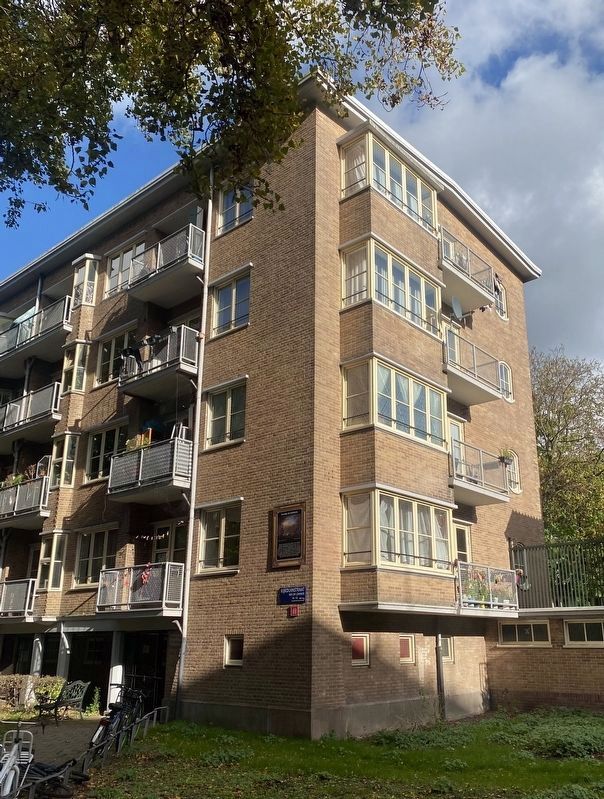
Excerpt: The naval Battle of Texel or Battle of Kijkduin took place off the southern coast of island of Texel on 21 August 1673 (11 August O.S.) between the Dutch and the combined English and French fleets. It was the last major battle of the Third Anglo-Dutch War, which was itself part of the Franco-Dutch War (1672–1678), during which Louis XIV of France invaded the Republic and sought to establish control over the Spanish Netherlands…. Prince Rupert of the Rhine commanded the Allied fleet of about 92 ships and 30 fireships, taking control of the centre himself, with Jean II d'Estrées commanding the van, and Sir(Submitted on November 17, 2022.)Edward Spragge the rear division. The Dutch fleet of 75 ships and 30 fireships was commanded by Lieutenant-Admiral-General Michiel de Ruyter, with Lieutenant-Admirals Adriaen Banckert in charge of the van and Cornelis Tromp the rear. Although the Dutch ships were smaller on average than their opponents, their crews were better trained and more experienced…. The size of the Allied fleet and length of its battle line, combined with inadequacies in fighting instructions and signalling, made it hard to control. It deepened suspicions between the English and French, further undercutting popular support for the war, while ending any hopes of starving the Dutch through a naval blockade, making it an overwhelming strategic victory for the Dutch. This campaign was the highlight of De Ruyter's career, as acknowledged by the Duke of York, who concluded "he was the greatest that ever to that time was in the world".Photographed by Andrew Ruppenstein, November 3, 20222. Zeeslag bij Kijkduin / Battle of Texel Marker
Credits. This page was last revised on June 3, 2026. It was originally submitted on November 17, 2022, by Andrew Ruppenstein of Lamorinda, California. This page has been viewed 303 times since then and 69 times this year. Photos: 1, 2. submitted on November 17, 2022, by Andrew Ruppenstein of Lamorinda, California.
