Prospect Park in Delaware County, Pennsylvania — The American Northeast (Mid-Atlantic)
Even History Changes
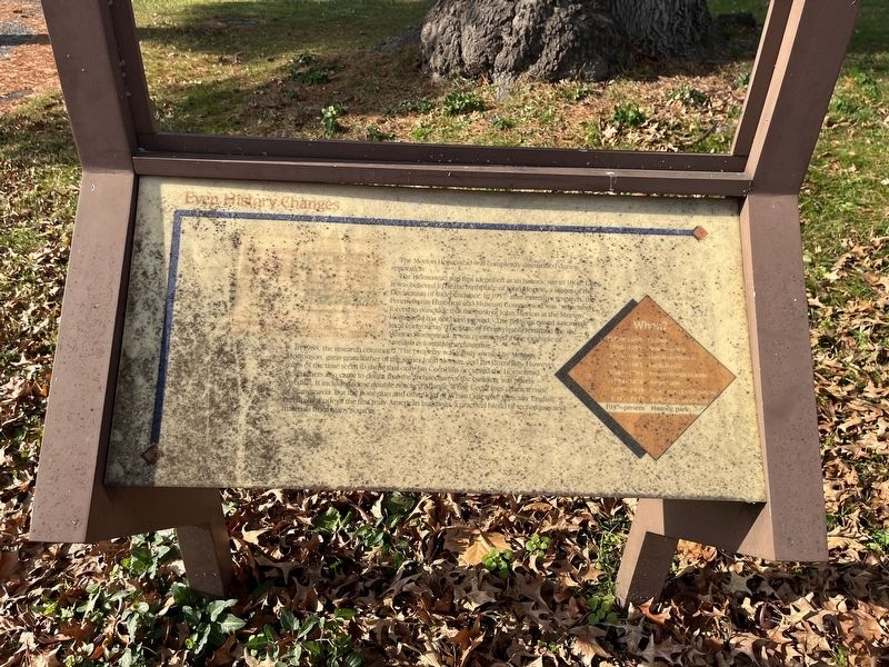
The Morton Homestead was completely dismantled during restoration.
The Homestead was first identified as an historic site in 1862. Later it was believed to be the birthplace of John Morton, a signer of the Declaration of Independence. In 1957, after extensive research, the Pennsylvania Historical and Museum Commission was "reluctantly forced to conclude that the birth of John Morton at the Morton Homestead has not been proved." The findings raised a storm of local controversy. The State of Pennsylvania renamed the site Morton Homestead. It was considered a fine example of Swedish colonial log architecture.
In 1988, the research continued. The property was jointly owned by Morton Mortonson, great-grandfather of the signer John Morton, and Jan Cornelius. However, maps of the time seem to show that only Jan Cornelius occupied the Homestead. Researchers also came to doubt that the architecture of the building was purely Swedish. It included some double notched Atlantic White Cedar logs characteristic of Scandinavia. But the floor plan and other logs of White Oak were typically English. Perhaps it is one of the first
this page online
When? Before 1638: Indians
1638 - 1655: New Sweden
1655 - 1664: Dutch dominion
1664 - 1681: English rule
1681 - 1784: Pennsylvania colony
1784 - 1870: Americans
1870 - 1935: Suburban development
1935 - 1937: Building restoration
1937 - present: Historic park
Topics and series. This historical marker is listed in these topic lists: Anthropology & Archaeology • Architecture • Colonial Era • Settlements & Settlers • War, US Revolutionary. In addition, it is included in the Signers of the Declaration of Independence series list. A significant historical year for this entry is 1862.
Location. This marker has been replaced by another marker nearby. It was located near 39° 52.613′ N, 75° 18.311′ W. Marker was in Prospect Park, Pennsylvania, in Delaware County. It was on Wanamaker Avenue (Pennsylvania Route 420) 0.2 miles south of Lafayette Avenue, on the right when traveling south. Touch for map. Marker was at or near this postal address: 100 Lincoln Ave, Prospect Park PA 19076, United States of America. Touch for directions.

Regionally,
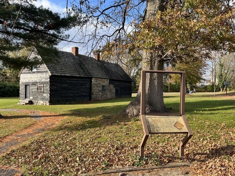
Other nearby markers. At least 8 other markers are within walking distance of this location: Darby Creek Then and Now (here, next to this marker); a different marker also named Darby Creek Then and Now (here, next to this marker); A Change For the Worse? (within shouting distance of this marker); John Morton– Signer of the Declaration of Independence (within shouting distance of this marker); a different marker also named The Ferry Landing (within shouting distance of this marker); Welcome to the Morton Homestead (within shouting distance of this marker); a different marker also named Welcome to the Morton Homestead (within shouting distance of this marker); Welcome (within shouting distance of this marker). Touch for a list and map of all markers in Prospect Park.
Other markers no longer nearby. The Ferry Landing (was within shouting distance of this marker but has been replaced with another marker now near it); Morton Homestead (was within shouting distance of this marker but has been replaced with another marker now near it); The First Building (was within shouting distance of this marker but has been replaced with another marker now near it); The Second Building (was within shouting distance of this marker but has been replaced with another marker now near it); a different marker also named Darby Creek Then and Now (was within shouting distance of this marker but has been replaced with another marker now near it); A Morton Mystery (was within shouting distance of this marker but has been replaced with another marker now near it).
Credits. This page was last revised on March 26, 2026. It was originally submitted on November 20, 2022, by Devry Becker Jones of Washington, District of Columbia. This page has been viewed 358 times since then and 64 times this year. Photos: 1, 2. submitted on November 20, 2022, by Devry Becker Jones of Washington, District of Columbia.
