Lincoln Park in San Francisco City and County, California — The American West (Pacific Coastal)
Lands End
Golden Gate National Recreation Area
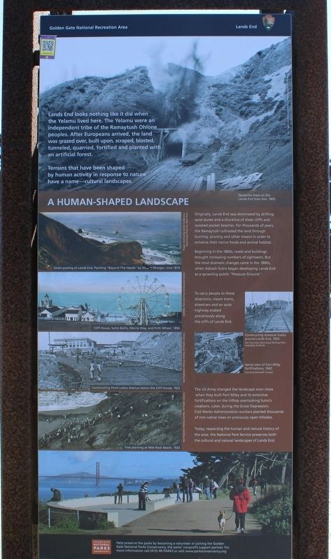
A Human-Shaped Landscape
Lands End looks nothing like it did when the Yelamu lived here. The Yelamu were an independent tribe of the Ramaytush Ohlone peoples. After Europeans arrived, the land was grazed over, built upon, scraped, blasted, tunneled, quarried, fortified and planted with and artificial forest.
Terrains that have been shaped by human activity in response to nature have a name – cultural landscapes.
Originally, Lands End was dominated by drifting sand dunes and a shoreline of sheer cliffs and isolated pocket beaches. For thousands of years, the Ramaytush cultivated the land through burning, pruning and other means in order to enhance their native foods and animal habitat.
Beginning in the 1860s, roads and buildings brought increasing numbers of sightseers. But the most dramatic changes came in the 1880s, when Adolph Sutro began developing Lands End as a sprawling public “Pleasure Ground.”
To carry people to these diversions, steam trains, street cars and an auto highway snaked precariously along the cliffs of Lands End.
The US Army changed the landscape even more when they built Fort Miley and its extensive fortifications on the hilltop overlooking Sutro’s creations. Later, during the Great Depression, Civil Works Administration workers planted thousands of non-native trees on previously open hillsides.
Today, respecting the human and natural history of the area, the National Park Service preserves both the cultural and natural landscapes of Lands End.
Images:
Dynamite blast on the Lands End train line, 1905.
Goats grazing at Lands End. Painting “Beyond the Heads” by Gilbert Munger, circa 1870.
Cliff Hous, Sutro Baths, Merrie Way, and Firth Wheel, 1896.
Constructing Point Lobos Avenue below the Cliff House, 1922.
Tree planting at Mile Rock Beach, 1933.
Constructing streetcar tracks around Lands End, 1905. San Francisco Municipal Railway Photography Archives
Aerial view of Fort Miley fortifications, 1942. Courtesy Kenneth Cooper
Panel Two:
What Defines Victory?
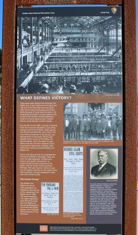
Sixty-seven years before the national Civil Rights Act, a new California civil rights law was put to the test after San Franciscan John Harris was turned away from Sutro Baths because of racial discrimination. His experience provided a unique opportunity to see if the recently ratified legislation, meant to ensure equal access in public places, could actually compel change.
On the 4th of July, 1897, a group of friends from San Francisco decided to cool off by taking a trip to Sutro Baths. After paying the 25 cent entrance fee, John Harris, the only African American in the group, was denied entry to the pools. Harris sued Adolph Sutro, owner of the baths, for discrimination. Harris brought his case before the San Francisco Superior Court claiming his rights were violated under California’s recently enacted Dibble Civil Rights Act.
Harris won the suit and was awarded the minimum $100.00 in damages; likely less than his legal expenses. Furthermore, Sutro’s vast wealth allowed him to continue exclusionary practices at the baths. Did the verdict achieve justice? Perhaps. The case inspired others to sue for civil rights violations in the wake of the Harris decision, though subsequent cases met with varied success.
What Sparks Change?
The Dibble Civil Rights Act set an early precedent for legislation that led up to the watershed Civil Rights Act of 1964. The most sweeping civil rights legislation since Reconstruction, the Civil Rights Act forced desegregation of schools and public spaces, and outlawed discriminatory hiring practices.
For years, African American community leaders lobbied for changes in the California legislature. The state president of the Afro-American League, Theophilus Morton, pressured San Francisco Assemblyman Henry Dibble to introduce a civil rights bill. Their efforts came to fruition when Dibble authored a landmark civil rights law, known as the Dibble Act. This law, enacted in 1897, mandated that all citizens “of every color or race whatsoever” shall “be entitled to the full and equal” facilities of “all places of public accommodation or amusement.” Dibble fought for human rights and justice throughout his life. He is buried in the San Francisco National Cemetery at the Presidio.
Images:
Sutro Baths circa 1900
Organizations like the Afro-American Council, pictured here in Oakland in 1907, pressed for civil rights in the late 1800s and early 1900s.
Aug 1, 1897, SF Call
Racist explanation of why Sutro Baths’ refused to allow Harrison to bathe. Aug 2, 1897, SF Call
Panel Three:
What To See And Do At Lands End
USS San Francisco Memorial
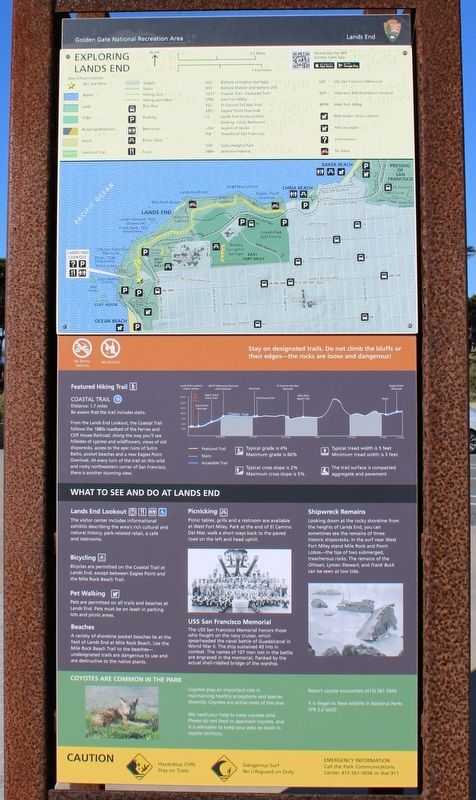
The USS San Francisco Memorial honors those who fought on the navy cruiser, which spearheaded the naval battle of Guadalcanal in World War II. The ship sustained 45 hits in combat. The names of 107 men lost in the battle are engraved in the memorial, flanked by the actual shell-riddled bridge of the warship.
Shipwreck Remains
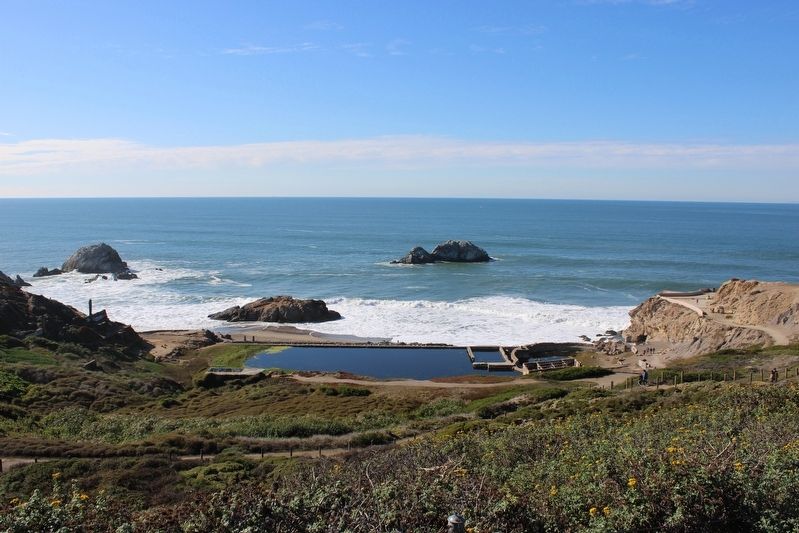
Looking down at the rocky shoreline from the heights of Lands End, you can sometimes see the remains of three historic shipwrecks. In the surf near West Fort Miley stand Mile Rock and Point Lobos – the tips of two submerged, treacherous rocks. The remains of the Ohioan, Lyman Stewart, and Frank Buck can be seen at low tide.
Panel Four:
Natural Treasures of Lands End
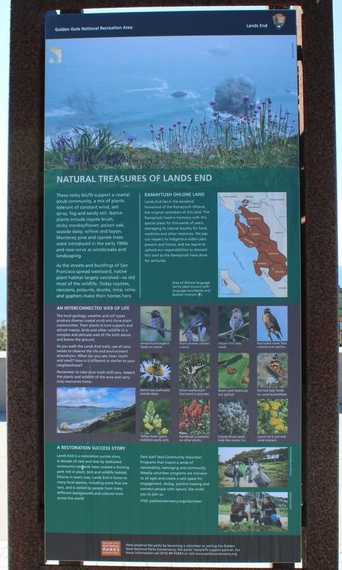
These rocky bluffs support a coastal scrub community, a mix of plants tolerant of constant wind, salt spray, fog and sandy soil. Native plants include coyote brush, sticky monkeyflower, poison oak, seaside daisy, willow and toyon. Monterey pine and cypress trees were introduced in the early 1900s and now serve as windbreaks and landscaping.
As the street and buildings of San Francisco spread westward, native plant habitat largely vanished – so did most of the wildlife. Today coyotes, raccoons, possums, skunks, mice, voles and gophers make their homes here.
Ramaytush Ohlone Land
Lands End lies in the ancestral homeland of the Ramaytush Ohlone, the original caretakers of this land. The Ramaytush lived in harmony with this special place for thousands of years, managing its natural bounty for food, medicine and other resources. We pay our respect to Indigenous elders past, present and future, and we aspire to uphold our responsibilities to steward this land as the Ramaytush have done for centuries.
An Interconnected Web of Life
The local geology, weather and soil types produce diverse coastal scrub and dune plant communities. Their plants in turn support and attract insects, birds and other wildlife in a complex and delicate web of life both above and below the ground.
As you walk the Lands End trails, use all your senses to observe the life and environment around you. What can you see, hear, touch and smell? How is it different or similar to your neighborhood?
Remember to take your trash with you, respect the plants and wildlife of the area and carry only memories home.
A Restoration Success Story
Lands End is a restoration success story. A decade of care and love by dedicated community stewards have created a thriving park rich in plant, bird and wildlife habitat. Diverse in every way, Lands End is home to many local species, including some that are rare, and is visited by people from many different backgrounds and cultures from across the world.
Park staff lead Community Volunteer Programs that inspire a sense of stewardship, belonging and community. Weekly volunteer programs are inclusive to all ages and create a safe space for engagement, dialog, positive healing and connect people with nature. We invite you to join us. Visit: parksconservancy.org/volunteer
Help preserve the parks by becoming a volunteer or joining the Golden Gate National Parks Conservancy, the Parks’ nonprofit support pioneer. For more information call (415) 4R-PARKS or visit www.parksconservancy.org
Erected by National Park Service.
Topics. This historical marker is listed in these topic lists: African Americans • Environment • Native Americans • Railroads & Streetcars.
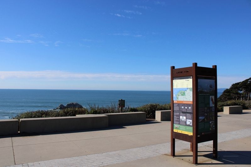
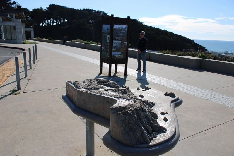
Location. 37° 46.805′ N, 122° 30.707′ W. Marker is in San Francisco, California, in San Francisco City and County. It is in Lincoln Park. Marker can be reached from Merrie Way near Point Lobos Avenue. The panels are mounted in a metal kiosk at the Lands End Lookout. Touch for map. Marker is at or near this postal address: 680 Point Lobos Avenue, San Francisco CA 94121, United States of America. Touch for directions.
Other nearby markers. At least 8 other markers are within walking distance of this marker. Peoples of the Coast (within shouting distance of this marker); Exploring Lands End (about 300 feet away, measured in a direct line); Sutro Heights (about 600 feet away); In Memory of Adolph Sutro (about 600 feet away); The Carpet Beds (about 700 feet away); The Parapet (about 800 feet away); The New Cliff House (approx. 0.2 miles away); Schooner Parallel “Blown to Atoms” 1887 (approx. 0.2 miles away). Touch for a list and map of all markers in San Francisco.
Also see . . . National Park Service: Lands End History.
"Under Mexican rule, this rugged section of coastline was part of a large land grant called Rancho Punta de Lobos. After California joined the U.S., the only visitors to this secluded and inaccessible area were naturalist who braved the long journey out to the coastline to observe marine mammals."(Submitted on November 21, 2022, by Joseph Alvarado of Livermore, California.)
Credits. This page was last revised on February 7, 2023. It was originally submitted on November 20, 2022, by Joseph Alvarado of Livermore, California. This page has been viewed 174 times since then and 47 times this year. Photos: 1, 2, 3, 4. submitted on November 20, 2022, by Joseph Alvarado of Livermore, California. 5, 6, 7, 8, 9. submitted on November 21, 2022, by Joseph Alvarado of Livermore, California.
