Leesburg in Loudoun County, Virginia — The American South (Mid-Atlantic)
Leesburg Passenger Station
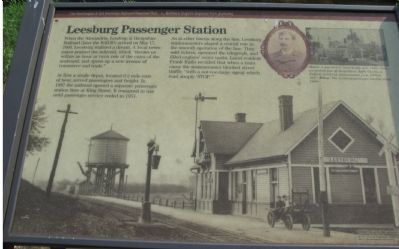
Photographed by Craig Swain, July 4, 2007
1. Leesburg Passenger Station Marker
At first a single depot, located 0.2 mile east of here, served passengers and freight. In 1887 the railroad opened a separate passenger station here at King Street. It remained in use until passenger service ended in 1951.
As at other towns along the line, Leesburg stationmasters played a crucial role in the smooth operation of the line. They sold tickets, operated the telegraph, and filled engines’ water tanks. Local resident Frank Raflo recalled that when a train came the stationmaster blocked street traffic “with a not-too-large signal which read simply ‘STOP.’ ”
Erected by The Washington & Old Dominion Railroad Regional Park, Northern Virginia Regional Park Authority.
Topics and series. This historical marker is listed in this topic list: Railroads & Streetcars. In addition, it is included in the NOVA Parks,
this page online
Location. 39° 6.721′ N, 77° 33.974′ W. Marker is in Leesburg, Virginia, in Loudoun County. It is on King Street (Business U.S. 15), on the left when traveling north. Located about 25 feet west of King Street along the Washington & Old Dominion Railroad Trail. Touch for map. Marker is in this post office area: Leesburg VA 20175, United States of America. Touch for directions.

Regionally, this marker is in the Washington Metropolitan Area and in Northern Virginia. It is also in the American South, specifically in the Upper South, and in the Mid-Atlantic. Globally, it is in North America, the Western Hemisphere, the Western World, and the Anglosphere. Historically, it finds itself in what was once the territory of the Mississippian Culture, one of the original Thirteen Colonies, one of the Confederate States of America, and the Antebellum South.
Other nearby markers. At least 8 other markers are within walking distance of this marker: The W&OD Railway and Jim Crow Laws (within shouting distance of this marker);
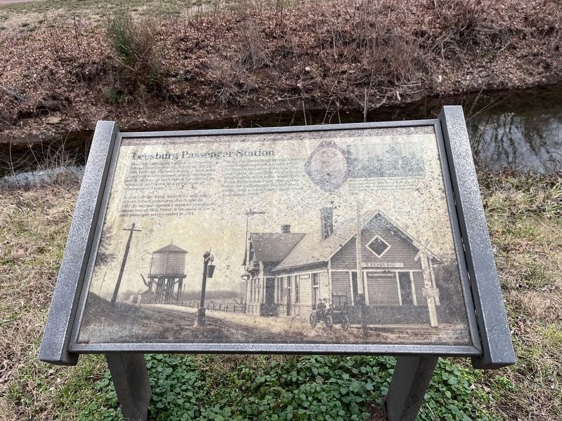
Photographed by Devry Becker Jones (CC0), January 21, 2023
2. Leesburg Passenger Station Marker
Unfortunately, the marker has weathered significantly.
More about this marker. The background of the marker is a photograph of the station from around 1906. An inset picture shows “A gas-electric train heads east, 1943. Cars are parked just off King Street.” The marker includes a portrait of Charles A. English, stationmaster 1866–1917.
Also see . . .
1. Leesburg Passenger Station. (Submitted on August 17, 2007, by Craig Swain of Leesburg, Virginia.)
2. The Washington and Old Dominion Railroad. Book by Ames Williams available on Amazon.com (Submitted on May 7, 2008, by Tom Fuchs of Greenbelt, Maryland.)
3. Rails to the Blue Ridge: The Washington and Old Dominion Railroad, 1847 - 1968.
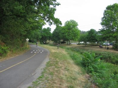
Photographed by Craig Swain, July 4, 2007
3. Marker Seen from King Street
Credits. This page was last revised on January 21, 2023. It was originally submitted on August 17, 2007, by Craig Swain of Leesburg, Virginia. This page has been viewed 4,058 times since then and 168 times this year. Photos: 1. submitted on August 17, 2007, by Craig Swain of Leesburg, Virginia. 2. submitted on January 21, 2023, by Devry Becker Jones of Washington, District of Columbia. 3. submitted on August 17, 2007, by Craig Swain of Leesburg, Virginia. • J. J. Prats was the editor who published this page.
