Near Fredericksburg in Spotsylvania County, Virginia — The American South (Mid-Atlantic)
Battle of Fredericksburg
Winter War on the Rappahannock
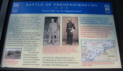
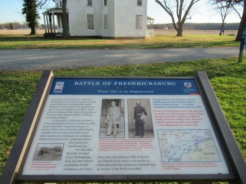
In November 1862, Union Gen. Ambrose E. Burnside led his 115,000-man army southward toward Richmond, the Confederate capital. Delayed by tardy pontoon boats, Burnside was slow to cross the Rappahannock River, which allowed Confederate Gen. Robert E. Lee time to block the Union advance with his 78,000 men near Fredericksburg.
On December 13, Burnside launched a two-pronged attack, the first of which was made across these fields. Despite the prospect of success, Union troops ultimately suffered heavy casualties and retreated. Burnside's second attack against the Confederate left on Marye's Heights fared even worse - no Federal soldiers even reached the Confederate line.
Two days later, Burnside retreated across the Rappahannock. Lee had inflicted a punishing 13,000 casualties on the Union army while only suffering 5,000 of his own. Lee followed up his victory with another at Chancellorsville that spring and embarked upon an invasion of the North soon after.
"Considerable nerve is required to march steadily against such murderous fire as that at Fredericksburg."
-Pvt. Bates Alexander, 7th Pennsylvania Reserves, USA
"It was a terribly grand scene - line after line of the foe were moved upon our brave troops, but they stood their ground manfully & finally broke the enemies lines. My heart swelled with joy & pride at the sight."
- Gen. Montgomery D. Corse, CSA
Erected 2009 by Civil War Preservation Trust and Virginia Civil War Trails.
Topics and series. This historical marker is listed in this topic list: War, US Civil. In addition, it is included in the Virginia Civil War Trails series list. A significant historical month for this entry is November 1862.
Location. 38° 15.862′ N, 77° 26.48′ W. Marker is near Fredericksburg, Virginia, in Spotsylvania County. Marker is on Tidewater Trail (U.S. 17), on the right when traveling south. Located on the Civil War Preservation Trust's Slaughter Pen Farm trail. Please obtain permission before entering the property. Call CWPT at (800) 298-7878. Touch for map. Marker is at or near this postal address: 11190 Tidewater Trail, Fredericksburg VA 22408, United States of America. Touch for directions.
Other nearby markers. At least 8 other markers are within walking distance of this marker. A different marker also named Battle of Fredericksburg (here, next to this marker); The Slaughter Pen Farm (a few steps from this marker); a different marker also named Slaughter Pen Farm (within shouting distance of this marker); a different marker also named Slaughter Pen Farm (about 800 feet away, measured in a direct line); Colonial Fort (approx. 0.2 miles away); a different marker also named
Slaughter Pen Farm (approx. 0.2 miles away); a different marker also named Slaughter Pen Farm (approx. ¼ mile away); a different marker also named Slaughter Pen Farm (approx. 0.3 miles away). Touch for a list and map of all markers in Fredericksburg.
More about this marker. On the lower left is a wartime photograph. The western outskirts of Fredericksburg show the scars of war in this 1863 photograph. In the center are photographs of Gens. Lee and Burnside. While army commanders Gen. Robert E. Lee, CSA, and Gen. Ambrose E. Burnside, USA, shared somewhat similar military backgrounds - both attended West Point and fought in the Mexican War - they employed drastically different strategies at Fredericksburg. Lee remained on the defensive while Burnside employed blunt, frontal assaults. Lee's approach proved superior at this battle.
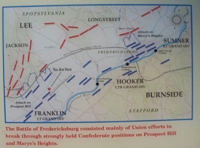
On the lower right is a campaign map. The Battle of Fredericksburg consisted mainly of Union efforts to break through strongly held Confederate positions on Prospect Hill and Marye's Heights.
Also see . . . Fredericksburg-Spotsylvania Battlefield. NPS web

3. Civil War Preservation Trust
Help preservation like the Slaughter Pen Farm.
Click for more information.
Click for more information.
Photographed By Craig Swain, July 25, 2009
6. Slaughter Pen Farm
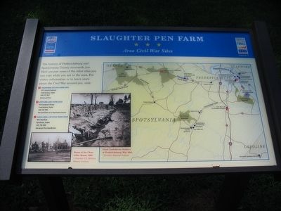
Area Civil War Sites
Area Civil War Sites
Double click the photo to zoom onto the map.
The history of Fredericksburg and Spotsylvania County surrounds you. Here are just some of the other sites you can visit while you are in the area. For visitor information or to learn more about the Civil War around you, visit:
(1) Fredericksburg Battlefield Visitor Center
1013 Lafayette Boulevard, Fredericksburg, Virginia (540) 373-6122
(2) Spotsylvania County Visitor Center
4704 Southpoint Parkway, Fredericksburg, Virginia (540) 507-7090
(3) Chancellorsville Battlefield Visitor Center
9001 Plank Road, Spotsylvania, Virginia (540) 786-2880
Photos depict the Ruins of the Chancellor House, 1865 and Dead Confederate Soldiers at Fredericksburg, May 1863.
Credits. This page was last revised on February 2, 2023. It was originally submitted on July 26, 2009, by Craig Swain of Leesburg, Virginia. This page has been viewed 1,419 times since then and 20 times this year. Photos: 1. submitted on July 26, 2009, by Craig Swain of Leesburg, Virginia. 2. submitted on February 23, 2022, by Benjamin Harrison Allen of Amissville, Virginia. 3, 4, 5, 6. submitted on July 26, 2009, by Craig Swain of Leesburg, Virginia.
