Near Argyle in Sanilac County, Michigan — The American Midwest (Great Lakes)
Sanilac Petroglyphs Park Geneology
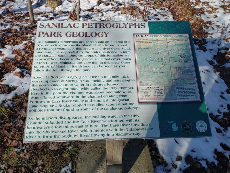
The Sanilac Petroglyphs are carved into an outcrop of a type of rock known as the Marshall Sandstone. About 340 million years ago, this area was a river delta. Sand, mud and lime deposited by the water hardened to form the Marshall Sandstone. Outcrops of this, formation are exposed here because the glacial soils that cover much of the Lower Peninsula are very thin in this area. Other outcrops of Marshall Sandstone can be seen as you follow the trail through the park.
About 12,500 years ago, glacial ice up to a mile thick covering much of Michigan was melting and retreating to the north. Glacial melt water in this area formed a riverbed up to eight miles wide called the Ubly Channel. Here in the park the channel was about one mile wide. Water flowed westward in the channel creating what is now the Cass River valley and emptied into glacial Lake Saginaw. Rocks trapped in eddies scoured out the potholes that are found in some of the sandstone outcrops.
As the glaciers disappeared, the rushing water in the Ubly Channel subsided and the Cass River was formed with its headwaters a few miles east of here. The Cass River now flows into the Shiawassee River, which merges with the Tittabawassee River to form the Saginaw River flowing into Saginaw Bay.
Topics. This historical marker is listed in these topic lists: Anthropology & Archaeology • Native Americans.
Location. 43° 39.393′ N, 83° 1.237′ W. Marker is near Argyle, Michigan, in Sanilac County. Marker can be reached from Germania Road south of Bay City Forestville Road, on the right when traveling south. Touch for map. Marker is at or near this postal address: 8251 Germania Rd, Cass City MI 48726, United States of America. Touch for directions.
Other nearby markers. At least 8 other markers are within 9 miles of this marker, measured as the crow flies. Archaeology (within shouting distance of this marker); Ezhibiigaadek Asia (within shouting distance of this marker); Sanilac Petroglyphs (about 600 feet away, measured in a direct line); Native Plants (about 600 feet away); Citizens Bank Block (approx. 5.8 miles away); State Reward Road No. 1 (approx. 7.7 miles away); First Presbyterian Church (approx. 8.6 miles away); Elkland Township Hall (approx. 8.7 miles away). Touch for a list and map of all markers in Argyle.
Credits. This page was last revised on November 27, 2022. It was originally submitted on November 23, 2022, by Craig Doda of Napoleon, Ohio. This page has been viewed 71 times since then and 8 times this year. Photos: 1, 2, 3, 4. submitted on November 23, 2022, by Craig Doda of Napoleon, Ohio. • Devry Becker Jones was the editor who published this page.


