Södermalm in Stockholm, Stockholm County, Sweden — Northern Europe (Scandinavia)
Hornsgatan
Photographed by Bruce InCharlotte, September 8, 2022
1. Hornsgatan Marker

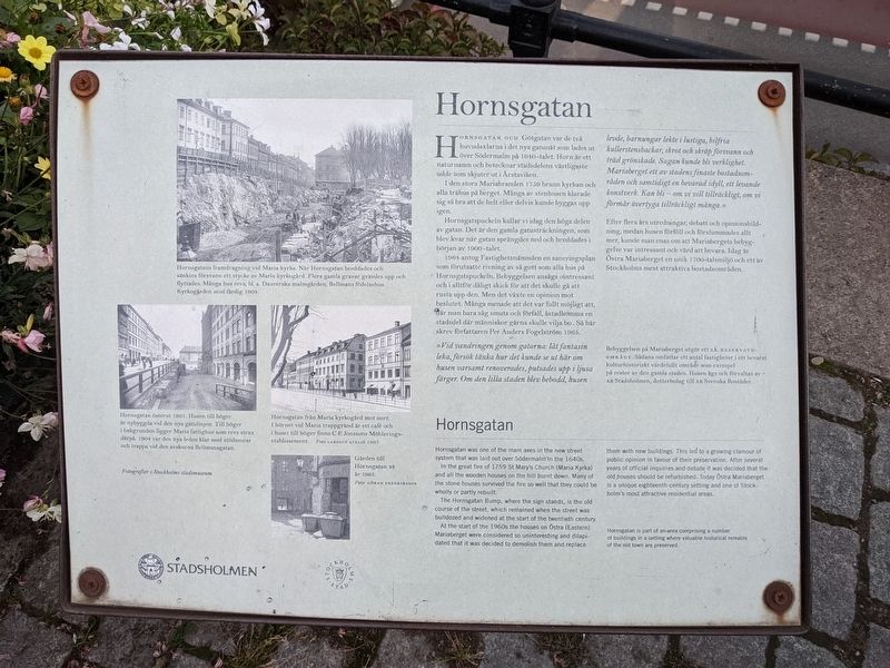
In the great fire of 1759, St. Mary's Church (Maria Kyrka) and all the wooden houses on the hill burnt down. Many of the stone houses survived the fire so well that they could be wholly or partly rebuilt.
The Hörnsgatan Bump, where the sign stands, is the old course of the street, which remained when the street was bulldozed and widened at the start of the twentieth century.
At the start of the 1960s, the houses on Östra (Eastern) Mariaberget were considered so uninteresting and dilapidated that it was decided to demolish them and replace them with new buildings. This led to a growing clamor of public opinion in favour of their preservation. After several years of official inquiries and debate, it was decided that the old houses should be refurbished. Today, Östra Mariaberget is a unique eighteenth-century setting and one of Stockholm's most attractive residential areas.
Hornsgatan is part of an area comprising a number of buildings in a setting where valuable historical remains of the old town
this page online
(Swedish text not transcribed)
Topics. This historical marker is listed in these topic lists: Architecture • Roads & Vehicles. A significant historical year for this entry is 1759.
Location. 59° 19.152′ N, 18° 3.911′ E. Marker is in Stockholm, Stockholms län (Stockholm County). It is in Södermalm. It is on Hornsgatan. Touch for map. Marker is at or near this postal address: Hornsgatan 40-42, Stockholm, Stockholms län 118 21, Sweden. Touch for directions.

Regionally, it is in Europe, the European Union, Scandinavia, the Nordic Countries, the Schengen Area, and the Western World.
Other nearby markers. At least 8 other markers are within walking distance of this marker: Västra Gymnasiehuset / Western High School Building (approx. 0.6 kilometers away); Östra Gymnasiehuset / Eastern High School building (approx. 0.6 kilometers away); Sparreska Palatset / Palace (approx. 0.6 kilometers away); Kammarrättens hus / Administrative Court of Appeal (approx. 0.6 kilometers away); Södra Bankohuset / Southern Bank Building (approx. 0.6 kilometers away); "Lejonet" / "The Lion" (approx. 0.6 kilometers away); Källaren Fimmelstången / The Fimmelstången Tavern (approx. 0.7 kilometers away); Erik Dahlbergh (approx. 0.7 kilometers away). Touch for a list and map of all markers in Stockholm.
Credits. This page was last revised on November 29, 2022. It was originally submitted on November 24, 2022, by Bruce InCharlotte of Charlotte, North Carolina. This page has been viewed 229 times since then and 30 times this year. Photo 1. submitted on November 24, 2022, by Bruce InCharlotte of Charlotte, North Carolina. • Andrew Ruppenstein was the editor who published this page.
