Near Williams in Lake of the Woods County, Minnesota — The American Midwest (Upper Plains)
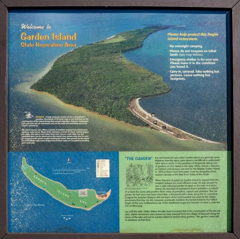
Welcome to Garden Island State Recreation Area
Wildlife: A walk along the beach can be a shorebirder's paradise. Shorebirds of all kinds stop to rest and feed on the sand beaches of this island during their annual migrations. Pelicans, cormorants, gulls and terns are all commonly seen on the sand spit stretching out to the island's eastern tip.
The island interior also offers a variety of habitats ranging from inland open marsh to cedar forest. Much of the overstory consists of aspen, balsam poplar, box elder, elm, spruce and cedar. Deer, bear, beaver, mink, otter, fox and snowshoe hare can be observed on the island. Grey wolves may also be seen on occasion in the winter months hunting the island. Also present on the island are several bald eagle nests. At least two of these nests are occupied by breeding pairs each year.
"The Garden"
It is not known for sure when Garden Island was given its name. However, how the name came about is not difficult to understand. John Tanner wrote in his narratives of frequently taking care of gardens on this island in the early 1800s. Simon J. Dawson, an explorer and surveyor, was sent by Her Majesty Queen Victoria in 1859 to find a land and water route for emigration from eastern Canada to the Red River Valley of the North.
When Dawson stopped on Garden Island to inquire from the resident Indians the most efficient route, he was amazed to see a well-cultivated garden located on the east end of the island. He reported to parliament that it included a cornfield of at least five acres and another three acres of pumpkins, squash and potatoes. The last garden he had seen had been more than a thousand miles away along the St. Lawrence. Imagine his surprise! Dawson did not learn of the well-traveled trail used by the Native Americans that day. He did, however, eventually establish the famed Dawson Trail which began at the very northwestern tip of the Northwest Angle and traveled to what is now the City of Winnipeg.
Up until the early 1900s, before the lake level increased due to the construction of the Kenora dam, Native Americans were known to have traveled from the village of Warroad along the shore of the lake and out to Garden Island to tend to their gardens. The gardens were still in existence at that time.
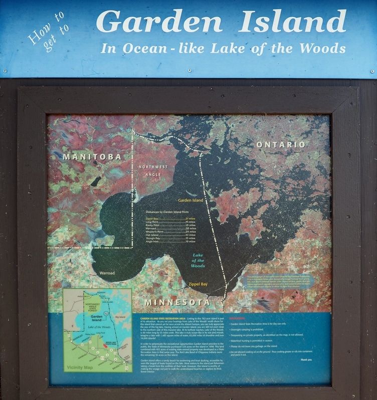
How to get to Garden Island in Ocean-like Lake of the Woods
Garden Island State Recreation Area: Getting to this 762-acre island is part of its attraction. As you set your bearings from Lake of the Woods' south shore for this island that cannot yet be seen across the distant horizon, you can truly appreciate the size of this big lake. Having arrived on Garden Island, you are still not even close to the northern side of this massive lake. At its farthest reaches, Lake of the Woods is 90 miles long by 55 miles wide. This lake is truly ocean-like in its size and moods. Imagine a lake with 1,485 square miles of water, 65,000 miles of shoreline and over 14,000 islands!
In order to perpetuate the recreational opportunities Garden Island provides to the public, the State of Minnesota purchased 324 acres on the island in 1998. This land combined with 402 acres of existing state-owned property was developed as a State Recreation Area in that same year. The Red Lake Band of Chippewa Indians owns the remaining 36 acres on the island.
Garden Island offers a sandy beach for swimming and boat docking, accessible by even the largest of boats found on the lake. Most visitors to the island are fishermen taking a break from the confines of their boat. However, this island is worthy of making the voyage out just to walk the undeveloped beaches or explore its thick forest interior.
This photograph of our earth was taken by the Landsat 5 satellite. It is a standard false-color composite image formed from green, red, and short-infrared bands, color coded as blue, green, and red. Active vegetation appears red and pink, and water bodies are black. Urban structures appear in white to light blue shades.
Erected by Minnesota Department of Natural Resources.
Topics. This historical marker is listed in these topic lists: Exploration • Horticulture & Forestry • Native Americans • Parks & Recreational Areas. A significant historical year for this entry is 1859.
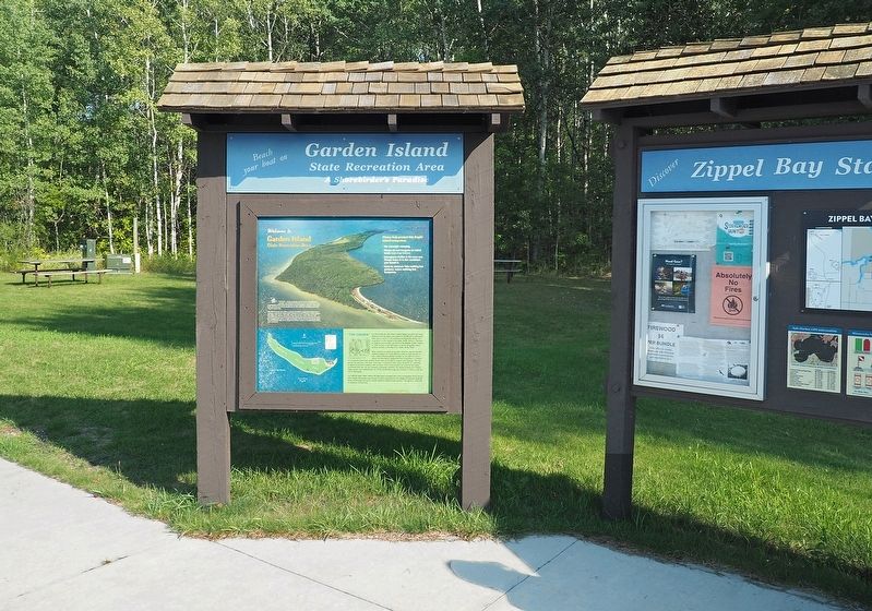
Location. 48° 52.149′ N, 94° 52.513′ W. Marker is near Williams, Minnesota, in Lake of the Woods County. Marker can be reached from 54th Avenue Northwest (County Road 34) 3.4 miles north of County Road 8NW, on the right when traveling north. Marker is in Zippel Bay State Park (fee area), at the Zippel Bay Boat Landing. Touch for map. Marker is in this post office area: Williams MN 56686, United States of America. Touch for directions.
Other nearby markers. At least 2 other markers are within 2 miles of this marker, measured as the crow flies. An Early Way of Life / The First Roads (approx. 1.2 miles away); The Zippel Town Site and Levee / The Zippel Fishery (approx. 1.3 miles away).
Regarding Welcome to Garden Island State Recreation Area. Garden Island State Recreation Area is 21 miles north of this marker, in Lake of the Woods.
Credits. This page was last revised on November 28, 2022. It was originally submitted on November 24, 2022, by McGhiever of Minneapolis, Minnesota. This page has been viewed 150 times since then and 40 times this year. Photos: 1, 2, 3. submitted on November 24, 2022, by McGhiever of Minneapolis, Minnesota. • Devry Becker Jones was the editor who published this page.


