Greenbrier West in Chesapeake, Virginia — The American South (Mid-Atlantic)
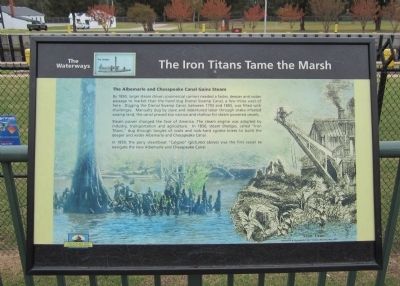
The Iron Titans Tame the Marsh
The Waterways
By 1850, larger steam driven commercial carriers needed a faster, deeper and wider passage to market than the hand dug Dismal Swamp Canal, a few miles west of here. Digging the Dismal Swamp Canal, between 1793 and 1805, was filled with challenges. Manually dug by slave and indentured labor through snake-infested swamp land, the canal proved too narrow and shallow for steam powered vessels.
Steam power changed the face of America. The steam engine was adopted by industry, transportation and agriculture. In 1850, steam dredges, called “Iron Titans,” dug through tangles of roots and rock-hard cypress knees to build the deeper and wider Albemarle and Chesapeake Canal.
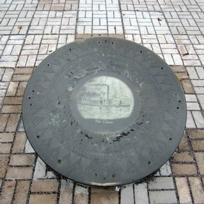
In 1859, the pony steamboat “Calypso” (pictured above) was the first vessel to navigate the new Albemarle and Chesapeake Canal.
Erected by Chesapeake Bay Gateways Network.
Topics. This historical marker is listed in these topic lists: Man-Made Features • Waterways & Vessels. A significant historical year for this entry is 1850.
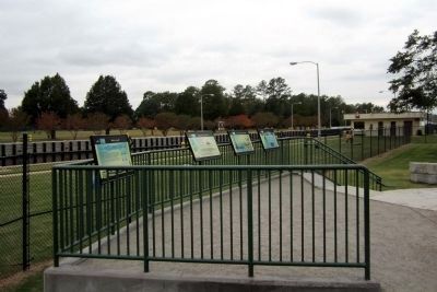
Location. 36° 43.419′ N, 76° 14.813′ W. Marker is in Chesapeake, Virginia. It is in Greenbrier West. Marker can be reached from Locks Road, 0.6 miles west of North Battlefield Boulevard (Virginia Route 168), on the left when traveling west. Located in Great Bridge Lock Park. Touch for map. Marker is in this post office area: Chesapeake VA 23320, United States of America. Touch for directions.
Other nearby markers. At least 8 other markers are within walking distance of this marker. Liquid Highways (here, next to this marker); Why Build a Canal Here? (here, next to this marker); What is a Lock? (here, next to this marker); Bridging the Past with the Present (within shouting distance of this marker); The Battle of Great Bridge (within shouting distance of this marker); Welcome (within shouting distance of this marker); Village of Great Bridge (about 500 feet away, measured in a direct line); Marine Veterans Memorial (approx. 0.4 miles away). Touch for a list and map of all markers in Chesapeake.
More about this marker. On the right is a drawing entitled "Iron Titan" from "Albemarle & Chesapeake Canal" Harpers Monthly May 1860
Also see . . .
1. Great Bridge Lock Park - Chesapeake, VA. Gateways and Watertrails Network (Submitted on October 30, 2011, by Bernard Fisher of Richmond, Virginia.)
2. Great Bridge Lock Park. City of Chesapeake (Submitted on October 30, 2011, by Bernard Fisher of Richmond, Virginia.)
3. Albemarle & Chesapeake Canal Historic District (pdf file). National Register of Historic Places (Submitted on October 30, 2011, by Bernard Fisher of Richmond, Virginia.)
Credits. This page was last revised on February 1, 2023. It was originally submitted on October 30, 2011, by Bernard Fisher of Richmond, Virginia. This page has been viewed 876 times since then and 20 times this year. Last updated on November 25, 2022, by Carl Gordon Moore Jr. of North East, Maryland. Photos: 1, 2, 3, 4. submitted on October 30, 2011, by Bernard Fisher of Richmond, Virginia.


