Osawatomie in Miami County, Kansas — The American Midwest (Upper Plains)
Battle of Osawatomie
Photographed by Ian Lefkowitz, June 22, 2023
1. Battle of Osawatomie Marker
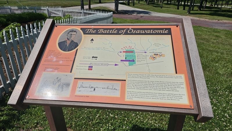
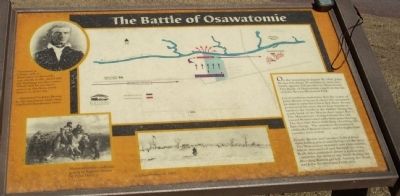
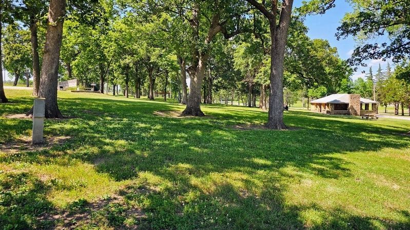
On the morning of August 30, 1856, John Brown led about 30 antislavery men into battle against 250 proslavery Missourians. This Battle of Osawatomie raged on the site of John Brown Memorial Park.
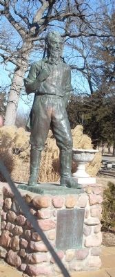
Local tradition maintains that the statue of John Brown is located where the mounted proslavery men fired their first shots. Brown positioned his men about four hundred yards to the north in the timber lining the south bank of the Marais Des Cygnes River. The Missourians charged down the hill towards Brown's men with their guns blazing. The free-state force held firm, checking the first charge. The attackers dismounted, outflanked Brown's force, and brought their cannon into action.
Finally Brown and his men bolted from their hiding places and fled across the river. The Missourians swarmed into Osawatomie where they sacked and burned the town. Both sides sustained about a half a dozen casualties, the most of any battle during the Bleeding Kansas period. Among the dead was John Brown's son Frederick.
"God sees it. I have only a short time to live - only one death to die, and I will die fighting for this cause. There will
this page online
-Attributed to John Brown by his son Jason while they watched Osawatomie burn. A map of the Battle is the main illustration on the marker.
On the lower left is an illustration of "Missouri border ruffians going to Kansas drawn by Felix Darley."
On the center bottom of the marker is an illustration of "Osawatomie in 1862."
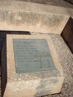
Near this marker in the plaza area is a metal marker with the following text:
John Brown and the Battle of Osawatomie 1856
The blood that
flowed in Kansas
before and during
the Civil War
nourished the
Twin Trees of
Liberty and Union.
Erected 1969 by National Park Service, U.S. Department of the Interior; State of Kansas; and the City of Osawatomie.
Topics. This historical marker is listed in this topic list: War, US Civil. A significant historical year for this entry is 1856.
Location. 38° 29.919′ N, 94° 57.539′ W. Marker is in Osawatomie, Kansas, in Miami County. It can be reached from Tenth Street 0.2 miles north of Main Street. Touch for map. Marker is in this post office area: Osawatomie KS 66064, United States of America.
Photographed by Thomas Onions, January 19, 2009
2. Battle of Osawatomie Marker
Closeup of Marker

Regionally, this marker is in Eastern Kansas, specifically in Bleeding Kansas Border War Country, and in Greater Kansas City. It is also in the American Midwest, in the Corn Belt, on the prairies, on the Southern Plains, and on the Santa Fe Trail Corridor. Globally, it is in North America, the Western Hemisphere, the Western World, and the Anglosphere. Historically, it finds itself in what was once the Louisiana Purchase.
Other nearby markers. At least 8 other markers are within walking distance of this marker: John Brown Statue (here, next to this marker); a different marker also named Battle of Osawatomie (a few steps from this marker); T. B. Williams and J. B. Remington (a few steps from this marker); John Brown Battleground (a few steps from this marker); a different marker also named Battle of Osawatomie (within shouting distance of this marker); John Brown of Kansas (within shouting distance of this marker); a different marker also named Battle of Osawatomie (about 300 feet away, measured in a direct line); Site of the Battle of Osawatomie (about 300 feet away). Touch for a list and map of
Photographed by Thomas Onions, January 19, 2009
3. Battle of Osawatomie Marker
Twin Trees Marker
More about this marker. The main marker is behind the building containing the Adair Cabin. The Twin Trees marker is in the plaza area just to the south of the cabin building.
Also see . . .
1. Battle of Osawatomie, Kansas. Legends of America website entry (Submitted on July 26, 2009, by Thomas Onions of Olathe, Kansas.)
2. John Brown Museum State Historic Site. Kansas Historical Society website entry (Submitted on July 26, 2009, by Thomas Onions of Olathe, Kansas.)
Photographed by Thomas Onions, January 19, 2009
4. Battle of Osawatomie Marker
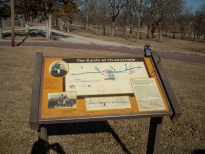
Shot of main marker with a portion of the Battlefield seen in the Distance
Photographed by Thomas Onions, January 19, 2009
5. Battle of Osawatomie Marker
Photo of John Brown Statue
Photographed by Ian Lefkowitz, June 22, 2023
6. Battle of Osawatomie Grounds
This historic site is the home of the cabin John Brown and his family used while in Kansas, and also the site of the Battle of Osawatomie.
Credits. This page was last revised on April 3, 2025. It was originally submitted on July 26, 2009, by Thomas Onions of Olathe, Kansas. This page has been viewed 3,186 times since then and 95 times this year. Photos: 1. submitted on March 25, 2025, by Ian Lefkowitz of New York, New York. 2, 3, 4, 5. submitted on July 26, 2009, by Thomas Onions of Olathe, Kansas. 6. submitted on March 25, 2025, by Ian Lefkowitz of New York, New York. • Craig Swain was the editor who published this page.
