Fairmont in Marion County, West Virginia — The American South (Appalachia)
Battle for the Bridge
The Foundry Fight
— Jones-Imboden Raid —
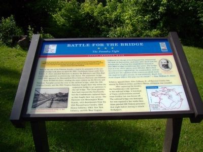
Here, at the site of the Palatine foundry, a battle for possession of the suspension bridge took place on April 29, 1863. Confederate forces under Gen. William E. Jones attacked Fairmont to destroy the Baltimore and Ohio Railroad bridge upstream at present-day 12th Street. The suspension bridge (1852–1908) spanned the Monongahela River between Fairmont and Palatine.
Jones divided his force, sending the main column up the Beverly and Fairmont Turnpike across the river to the railroad bridge, while the 12th Virginia Cavalry and the 35th Virginia Battalion fought their way across the suspension bridge to go upstream to the rail bridge. The Union garrison here had removed the floorboards, but the Confederates replaced them as they fought their way across. The Fairmont and Mannington Home Guards, with detachments from the 13th Pennsylvania Cavalry, 23rd Illinois Infantry, 106th New York Infantry, and 6th West Virginia Infantry, opposed them. John Coffman, Jr., of Harrison County, was among the Federals killed, and Perry Watton of Palatine was wounded.
After capturing the foundry, the Confederates rode upstream to the railroad bridge. A trainload of Union reinforcements arrived from Grafton but was driven off. The railroad bridge was destroyed but was repaired a few weeks later. Jones paroled 260 Federal prisoners that night before leaving to attack Bridgeport.
“[Officers] in charge of working parties, commenced the task of destruction, and soon after dark had the satisfaction of seeing this magnificent structure [the B&O bridge] tumble into the water. The bridge was of iron; three spans, each 300 feet. More than two years were required for its
construction, and six months for the erection of the centers on which to fix the superstructure of iron. It cost $486,333. Much time must elapse before this gap can be closed.” —Gen. William. E. Jones
Erected by Civil War Trails.
Topics and series. This historical marker is listed in this topic list: War, US Civil. In addition, it is included in the West Virginia Civil War Trails series list. A significant historical month for this entry is April 1605.
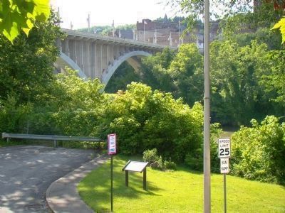
Location. 39° 28.933′ N, 80° 8.317′ W. Marker is in Fairmont, West Virginia, in Marion County. Marker is on Everest Drive just north of Merchant Street (West Virginia Route 73), on the left when traveling east. It is under the Jefferson Street bridge in Palatine Park. From downtown Fairmont, take the 3rd Street bridge across the river (the roadway changes name to Merchant Street) and make the first left onto an unnamed street that will wind you down to the riverbank and continue under the Jefferson Street bridge. The marker is just past the Jefferson Street bridge overpass. Touch for map. Marker is in this post office area: Fairmont WV 26554, United States of America. Touch for directions.
Other nearby markers. At least 8 other markers are within walking distance of this marker. High-Level / Million Dollar Robert H. Mollohan Bridge (about 400 feet away, measured in a direct line); Attack on Fairmont (about 700 feet away); Johnnie Johnson (about 800 feet away); Battle Of Fairmont (approx. 0.2 miles away); Confederate Cemetery (approx. 0.2 miles away); a different marker also named High-Level / Million Dollar Robert H. Mollohan Bridge (approx. ¼ mile away); A. Brooks Fleming House (approx. ¼ mile away); Veterans Memorial (approx. ¼ mile away). Touch for a list and map of all markers in Fairmont.
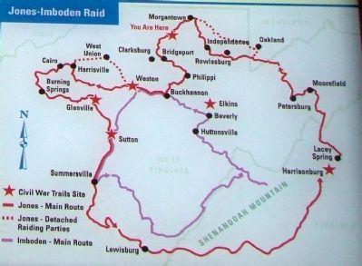
More about this marker. This Civil War Trails marker has a photograph of the “Fairmont and Palatine Suspension Bridge ca. 1900” on the lower left, a portrait of General William E. Jones on the upper right, and a map of the route of the Jones–Imboden raid on the lower right.
The “Attack on Fairmont” marker is on the opposite shore.
Also see . . . Jones–Imboden Raid. Wikipedia entry (Submitted on January 29, 2022, by Larry Gertner of New York, New York.)

Photographed By J. J. Prats, June 23, 2009
4. Piers from the Suspension Bridge
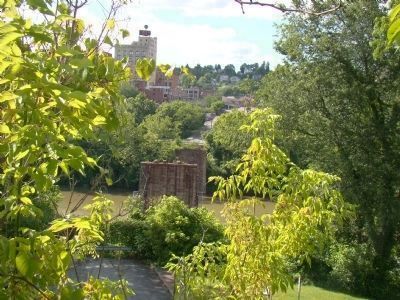
The Suspension Bridge connected what was then called Palatine (now part of Fairmont, foreground) and Fairmont (distance). The marker is hidden by the tree branches to the right of the roadway. The bridge landed at Madison Street across the river in Fairmont.
Credits. This page was last revised on January 29, 2022. It was originally submitted on July 26, 2009, by J. J. Prats of Powell, Ohio. This page has been viewed 2,956 times since then and 58 times this year. Photos: 1, 2, 3, 4, 5. submitted on July 26, 2009, by J. J. Prats of Powell, Ohio.


