Capitol Hill in Southwest Washington in Washington, District of Columbia — The American Northeast (Mid-Atlantic)
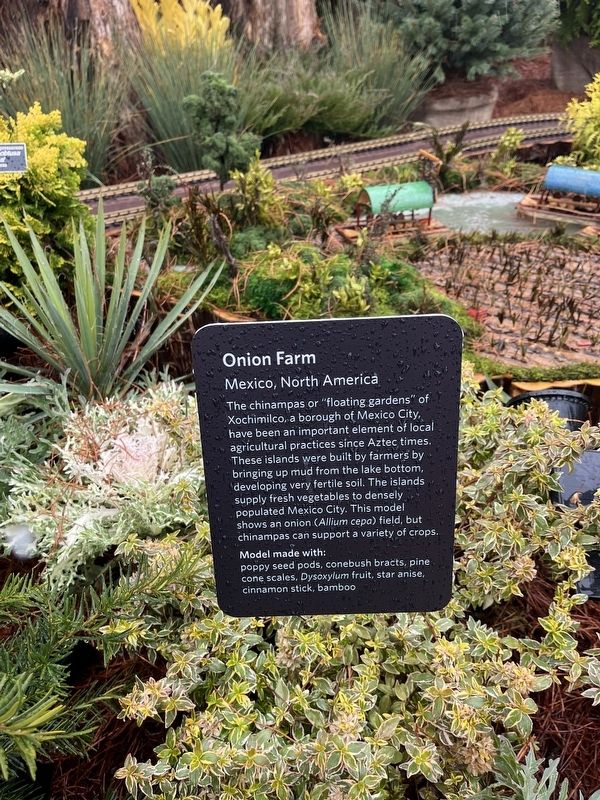
Onion Farm
Mexico, North America
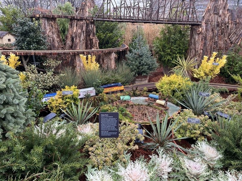
The chinampas or "floating gardens" of Xochimilco, a borough of Mexico City, have been an important element of local agricultural practices since Aztec times. These islands were built by farmers by bringing up mud from the lake bottom, developing very fertile soil. The islands supply fresh vegetables to densely populated Mexico City. This model shows an onion (Allium cepa) field, but chinampas can support a variety of crops.
Model made with:
poppy seed pods, conebush bracts, pine cone scales, Dysolyxylum fruit, star anise, cinnamon stick, bamboo
Erected by United States Botanic Garden.
Topics. This historical marker is listed in these topic lists: Agriculture • Native Americans.
Location. 38° 53.296′ N, 77° 0.815′ W. Marker is in Southwest Washington in Washington, District of Columbia. It is in Capitol Hill. Marker can be reached from Maryland Avenue Southwest east of 3rd Street Southwest, on the right when traveling east. Touch for map. Marker is at or near this postal address: 100 Maryland Ave SW, Washington DC 20024, United States of America. Touch for directions.
Other nearby markers. At least 8 other markers are within walking distance of this marker. Potato Farm and Machu Picchu (here, next to this marker); Cranberry Bog (a few steps from this marker); The National Garden Takes Root (a few steps from this marker); What Kind of Rose Is That? (within shouting distance of this marker); Grains (about 300 feet away, measured in a direct line); Bartholdi Fountain and Gardens (about 300 feet away); Medicinal Natives (about 300 feet away); Citrus (about 400 feet away). Touch for a list and map of all markers in Southwest Washington.
Credits. This page was last revised on January 30, 2023. It was originally submitted on November 27, 2022, by Devry Becker Jones of Washington, District of Columbia. This page has been viewed 94 times since then and 14 times this year. Photos: 1, 2. submitted on November 27, 2022, by Devry Becker Jones of Washington, District of Columbia.

