Blairsville in Indiana County, Pennsylvania — The American Northeast (Mid-Atlantic)
Samuel McCune Safehouse
The Blairsville Area Underground Railroad
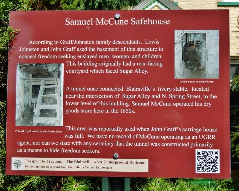
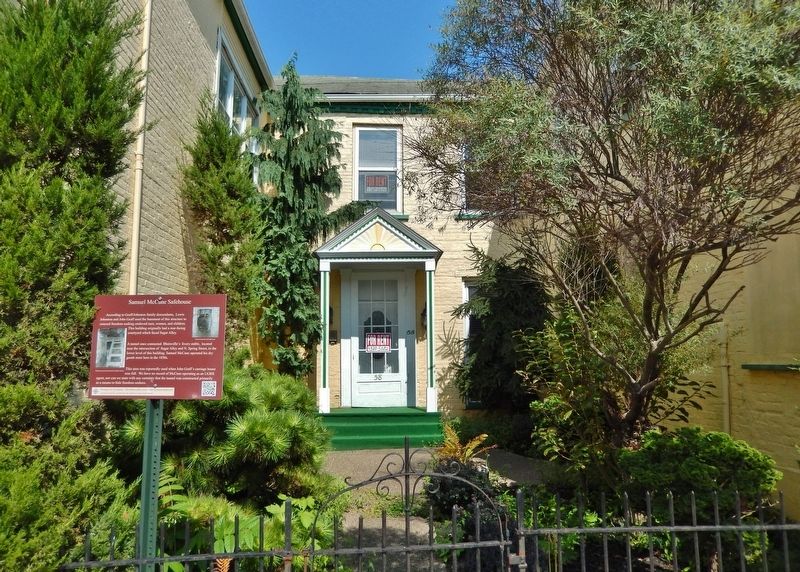
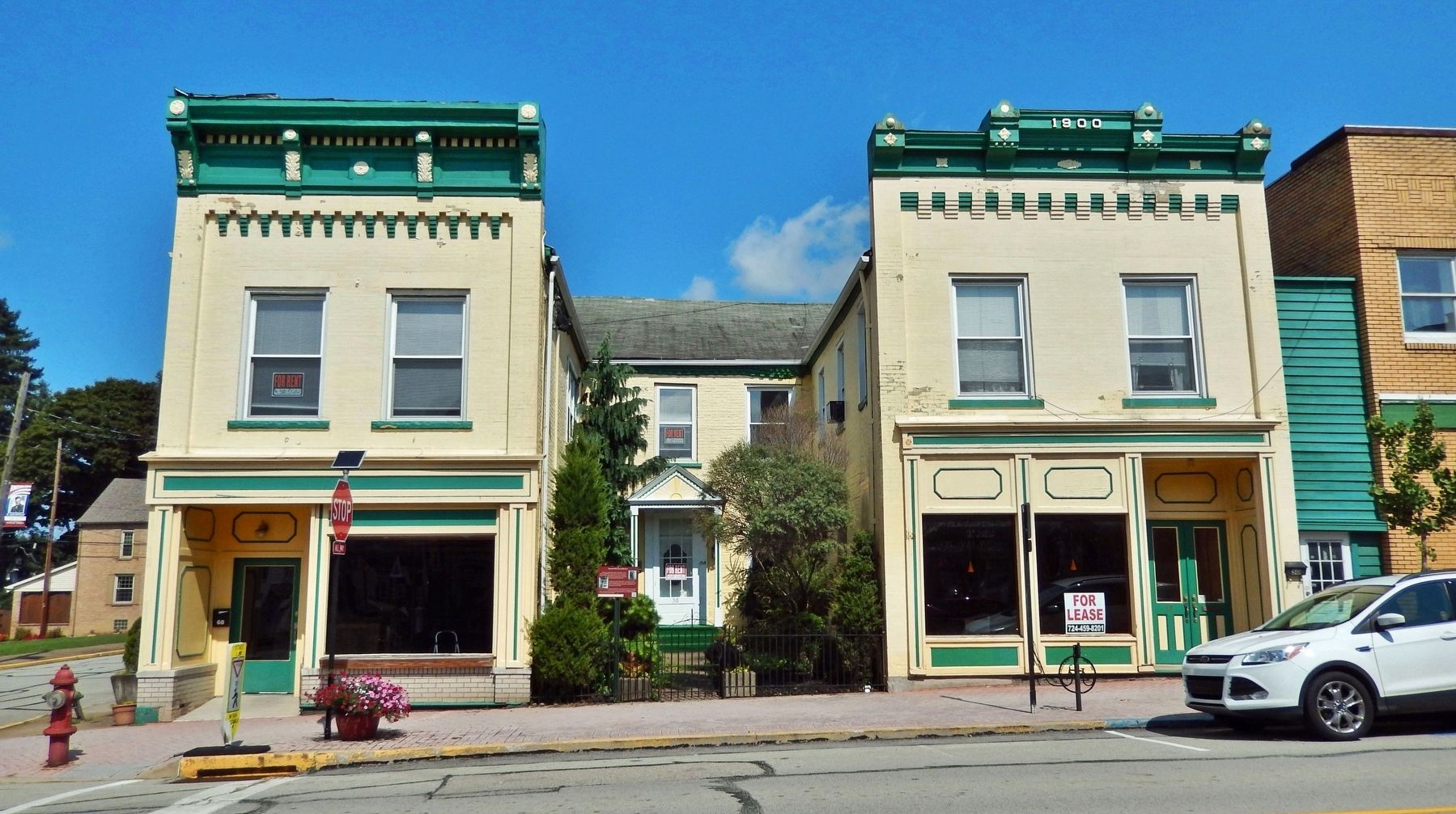
According to Graff/Johnston family descendants, Lewis Johnston and John Graff used the basement of this structure to conceal freedom seeking enslaved men, women, and children. This building originally had a rear-facing courtyard which faced Sugar Alley.
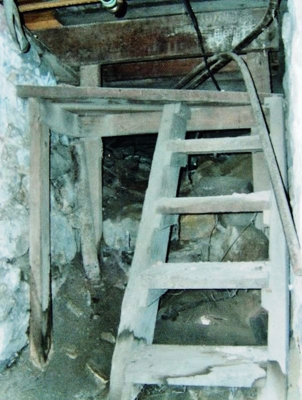
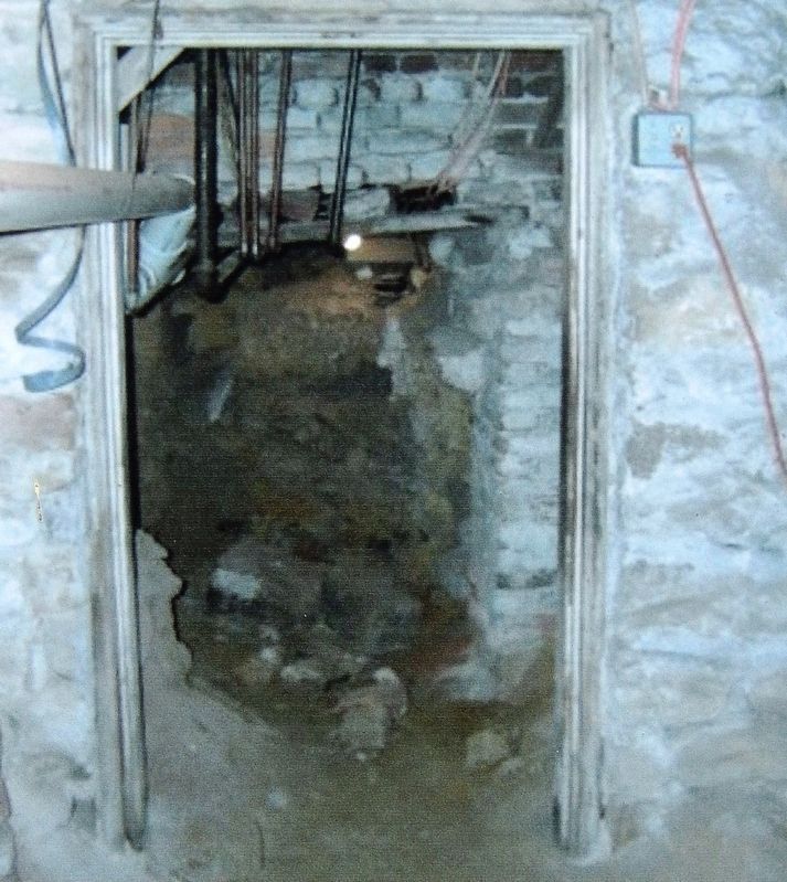
A tunnel once connected Blairsville's livery stable, located near the intersection of Sugar Alley and N. Spring Street, to the lower level of this building. Samuel McCune operated his dry goods store here in the 1850s.
This area was reportedly used when John Graff's carriage house was full. We have no record of McCune operating as an UGRR agent, nor can we state with any certainty that the tunnel was constructed primarily as a means to hide freedom seekers.
Topics. This historical marker is listed in these topic lists: Abolition & Underground RR • African Americans • Civil Rights • Industry & Commerce. A significant historical year for this entry is 1850.
Location. 40° 25.851′ N, 79° 15.955′ W. Marker is in Blairsville, Pennsylvania, in Indiana County. Marker is on West Market Street just east of North Spring Street, on the right when traveling west. Marker is located beside the sidewalk, directly in front of the subject building. Touch for map. Marker is at or near this postal address: 58 West Market Street, Blairsville PA 15717, United States of America. Touch for directions.
Other nearby markers. At least 8 other markers are within walking distance of this marker. Chester C. Davis and the Kidnapping of 1858 (within shouting distance of this marker); George Wilkinson and the Kidnapping of 1858 (about 300 feet away, measured in a direct line); St. Peter's Episcopal Church and Rectory (about 400 feet away); Fugitive Slave Rescue (about 400 feet away); Site of Former Associate Reformed and United Presbyterian Churches (about 500 feet away); Dr. Edward Emerson & Dred Scott (about 500 feet away); Blairsville Veterans Memorial (about 500 feet away); Blairsville Armory (about 600 feet away). Touch for a list and map of all markers in Blairsville.
Related markers. Click here for a list of markers that are related to this marker. Passport to Freedom: The Blairsville Area Underground Railroad
Also see . . .
1. John Graff.
John Graff was a wealthy merchant, devoted elder in the Methodist Episcopal Church, and strong temperance man. John Graff was also an agent on the Underground Railroad. Mr. Graff’s vast holdings in coal companies, transportation, and iron furnaces connected him with the UGRR network outside of Indiana County. In Blairsville, Mr. Graff had constructed a tunnel from the top of the Conemaugh riverbank, through the yard of his brother’s 1820s home, under South Liberty St, and into the floor of his carriage house. The carriage house was a hiding area for the freedom seekers. John Graff worked in conjunction with fellow Underground Railroad conductor Lewis Johnston.(Submitted on November 29, 2022, by Cosmos Mariner of Cape Canaveral, Florida.)
2. Lewis Johnston, Underground Railroad Conductor.
Lewis Johnston and his wife Jane Bronson Johnston were UGRR conductors in Blairsville and Allegheny City (North Pittsburgh), PA. It is believed that Mr. Johnston transported freedom seekers as he hauled iron blooms over the mountains between Blairsville and Hollidaysburg.(Submitted on November 29, 2022, by Cosmos Mariner of Cape Canaveral, Florida.)
3. Graff Tunnel.
This tunnel was used by freedom seekers to connect the river to a safe area in Graff’s carriage house. In the carriage house, a circular room lined with stone was dug. The tunnel entered into the room and it’s entrance was concealed above. There, freedom seekers could rest, eat, and bathe before continuing further north.(Submitted on November 29, 2022, by Cosmos Mariner of Cape Canaveral, Florida.)Blairsville was a busy transportation hub for canal, coach, and rail travel and Graff had recognized the need for concealment. As a mine owner, the technology and manpower was available to him for the tunnel construction. Today, the riverbank entrance is buried under decades of debris.
The tunnel collapsed throughout the ages and the room filled and sealed.
Credits. This page was last revised on November 29, 2022. It was originally submitted on November 28, 2022, by Cosmos Mariner of Cape Canaveral, Florida. This page has been viewed 151 times since then and 22 times this year. Photos: 1, 2, 3, 4, 5. submitted on November 29, 2022, by Cosmos Mariner of Cape Canaveral, Florida.
