Uptown in San Antonio in Bexar County, Texas — The American South (West South Central)
The Argyle
Photographed by Dave W, March 24, 2022
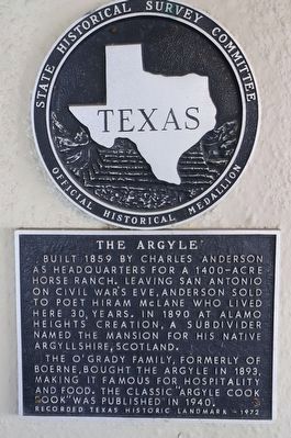
1. The Argyle Marker
Built 1859 by Charles Anderson as headquarters for a 1400-acre house ranch. Leaving San Antonio on Civil War's eve, Anderson sold to poet Hiram McLane who lived here 30 years. In 1890 at Alamo Heights' creation, a subdivider named the mansion for his native Argyllshire, Scotland.
The O'Grady family, formerly of Boerne, bought the Argyle in 1893, making it famous for hospitality and food. The classic "Argyle Cook Book" was published in 1940.
Erected 1972 by State Historical Survey Committee. (Marker Number 197.)
Topics. This historical marker is listed in these topic lists: Agriculture • Architecture. A significant historical year for this entry is 1859.
Location. 29° 28.54′ N, 98° 28.308′ W. Marker is in San Antonio, Texas, in Bexar County. It is in Uptown. It is on Patterson Avenue. The marker is on the building next to the valet stand. Touch for map. Marker is at or near this postal address: 934 Patterson Ave, San Antonio TX 78209, United States of America. Touch for directions.

Regionally, this marker is in South Texas. It is also in the American South. Globally, it is in North America, a Gulf of Mexico state, the Western Hemisphere, the Western World, and the Anglosphere. Historically, it finds itself in what was once New Spain, the Republic of Texas, and one of the Confederate States of America.
Other nearby markers. At least 8 other markers are within walking distance of this marker: Patsy P. and Walter Scott Light House (about 800 feet away, measured in a direct line); Headwaters Sanctuary (approx. 0.4 miles away); San Antonio Spring "Blue Hole" (approx. half a mile away); Bridge Over the San Antonio River (approx. 0.6 miles away); Lourdes Grotto (approx. 0.6 miles away); Brackenridge Villa (approx. 0.6 miles away); Brackenridge Villa Memorial (approx. 0.6 miles away); Motherhouse
this page online
Another marker is no longer nearby. San Antonio Spring (The Blue Hole) (was approx. half a mile away but has been confirmed missing).
Also see . . .
1. The Argyle.
"Originally built in 1854 as the headquarters of a horse ranch which extended from down-town San Antonio to the town of Boerne, some 30 miles distant, it was an outpost of Texas hospitality. "(Submitted on November 29, 2022, by Dave W of Co, Colorado.)
2. Library of Congress Photos taken March 18, 1936 of the exterior.
Argyle House, 924 Patterson & Argyle-Alamo Heights, San Antonio, Bexar County, TX(Submitted on November 29, 2022, by Dave W of Co, Colorado.)
Credits. This page was last revised on February 2, 2023. It was originally submitted on November 29, 2022, by Dave W of Co, Colorado. This page has been viewed 686 times since then and 53 times this year. Photo 1. submitted on November 29, 2022, by Dave W of Co, Colorado. • J. Makali Bruton was the editor who published this page.
Editor’s want-list for this marker. A wide view photo of the marker and the surrounding area together in context. • Can you help?
