Katy in Harris County, Texas — The American South (West South Central)
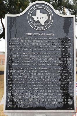
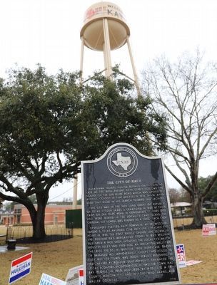
The City of Katy
Karankawa Indians hunted buffalo on this site as late as the 1820s. Present Fifth Street follows the course of the San Felipe Road, which was opened to Austin's colony in that decade. In 1836 Santa Anna used that road in his march toward San Jacinto.
This site was in the 1839 land grant of Republic of Texas citizen James J. Crawford. In 1863 at their camp on San Felipe Road, 35 Confederate soldiers died and were buried in the locality. Cane Island, the original settlement, was known as a stagecoach stop.
Developers platted Katy townsite after Missouri, Kansas & Texas Railroad ("The Katy Line") reached this point in 1895. The post office opened Jan. 23, 1896, in the postmaster's mercantile store. In 1897, William Eule grew a rice crop, initiating the locality's major industry. Eule's son Fred dug an irrigation well for the rice fields in 1899. The 1900 hurricane razed or damaged all improvements except two houses in Katy, but the town was soon rebuilt. Beginning in 1927, nearby petroleum developments enhanced the local economy. Incorporated in 1945, the town had 849 people in 1950 and 3800 by 1970. It is a tri-county municipality, lying in Fort Bend, Harris, and Waller counties.
Erected 1978 by Texas Historical Commission. (Marker Number 10711.)
Topics. This historical marker is listed in these topic lists: Agriculture • Animals • Industry & Commerce • Native Americans • Settlements & Settlers. A significant historical year for this entry is 1895.
Location. 29° 47.245′ N, 95° 49.343′ W. Marker is in Katy, Texas, in Harris County. Marker is at the intersection of 2nd Street and Avenue B, on the right on 2nd Street. Touch for map. Marker is at or near this postal address: 5707 2nd St, Katy TX 77493, United States of America. Touch for directions.
Other nearby markers. At least 8 other markers are within walking distance of this marker. Dube's Super Market (within shouting distance of this marker); The MKT Depot (about 400 feet away, measured in a direct line); The Stewart-Lott Home (about 600 feet away); The Romack Home (about 800 feet away); The Peck Home (approx. 0.2 miles away); First United Methodist Church of Katy (approx. 0.2 miles away); The Hubler-Pitts Home (approx. 0.2 miles away); The Weller-Baird Home (approx. 0.2 miles away). Touch for a list and map of all markers in Katy.
Credits. This page was last revised on February 1, 2023. It was originally submitted on November 29, 2022, by Dave W of Co, Colorado. This page has been viewed 115 times since then and 23 times this year. Photos: 1, 2. submitted on November 29, 2022, by Dave W of Co, Colorado. • Devry Becker Jones was the editor who published this page.

