Wurtland in Greenup County, Kentucky — The American South (East South Central)
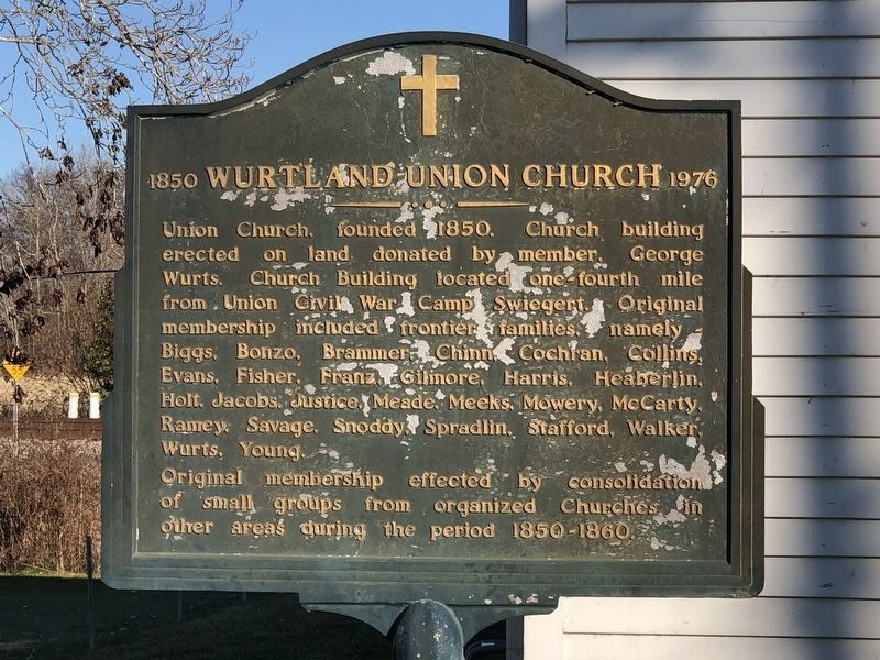
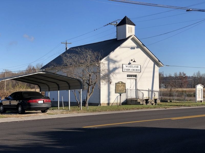
Wurtland Union Church
1850 - 1976
Original membership effected by consolidation of small groups from organized churches in other areas during the period 1850-1860.
Topics. This historical marker is listed in these topic lists: Churches & Religion • War, US Civil. A significant historical year for this entry is 1850.
Location. 38° 33.032′ N, 82° 46.868′ W. Marker is in Wurtland, Kentucky, in Greenup County. Marker is on Wurtland Avenue (Kentucky Route 67) west of Heaberlin Road, on the right when traveling west. Touch for map. Marker is at or near this postal address: 325 Wurtland Ave, Greenup KY 41144, United States of America. Touch for directions.
Other nearby markers. At least 8 other markers are within 3 miles of this marker, measured as the crow flies. Iron made in Kentucky / Steam Furnace (about 700 feet away, measured in a direct line); Camp Swigert (approx. ¼ mile away); McConnell House Complex (approx. 0.4 miles away); John M. McConnell House (approx. 0.4 miles away); Race Track (approx. 1.9 miles away); Caroline Furnace / Iron Made in Kentucky (approx. 2 miles away); Jesse Stuart (1906-1984) (approx. 2 miles away); E. K. Railway (approx. 2.9 miles away). Touch for a list and map of all markers in Wurtland.
Regarding Wurtland Union Church. Excerpt from the National Register of Historic Places nomination for the former church, which was listed in 2008:
An early deed describes the property as “the white frame church or meeting house and the lot enclosed with a link fence around the same, being a part of the old Fulton Forge property” (Deed Book Q, Page 19, December24,1868). It was standing on property George Wurts sold to Greenup County for construction of the County’s Poor House. The Poor House Farm was maintained by a caretaker. At that time, the building served as a non-denominational church and as a community meeting house, which made its use consistent with the public ownership of the adjacent Poor Farm property. During the Civil War, the church became a general meeting quarters for the nearby Civil War Camp Swiegert.
Also see . . . Wurtland Union Church (PDF). National Register nomination for the former church. (National Archives) (Submitted on November 30, 2022, by Duane and Tracy Marsteller of Murfreesboro, Tennessee.)
Credits. This page was last revised on November 30, 2022. It was originally submitted on November 30, 2022, by Duane and Tracy Marsteller of Murfreesboro, Tennessee. This page has been viewed 135 times since then and 17 times this year. Photos: 1, 2. submitted on November 30, 2022, by Duane and Tracy Marsteller of Murfreesboro, Tennessee.

