Pettus in Bee County, Texas — The American South (West South Central)
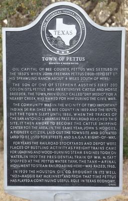
Town of Pettus
(Located 3 Miles South)
Oil capital of Bee County, Pettus was settled in the 1850's when John Freeman Pettus set up his sprawling ranch about 4 miles south of here.
The son of one of Stephen F. Austin's first 300 colonists, Pettus was an extensive cattle and horse breeder. The town, previously called "Dry Medio" for a nearby creek, was named for him during the Civil War.
The community was in the vicinity of two important Indian skirmishes in Bee County in 1859 and the 1870's; but the town slept until 1886, when the tracks of the San Antonio & Aransas Pass railroad reached this site. It then awoke to become the cattle shipping center for the area. In the same year, John S. Hodges, a pioneer citizen, laid out the townsite and donated land to be used for streets and S.A. & A.P. right-of-way.
For years the railroad stockyards and depot were places of bustling activity as freight trains came for loading and wood-burning steam engines took on water. In 1909 the presidential train of Wm. H. Taft stopped at the Pettus water tank. The tank--a final monument to steam railroading here--was razed, 1965.
In 1929 the Houston Oil Co. brought in its well "No. 1-Maggie Ray McKinney" and from that time Pettus has played a continuing useful role in Texas economy.
Erected 1968 by State Historical Survey Committee. (Marker Number 5536.)
Topics. This historical marker is listed in these topic lists: Agriculture • Native Americans • Railroads & Streetcars • Settlements & Settlers.
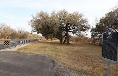
Location. 28° 38.447′ N, 97° 48.867′ W. Marker is in Pettus, Texas, in Bee County. Marker is on U.S. 181 south of Mineral Avenue, on the right when traveling south. Touch for map. Marker is at or near this postal address: 11251 Hwy 181, Pettus TX 78146, United States of America. Touch for directions.
Other nearby markers. At least 8 other markers are within 14 miles of this marker, measured as the crow flies. First Christian Church (approx. 1.6 miles away); Tuleta (approx. 5.3 miles away); Community of Normanna (approx. 8.8 miles away); Early Trails in Bee County (approx. 11 miles away); Kenedy Alien Detention Camp Cemetery (approx. 11˝ miles away); St. Matthew's Episcopal Church (approx. 12.3 miles away); Kenedy (approx. 12˝ miles away); Butler Family Cemetery (approx. 13.3 miles away).
Credits. This page was last revised on December 1, 2022. It was originally submitted on December 1, 2022, by Dave W of Co, Colorado. This page has been viewed 260 times since then and 49 times this year. Photos: 1, 2. submitted on December 1, 2022, by Dave W of Co, Colorado. • Devry Becker Jones was the editor who published this page.

