Pleasanton in Alameda County, California — The American West (Pacific Coastal)
Gay 90's Pizzeria
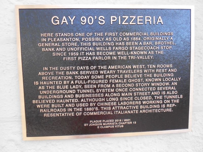
Photographed by Joaquin Murrieta Chapter 13 E Clampus Vitus, November 12, 2016
1. Gay 90's Pizzeria Marker
In the dusty days of the American West, ten rooms above the bank served weary travelers with rest and recreation. Today some people believe the building is haunted by a full-figured female ghost, know locally as the Blue Lady, seen from a second story window. An underground tunnel system once connected several buildings and businesses along Main Street and it's also believed haunted. Although long since closed, the tunnels were built and used by Chinese laborers working on the railroads in 1880’S. This attractive building is representative of commercial Italianate architecture.
Plaque placed 2016 / 6021
By Joaquin Murrieta Chapter 13
E Clampus Vitus
Erected 2016 by Joaquin Murrieta Chapter 13 E Clampus Vitus.
Topics and series. This historical marker is listed in these topic lists: Entertainment • Environment •
this page online
Location. 37° 39.512′ N, 121° 52.608′ W. Marker is in Pleasanton, California, in Alameda County. It is at the intersection of Main Street and Abbie Street, on the right when traveling north on Main Street. Touch for map. Marker is at or near this postal address: 288 Main Street, Pleasanton CA 94566, United States of America. Touch for directions.

Regionally, this marker is in the San Francisco Bay Area and on the Coast Ranges. It is also on the American Pacific Coast. Globally, it is in North America, on the Ring of Fire, on the Pacific Rim, in the Western Hemisphere, in the Western World, and in the Anglosphere. Historically, it finds itself in what was once New Spain and also Mexico’s Alta California.
Other nearby markers. At least 8 other markers are within walking distance of this marker: Nevis Pavilion (about 600 feet away, measured in a direct line); Johnston Building (about 700 feet away); Larkin Locke House (approx. 0.2 miles away); The Pleasanton Sign
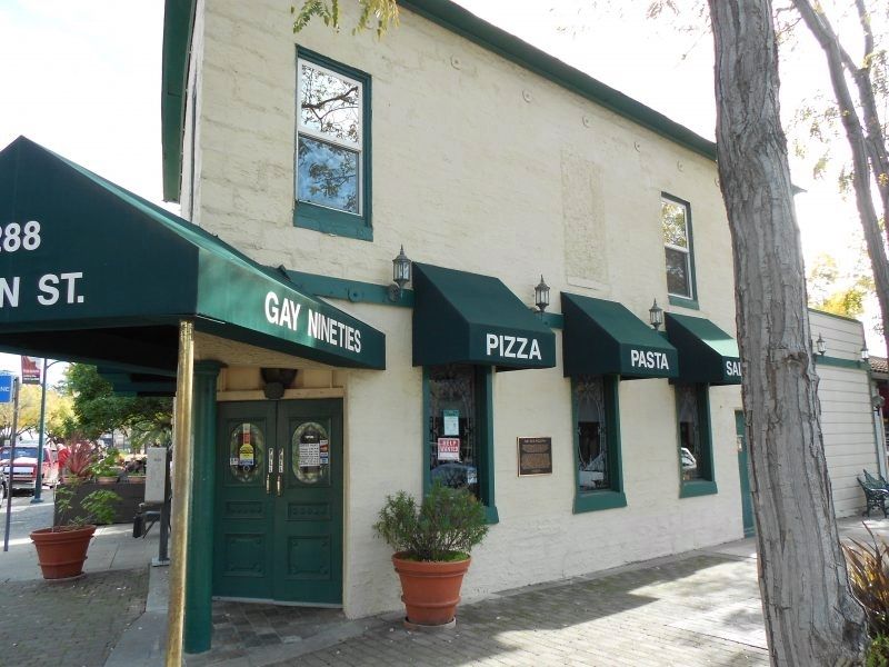
Photographed by Joaquin Murrieta Chapter 13 E Clampus Vitus
2. Gay 90's Pizza Parlor
Additional keywords. prostitution
Credits. This page was last revised on December 5, 2022. It was originally submitted on January 18, 2018, by Frank Gunshow Sanchez of Hollister, California. This page has been viewed 2,048 times since then and 153 times this year. Last updated on December 2, 2022, by Carl Gordon Moore Jr. of North East, Maryland. Photos: 1, 2. submitted on January 18, 2018. • Bill Pfingsten was the editor who published this page.
