Near Brookeville in Montgomery County, Maryland — The American Northeast (Mid-Atlantic)
Brighton Azalea Garden
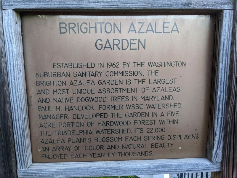
Photographed by Sean C Bath, April 27, 2022
1. Brighton Azalea Garden Marker
Topics. This historical marker is listed in these topic lists: Horticulture & Forestry • Parks & Recreational Areas. A significant historical year for this entry is 1962.
Location. 39° 11.513′ N, 77° 0.424′ W. Marker is near Brookeville, Maryland, in Montgomery County. It is on Brighton Dam Road. Touch for map. Marker is at or near this postal address: 2 Brighton Dam Rd, Brookeville MD 20833, United States of America. Touch for directions.

Regionally, this marker is in the Washington Metropolitan Area. It is also in the American Mid-Atlantic. Globally, it is in North America, the Western Hemisphere, the Western World, and the Anglosphere. Historically, it finds
this page online
Other nearby markers. At least 8 other markers are within 3 miles of this marker, measured as the crow flies: Round Oak Missionary Baptist Church / Sandy Spring African American Heritage Trail (approx. 2.6 miles away); Nina Honemond Clarke / The Richard Perry Budd House / The Budd, Williams, Butler Lineage (approx. 2.6 miles away); Great Hall (approx. 2.6 miles away); Tribute to Robert H. "Bob" Hill / Sharp Street United Methodist Church (approx. 2.6 miles away); Ross J. Boddy / Archie (Jerry) Bell / Hill Top Elementary School (approx. 2.6 miles away); Mysteries of the Hopkins House / Free Black Slaves Settled the Norbeck Community (approx. 2.6 miles away); The Williams and Claggett Families in Ashton / Lineage of Greenberry Howard Family (approx. 2.6 miles away); Brookeville - Mt. Zion / Early Builders in Sandy Spring: The Robert Hill Story (approx. 2.6 miles away).

Photographed by Sean C Bath, April 27, 2022
2. Brighton Azalea Garden Marker
Credits. This page was last revised on December 13, 2022. It was originally submitted on December 3, 2022, by Sean C Bath of Silver Spring, Maryland. This page has been viewed 256 times since then and 36 times this year. Photos: 1, 2. submitted on December 3, 2022, by Sean C Bath of Silver Spring, Maryland. • Bill Pfingsten was the editor who published this page.
