Southwest Minneapolis in Hennepin County, Minnesota — The American Midwest (Upper Plains)
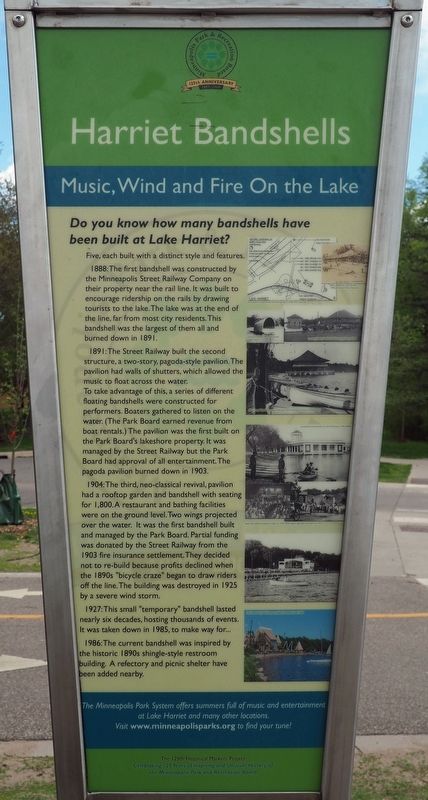
Harriet Bandshells
Music, Wind and Fire On the Lake
Do you know how many bandshells have been built at Lake Harriet?
Five, each built with a distinct style and features.
1888: The first bandshell was constructed by the Minneapolis Street Railway Company on their property near the rail line. It was built to encourage ridership on the rails by drawing tourists to the lake. The lake was at the end of the line, far from most city residents. This bandshell was the largest of them all and burned down in 1891.
1891: The Street Railway built the second structure, a two-story, pagoda-style pavilion. The pavilion had walls of shutters, which allowed the music to float across the water.
To take advantage of this, a series of different floating bandshells were constructed for performers. Boaters gathered to listen on the water. (The Park Board earned revenue from boat rentals.) The pavilion was the first built on the Park Board's lakeshore property. It was managed by the Street Railway but the Park Board had approval of all entertainment. The pagoda pavilion burned down in 1903.
1904: The third, neo-classical revival, pavilion had a rooftop garden and bandshell with seating for 1,800. A restaurant and bathing facilities were on the ground level. Two wings projected over the water. It was the first bandshell built and managed by the Park Board. Partial funding was donated by the Street Railway from the 1903 fire insurance settlement. They decided not to re-build because profits declined when the 1890s "bicycle craze" began to draw riders off the line. The building was destroyed in 1925 by a severe wind storm.
1927: This small "temporary" bandshell lasted nearly six decades, hosting thousands of events. It was taken down in 1985, to make way for...
1986: The current bandshell was inspired by the historic 1890s shingle-style restroom building. A refectory and picnic shelter have been added nearby.
Erected by Minneapolis Park and Recreation Board.
Topics. This historical marker is listed in these topic lists: Entertainment • Parks & Recreational Areas • Railroads & Streetcars • Waterways & Vessels. A significant historical year for this entry is 1888.
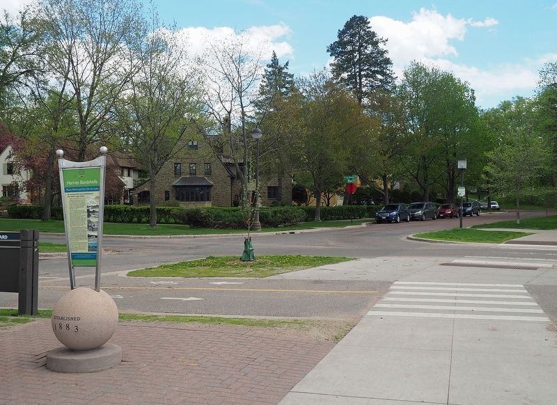
Location. 44° 55.028′ N, 93° 18.02′ W. Marker is in Minneapolis, Minnesota, in Hennepin County. It is in Southwest Minneapolis. Marker is at the intersection of East Lake Harriet Parkway and West Minnehaha Parkway, on the left when traveling north on East Lake Harriet Parkway. Marker is at the Lake Harriet South Beach, between the bike lanes and the footpath around the lake. Touch for map. Marker is at or near this postal address: 4612 E Lake Harriet Pkwy, Minneapolis MN 55419, United States of America. Touch for directions.
Other nearby markers. At least 8
other markers are within 2 miles of this marker, measured as the crow flies. The Crash of Flight 307 (approx. 0.7 miles away); Geology of Minnesota (approx. 0.8 miles away); Harriet Bandshells / Our Park Legacy (approx. 0.8 miles away); Como–Harriet Streetcar Line (approx. 0.8 miles away); First School House (approx. 0.9 miles away); Original Millstone from the Washburn-Crosby Flour Mill (approx. 0.9 miles away); First Dwelling in Minneapolis (approx. 1.6 miles away); PFC. Jimmy Berray (approx. 1.6 miles away). Touch for a list and map of all markers in Minneapolis.
More about this marker. There is an identical marker at the northwest shore of Lake Harriet, beside the current Harriet Bandshell.
Credits. This page was last revised on February 12, 2023. It was originally submitted on December 4, 2022, by McGhiever of Minneapolis, Minnesota. This page has been viewed 77 times since then and 13 times this year. Photos: 1, 2. submitted on December 4, 2022, by McGhiever of Minneapolis, Minnesota. • Devry Becker Jones was the editor who published this page.

