Georgetown in Northwest Washington in Washington, District of Columbia — The American Northeast (Mid-Atlantic)
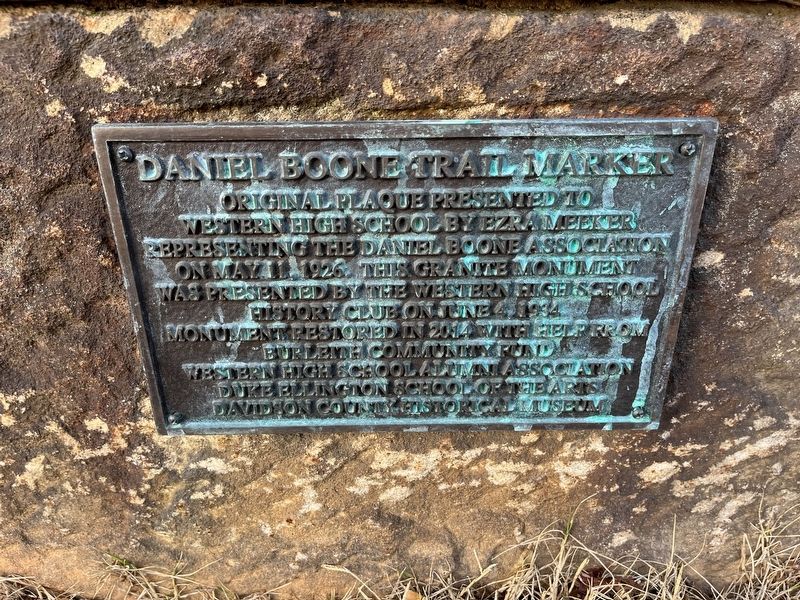
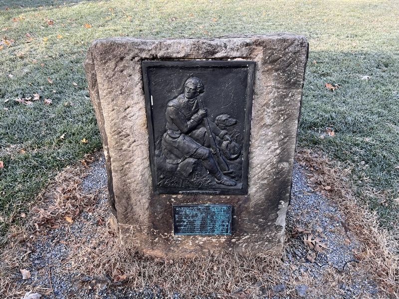
Daniel Boone Trail Marker
Erected 2014 by Burleith Community Fund, Western High School Alumni Association, Duke Ellington School of the Arts, Davidson County Historical Museum.
Topics. This historical marker is listed in these topic lists: Arts, Letters, Music • Education • Roads & Vehicles. A significant historical date for this entry is May 11, 1926.
Location. 38° 54.775′ N, 77° 4.163′ W. Marker is in Northwest Washington in Washington, District of Columbia. It is in Georgetown. Marker is on 35th Street Northwest just north of Reservoir Road Northwest, on the right when traveling south. Touch for map. Marker is at or near this postal address: 3500 Reservoir Rd NW, Washington DC 20007, United States of America. Touch for directions.
Other nearby markers. At least 8 other markers are within walking distance of this marker. Brinetown and Western High School (a few steps from this marker); Temple of Learning and Talent (about 300 feet away, measured in a direct line); Hilleary's Smiling Corner (about 400 feet away); Freed Slave and Future President (about 600 feet away); The Origins of Burleith (about 800 feet away); Mahmoud Yarrow or Yarrow Mamout (approx. 0.2 miles away); "The Birth of Camelot" (approx. 0.2 miles away); The Original Georgetown Reservoir (approx. 0.2 miles away). Touch for a list and map of all markers in Northwest Washington.
Credits. This page was last revised on January 30, 2023. It was originally submitted on December 5, 2022, by Devry Becker Jones of Washington, District of Columbia. This page has been viewed 105 times since then and 21 times this year. Photos: 1, 2. submitted on December 5, 2022, by Devry Becker Jones of Washington, District of Columbia.

