Near Salyersville in Magoffin County, Kentucky — The American South (East South Central)
First Settlement

Photographed by Duane and Tracy Marsteller, November 19, 2022
1. First Settlement Marker
Erected 1964 by Kentucky Historical Society. (Marker Number 202.)
Topics and series. This historical marker is listed in these topic lists: Indigenous Peoples and Communities • Settlements & Settlers. In addition, it is included in the Kentucky Historical Society series list. A significant historical year for this entry is 1794.
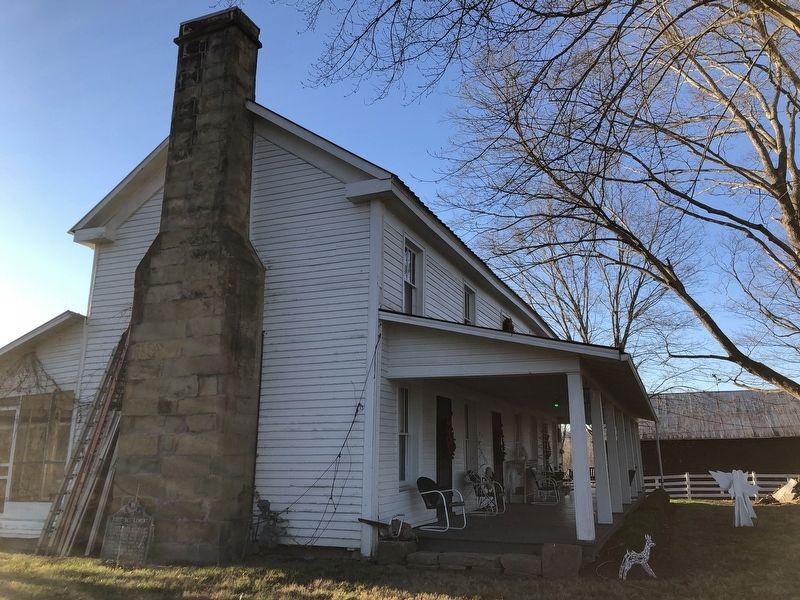
Location. 37° 44.672′ N, 83° 4.87′ W. Marker is near Salyersville, Kentucky, in Magoffin County. It can be reached from Licking Station Road 0.1 miles south of West Maple Street (U.S. 460), on the right when traveling south. Marker is in the Gardner Farmstead Historic Site. It is leaning against the chimney of the main house. Touch for map. Marker is in this post office area: Salyersville KY 41465, United States of America. Touch for directions.

Regionally, this marker is in Eastern Kentucky and in the Cumberland Plateau. It
this page online
Other nearby markers. At least 8 other markers are within 9 miles of this marker, measured as the crow flies: Ivy Point Skirmishes (about 800 feet away, measured in a direct line); a different marker also named First Settlement (approx. 0.2 miles away); Legends in Blue and Gray (approx. 0.8 miles away); Magoffin County Sesquicentennial Anniversary (approx. 0.9 miles away); County Named, 1860 (approx. 0.9 miles away); Wm. "Uncle Billie" Adams (approx. 0.9 miles away); Reuben Patrick Grave (approx. 4.6 miles away); Civil War Action (approx. 8.1 miles away). Touch for a list and map of all markers in Salyersville.
More about this marker. It previously was located at U.S. 460 and KY-7, but was replaced in 1994 by a nearly identical marker located about a quarter mile away.
Also see . . . Gardner Farmstead (PDF).
Photographed by Duane and Tracy Marsteller, November 19, 2022
2. First Settlement Marker
Marker is resting against the chimney.
Credits. This page was last revised on December 6, 2022. It was originally submitted on December 6, 2022, by Duane and Tracy Marsteller of Murfreesboro, Tennessee. This page has been viewed 563 times since then and 50 times this year. Photos: 1, 2. submitted on December 6, 2022, by Duane and Tracy Marsteller of Murfreesboro, Tennessee.
