
St. Augustine in St. Johns County, Florida — The American South (South Atlantic)
570 Christopher Street
ACCORD Freedom Trail
Photographed by Gwendolyn Duncan, February 24, 2008
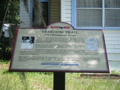
1. 570 Christopher Street Marker at the home of Rev. and Mrs. Roscoe Halyard
He was one of the group that convinced the Southern Christian Leadership Conference (SCLC) to come to St. Augustine in the Spring of 1964, and made the trip to Jacksonville to pick up Dr. Martin Luther King, Jr. at the airport.
The Halyards also provided lodging for people who came from around the country to support the civil rights efforts here. One of them was the famous author Sarah Patton Boyle (1906-1994) who wrote the Desegregated Heart (1962) and other books. A Virginian, and a cousin of General George S. Patton, was praised by Dr. King in his celebrated "Letter from the Birmingham Jail" for having written about our struggle in eloquent and prophetic terms."
Boyle was arrested, for the first time in her life, when attempting, as part of a racially integrated group, to be
this page online
This Historical Marker presented this 2nd Day of July, 2008 by: Northrop Grumman
Erected 2008.
Topics. This historical marker is listed in these topic lists: African Americans • Civil Rights • Notable Buildings • Religion & Religious Structures. A significant historical month for this entry is July 2008.
Location. 29° 53.269′ N, 81° 20.04′ W. Marker is in St. Augustine, Florida, in St. Johns County. It is on Christopher Street. Touch for map. Marker is at or near this postal address: 570 Christopher Street, Saint Augustine FL 32084, United States of America. Touch for directions.

Regionally, this marker is in First Coast and in Greater Jacksonville. It is also in the American South and on the Eastern Seaboard. Globally, it is in the North Atlantic Region, North America, a Gulf of Mexico state, the Western Hemisphere,
Photographed by James R. Murray, May 19, 2014
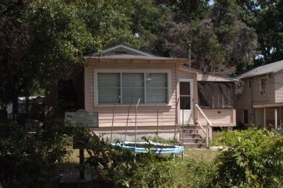
2. 570 Christopher Street Marker
The house as it appeared today. Apparently some small children live there now!
Other nearby markers. At least 8 other markers are within walking distance of this marker: 8 Dr. R.B. Hayling Place (about 700 feet away, measured in a direct line); S.D.W. Smith, Ancient City, Mt. Horeb #20 (approx. 0.2 miles away); Shiloh Missionary Baptist Church (approx. 0.2 miles away); 262 West King Street (approx. ¼ mile away); Zora Neale Hurston (approx. 0.4 miles away); Randolph Caldecott (approx. 0.4 miles away); 57 Chapin Street (approx. 0.4 miles away); Zion Baptist Church (approx. half a mile away). Touch for a list and map of all markers in St. Augustine.
Also see . . . ACCORD Freedom Trail. (Submitted on May 14, 2024.)
Credits. This page was last revised on May 14, 2024. It was originally submitted on July 28, 2009, by Gwendolyn Duncan of St. Augustine, Florida. This page has been viewed 1,546 times since then and 29 times this year. Photos: 1. submitted on July 28, 2009, by Gwendolyn Duncan of St. Augustine, Florida. 2. submitted on May 19, 2014, by James R. Murray of Elkton, Florida. • Kevin W. was the editor who published this page.
