
St. Cloud in Osceola County, Florida — The American South (South Atlantic)
Seminole Land Investment Company
St. Cloud Main Street
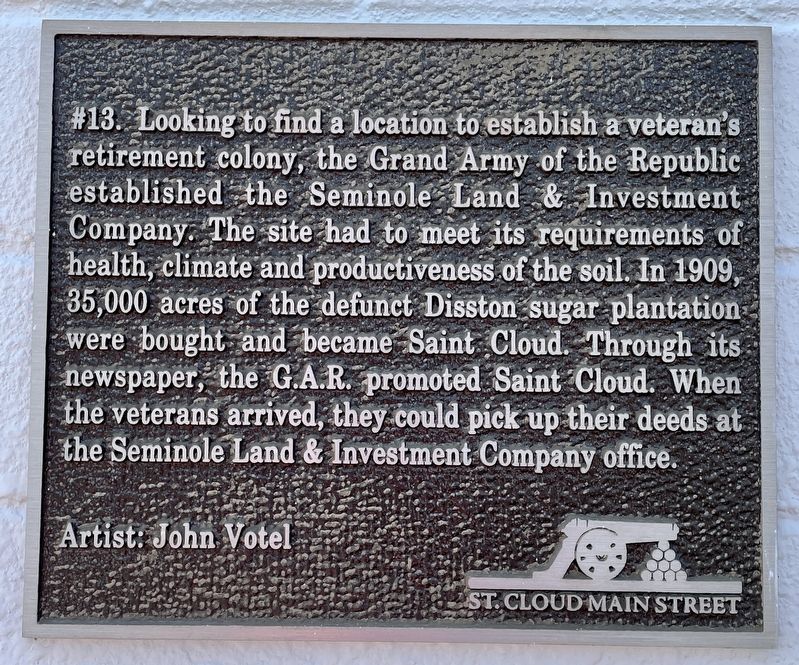
Photographed by Brandon D Cross, December 4, 2022
1. Seminole Land Investment Company Marker
Artist: John Votel
Erected by City of St. Cloud and St. Cloud Main Street Program (Marker Number 13 .). (Marker Number 13.)
Topics. This historical marker is listed in these topic lists: Fraternal or Sororal Organizations • War, US Civil. A significant historical year for this entry is 1909.
Location. 28° 14.941′ N, 81° 16.975′ W. Marker is in St. Cloud, Florida, in Osceola County. It is on 10th Street west of Pennsylvania Avenue, on the right when traveling west. This marker and its associated mural are included in the Historic Walking Tour of Downtown St. Cloud. Touch for map. Marker is at or near this postal
this page online

Regionally, this marker is in Greater Orlando and in Central Florida. It is also in the American South. Globally, it is in the North Atlantic Region, North America, a Gulf of Mexico state, the Western Hemisphere, the Western World, and the Anglosphere. Historically, it finds itself in what was once New Spain, the territory of the Mississippian Culture, one of the Confederate States of America, and the Antebellum South.
Other nearby markers. At least 8 other markers are within walking distance of this marker: War Heroes From The Past And Present (within shouting distance of this marker); The Saint Cloud Sugar Belt Railway (within shouting distance of this marker); Veterans of All Wars (within shouting distance of this marker); Joyland Beach and Bathing Beauties (within shouting distance of this marker); St. Cloud Veteran Fife and Drum Corps (within shouting distance of this marker); St. Cloud Roll of Honor World War One (within shouting distance of this marker); Sugar Belt Railway/VFW Post (within shouting distance of this
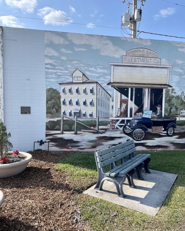
Photographed by Brandon D Cross, December 4, 2022
2. Seminole Land Investment Company Marker
Also see . . .
1. Historic Downtown Murals. (Submitted on December 9, 2022, by Brandon D Cross of Flagler Beach, Florida.)
2. St. Cloud Main Street Program. (Submitted on December 9, 2022, by Brandon D Cross of Flagler Beach, Florida.)
Credits. This page was last revised on December 9, 2022. It was originally submitted on December 9, 2022, by Brandon D Cross of Flagler Beach, Florida. This page has been viewed 720 times since then and 78 times this year. Photos: 1, 2. submitted on December 9, 2022, by Brandon D Cross of Flagler Beach, Florida. • Bernard Fisher was the editor who published this page.
