Hiawatha in Minneapolis in Hennepin County, Minnesota — The American Midwest (Upper Plains)
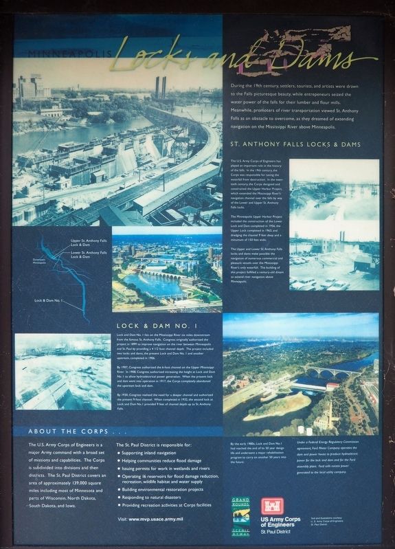
Minneapolis Locks and Dams
During the 19th century, settlers, tourists, and artists were drawn to the Falls picturesque beauty, while entrepreneurs seized the water power of the falls for their lumber and flour mills. Meanwhile, promoters of river transportation viewed St. Anthony Falls as an obstacle to overcome, as they dreamed of extending navigation on the Mississippi River above Minneapolis.
St. Anthony Falls Locks & Dams
The U.S. Army Corps of Engineers has played an important role in the history of the falls. In the 19th century, the Corps was responsible for saving the waterfall from destruction. In the twentieth century, the Corps designed and constructed the Upper Harbor Project, which extended the Mississippi River's navigation channel over the falls by way of the Lower and Upper St. Anthony Falls locks.
The Minneapolis Upper Harbor Project included the construction of the Lower Lock and Dam completed in 1956, the Upper Lock completed in 1963, and dredging the channel 9 feet deep and a minimum of 150 feet wide.
The Upper and Lower St. Anthony Falls locks and dams make possible the navigation of numerous commercial and pleasure vessels over the Mississippi River's only waterfall. The building of this project fulfilled a century-old dream to extend river navigation above Minneapolis.
Lock & Dam No. 1
Lock and Dam No. 1 lies on the Mississippi River six miles downstream from the famous St. Anthony Falls. Congress originally authorized the project in 1899 to improve navigation on the river between Minneapolis and St. Paul by providing a 4 1/2 foot channel depth. The project included two locks and dams, the present Lock and Dam No. 1 and another upstream, completed in 1906.
By 1907, Congress authorized the 6-foot channel on the Upper Mississippi River. In 1908, Congress authorized increasing the height at Lock and Dam No. 1 to allow hydroelectrical power generation. When the present lock and dam went into operation in 1917, the Corps completely abandoned the upstream lock and dam.
By 1930, Congress realized the need for a deeper channel and authorized the present 9-foot channel. When completed in 1932, the second lock at Lock and Dam No. 1 provided 9 feet of channel depth up to St. Anthony Falls.
About the Corps...
The U.S. Army Corps of Engineers is a major Army command with a broad set of missions and capabilities. The Corps is subdivided into divisions and then districts. The St. Paul District covers an area of approximately 139,000 square miles including most of Minnesota and parts of Wisconsin, North Dakota, South Dakota, and Iowa.
The St. Paul District is responsible for:
• Supporting inland navigation
• Helping communities reduce flood damage
• Issuing permits for work in wetlands and rivers
• Operating 16 reservoirs for flood damage reduction, recreation, wildlife habitat and water supply.
• Building environmental restoration projects
• Responding to natural disasters
• Providing recreation activities at Corps facilities
By the early 1980s, Lock and Dam No. 1 had reached the end of its 50 year design life and underwent a major rehabilitation program to carry on another 50 years into the future.
Under a Federal Energy Regulatory Commission agreement, Fort Motor Company operates the dam and power house to produce hydroelectric power for the lock and dam and for the Ford assembly plant. Ford sells excess power generated to the local utility company.
Erected by U.S. Army Corps of Engineers.
Topics. This historical marker is listed in this topic list: Waterways & Vessels. A significant historical year for this entry is 1899.
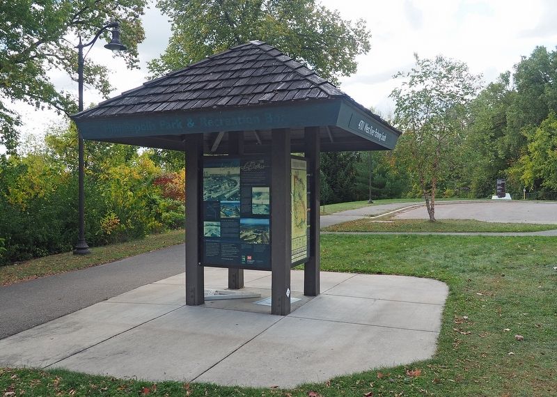
Location. 44° 55.187′ N, 93° 12.235′ W. Marker is in Minneapolis, Minnesota, in Hennepin County. It is in Hiawatha. Marker is at the intersection of West River Parkway and Godfrey Parkway, on the right when traveling north on West River Parkway. The marker is on a kiosk at the north end of the parking lot for Locks and Dam #1. Touch for map. Marker is at or near this postal address: 4701 W River Parkway S, Minneapolis MN 55406, United States of America. Touch for directions.
Other nearby markers. At least 8 other markers are within walking distance of this marker. The Winchell Trail (approx. ¼ mile away); Big Water / Stairway of Water (approx. 0.3 miles away); Wing Dams (approx. 0.3 miles away); Mississippi River Gorge (approx. 0.4 miles away); The Lock and Dam No. 1 Story (approx. 0.4 miles away); 1–Main Entrance Minnehaha Lower Glen (approx. 0.4 miles away); Geology of Minnesota (approx. 0.4 miles away); 3 – Master Map (approx. 0.4 miles away). Touch for a list and map of all markers in Minneapolis.
Credits. This page was last revised on February 12, 2023. It was originally submitted on December 9, 2022, by McGhiever of Minneapolis, Minnesota. This page has been viewed 88 times since then and 9 times this year. Photos: 1, 2. submitted on December 9, 2022, by McGhiever of Minneapolis, Minnesota. • J. Makali Bruton was the editor who published this page.

