Florence in Lauderdale County, Alabama — The American South (East South Central)
Removal
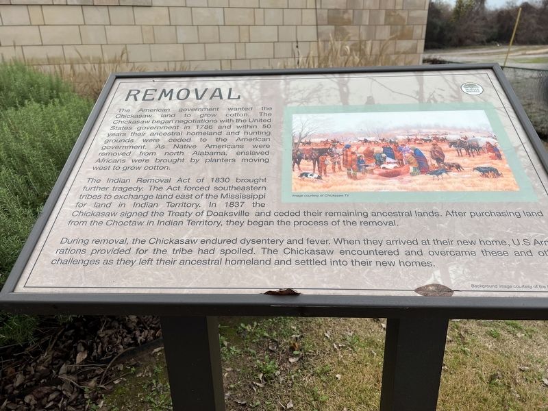
The American government wanted the Chickasaw land to grow cotton. The Chickasaw began negotation with the United States government in 1786 and within 50 years their ancestral homeland and hunting grounds were cederd to the American government. As Native Americans were removed from north Alabama, enslaved Africans were brought by planters moving west to grow cotton.
The Indian Removal Act of 183 brought further tragedy. The act forced southeastern tribes to exchange land east of the Mississippi for land in Indian Territory. In 1837 the Chickasaw signed the Treaty of Doaksville and ceded their remaining ancestral lands. After purchasing land from the Choctaw in Indian Territory, they began the process of the removal.
During removal, the Chickasaw endured dysentery and fever. When they arrived at their new home, U.S. Army rations provided for the tribe had spoiled. The Chickasaw encountered and overcame these and other challenges as they left their ancestral homeland and settled into their new homes.
Topics. This historical marker is listed in these topic lists: Agriculture • Native Americans • Settlements & Settlers. A significant historical year for this entry is 1786.
Location. 34° 47.437′ N, 87° 40.216′ W. Marker is in Florence, Alabama, in Lauderdale County . Marker can be reached from the intersection of South Court Street and Canal Street, on the right when traveling south. Touch for map. Marker is at or near this postal address: 1028 S Court St, Florence AL 35630, United States of America. Touch for directions.
Other nearby markers. At least 8 other markers are within walking distance of this marker. Adaptation (here, next to this marker); Culture (here, next to this marker); Continuity (here, next to this marker); Florence Indian Mound (a few steps from this marker); Prehistoric Mound (within shouting distance of this marker); Florence Little League Baseball (1951) (approx. ¼ mile away); Church Spring Church and School (approx. 0.4 miles away); Prehistoric Native Americans / Historic Native Americans (approx. 0.4 miles away). Touch for a list and map of all markers in Florence.
Credits. This page was last revised on December 12, 2022. It was originally submitted on December 10, 2022, by Sandra Hughes Tidwell of Killen, Alabama, USA. This page has been viewed 120 times since then and 26 times this year. Photo 1. submitted on December 10, 2022, by Sandra Hughes Tidwell of Killen, Alabama, USA. • Devry Becker Jones was the editor who published this page.
Editor’s want-list for this marker. A wide shot of the marker in context. • Can you help?
