Spring Hill in Maury County, Tennessee — The American South (East South Central)
Oaklawn
The Absalom Thompson House
| — | Hood's Headquarters | — |
Photographed by Don Morfe, April 23, 2014
1. Oaklawn Marker
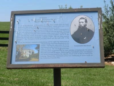
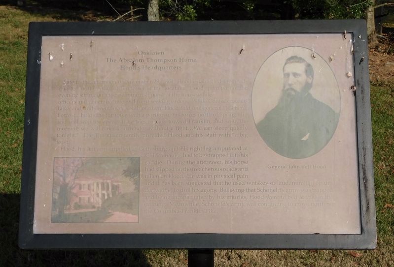
Late in the afternoon of November 29, 1864, Hood established the headquarters of the Army of Tennessee at this location. Hood spent part of the evening sitting on a log near the fish pond of the house while officers and generals came and went seeking orders. While Confederate attacks and units went awry south of town, Hood told one general, “General Forrest…holds the turnpike with a portion of his forces north of Spring Hill and will stop the enemy if he tries to pass toward Franklin, and so in the morning we will have a surrender without a fight…We can sleep quietly tonight.” The Thompson family provided Hood and his staff with “a big feast.”
Hood, his left arm crippled at Gettysburg and his right leg amputated at Chickamauga, had to be strapped into his saddle. During the afternoon, his horse had slipped on the treacherous roads and fallen on Hood. He was in physical pain and it has been suggested that he used whiskey or laundanum (an opium derivative) to dull his agony. Believing that Schofield’s army was trapped and being incapacitated by his injuries, Hood went to bed at 9:00 in the evening. Meanwhile, Schofield’s
this page online
Topics. This historical marker is listed in this topic list: War, US Civil. A significant historical date for this entry is November 29, 1864.
Location. 35° 43.141′ N, 86° 55.795′ W. Marker has been reported unreadable. Marker is in Spring Hill, Tennessee, in Maury County. It is on Denning Lane 0.4 miles west of Kedron Road, on the right when traveling west. The marker is located outside of the gate to the entrance to the house. Touch for map. Marker is at or near this postal address: 3331 Denning Lane, Spring Hill TN 37174, United States of America. Touch for directions.

Regionally, this marker is in Middle Tennessee and in Greater Nashville. It is also in the American South and specifically in the Upper South. Globally, it is in North America, the Western Hemisphere, the Western World, and the Anglosphere. Historically, it finds itself in what was once the territory of the Mississippian Culture, one of the Confederate States of America, and the Antebellum South.
Other nearby markers. At least 8 other markers are within 2 miles of this location, measured as the crow flies:

Photographed by Don Morfe, April 23, 2014
2. Oaklawn Marker
Another marker is no longer nearby. The Battle of Spring Hill (was approx. 1.4 miles away but has been replaced with another marker now near it).
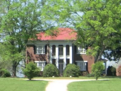
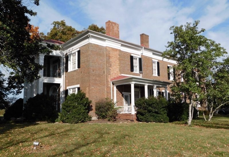
Regarding Oaklawn. Historic Oaklawn Plantation: History states Oaklawn has been placed on the National Register of Historic Places by the United States Department of the Interior, built circa 1835. It also states that it was the home of George Jones and Tammy Wynette for a short while.
Photographed by Bradley Owen, October 22, 2022
3. Oaklawn Marker
The marker background color has been changed and is significantly unreadable.
Photographed by Don Morfe, April 23, 2014
4. Oaklawn Plantaton-The Absalom Thompson House
Photographed by Bradley Owen, October 22, 2022
5. Oaklawn Plantaton-The Absalom Thompson House
Credits. This page was last revised on December 12, 2022. It was originally submitted on July 5, 2014, by Don Morfe of Baltimore, Maryland. This page has been viewed 1,390 times since then and 94 times this year. Last updated on December 11, 2022, by Bradley Owen of Morgantown, West Virginia. Photos: 1, 2. submitted on July 5, 2014, by Don Morfe of Baltimore, Maryland. 3. submitted on December 11, 2022, by Bradley Owen of Morgantown, West Virginia. 4. submitted on July 5, 2014, by Don Morfe of Baltimore, Maryland. 5. submitted on December 11, 2022, by Bradley Owen of Morgantown, West Virginia. • Devry Becker Jones was the editor who published this page.
