Port Huron in St. Clair County, Michigan — The American Midwest (Great Lakes)
Fort St. Joseph
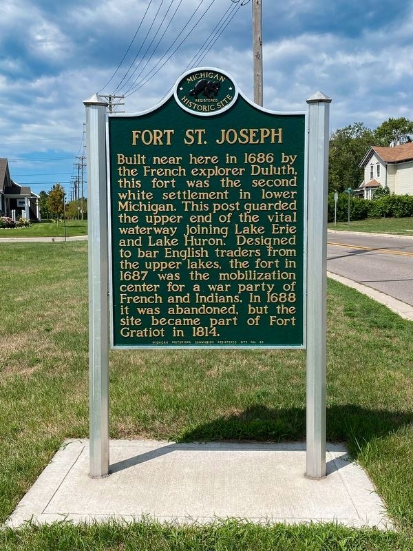
Photographed by J.T. Lambrou, August 15, 2022
1. Fort St. Joseph Marker
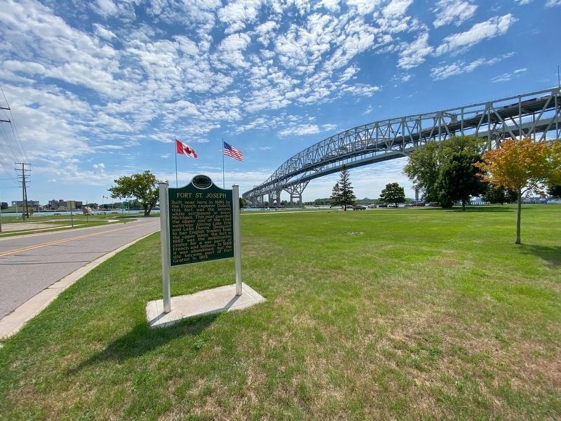
This photo of the marker was taken in its new location.
Built near here in 1686 by the French explorer Duluth, this fort was the second white settlement in lower Michigan. This post guarded the upper end of the vital waterway joining Lake Erie and Lake Huron. Designed to bar English traders from the upper lakes, the fort in 1687 was the mobilization center for a war party of French and Indians. In 1688 it was abandoned, but the site became part of Fort Gratiot in 1814.
Erected 1957 by Michigan Historical Commission. (Marker Number 80.)
Topics and series. This historical marker is listed in these topic lists: Colonial Era • Forts and Castles • Settlements & Settlers • War, French and Indian. In addition, it is included in the Michigan Historical Commission series list. A significant historical year for this entry is 1686.
Location. 43° 0.028′ N, 82° 25.547′ W. Marker is in Port Huron, Michigan, in St. Clair County. It is on Elmwood Street just north of Forest Avenue, on the right when traveling east. The marker was moved to the south side of Elmwood west of Thomas Edison Parkway. Touch for map. Marker is at or near this postal address: 540 Elmwood Street,
this page online

Regionally, this marker is in Southeast Michigan and in one of the Lake Huron Shore counties. It is also in the American Midwest. Globally, it is in North America, on the Great Lakes, in the Western Hemisphere, in the Western World, and in the Anglosphere. Historically, it finds itself in what was once the Northwest Territory.
Other nearby markers. At least 8 other markers are within walking distance of this marker: Native American Monument (about 300 feet away, measured in a direct line); The "John S. Martin" (about 300 feet away); Great Storm of 1913 and Sailors Memorial (about 400 feet away); The Tuskegee Airmen Memorial (about 400 feet away); Tom Edison at Grand Trunk (about 600 feet away); Native Americans (about 600 feet away); Ships on the St. Clair (about 600 feet away); Immigration (about 600 feet away). Touch for a list and map of all markers in Port Huron.
Also see . . .
1. Fort St. Joseph (Port Huron). Wikipedia entry (Submitted on September 11, 2024, by Larry Gertner of New York, New York.)
2. Fort St. Joseph Archaeological Project.
Photographed by Jenn Wintermantel, March 26, 2011
2. Fort St. Joseph Marker
3. Fort St. Joseph marker moved to better location. Times Herald article from October 7, 2016 stating that the "state historical marker commemorating Fort St. Joseph is now on the south side of Elmwood Street, across from the International Flag Plaza. The sign previously had been at Gratiot Park on Gratiot Avenue." The article also indicates that "the sign has been in its new location for about two weeks." (Submitted on January 27, 2022, by Joel Seewald of Madison Heights, Michigan.)
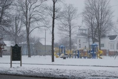
Photographed by Jenn Wintermantel, March 26, 2011
3. Fort St. Joseph Marker and Gratiot Park
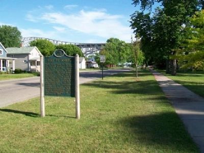
Photographed by William Fischer, Jr., July 5, 2014
4. Fort Saint Joseph Marker
(original location)
Photographed by J.T. Lambrou, August 15, 2022
5. Fort St. Joseph Marker
This photo of the marker shows it at its new location on Elmwood Street looking at the International Flag Plaza.
Credits. This page was last revised on September 11, 2024. It was originally submitted on March 27, 2011. This page has been viewed 2,141 times since then and 166 times this year. Last updated on December 16, 2022. Photos: 1. submitted on September 1, 2022, by J.T. Lambrou of New Boston, Michigan. 2, 3. submitted on March 27, 2011, by Mike Wintermantel of Pittsburgh, Pennsylvania. 4. submitted on August 4, 2014, by William Fischer, Jr. of Reynoldsburg, Ohio. 5. submitted on September 1, 2022, by J.T. Lambrou of New Boston, Michigan. • J. Makali Bruton was the editor who published this page.
