Near Dundee in Monroe County, Michigan — The American Midwest (Great Lakes)
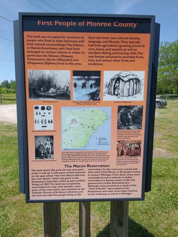
First People of Monroe County
This land was occupied for centuries by people who lived in close harmony with their natural surroundings. The Indians, or Native Americans, who lived here belonged to various nations or tribes. In particular, the Ottawa (Odawa), Potawatomi, Huron (Wyandot) and Chippewas (Ojibwa) lived in this area. First People of Monroe County Each had their own cultural identity, language, and lifestyle. They typically had both agriculture (growing primarily corn, beans, and squash) as well as excellent fishing and hunting skills. The vast forests and prairies provided fruits, nuts, and various other foods and medicines.
The Macon Reservation
The land where this park sits was once part of the 3 mile by 3 mile piece of land centered on the spot where "the river Macon falls into the river Raisin” which was given to the Potawatomi and other tribes as part of Hull's Treaty of 1807. The land was occupied by local Indians for only a few decades, when parts of the reservation were donated to the Catholic Church of St. Anne in Detroit, and the rest was sold. The people living on the reservation, for the most part, moved with their chief, Chief Moran, to St. Joseph County in western Michigan. From there, many were eventually forced to relocate to Indian reservations in Kansas as part of the U.S. government's Indian Relocation Act. Although many perished as a result of this "Trail of Death,” descendants of the Potawatomi and other local tribes continue to live in Kansas, as well as in Michigan. [Captions:]
Canoes were important for hunting, fishing, and transportation
Native Americans lived in close harmony with nature. Women typically cared for the young and tended crops, while the men hunted and fished.
The local native people had a reputation for having peaceful villages and expert knowledge of hunting, fishing, and wild foods and medicines.
This map shows the approximate location of some of the many Native American villages and trails from the Late Woodland period (500-1000 AD). Many Native American artifacts have been found in Monroe County, but unfortunately many sites have been destroyed. Burial grounds in particular should be protected and respected, as they are considered by many to be sacred sites.
Topics. This historical marker is listed in these topic lists: Anthropology & Archaeology • Churches & Religion • Native Americans • Settlements & Settlers. A significant historical year for this entry is 1807.
Location. 41° 57.758′ N, 83° 37.909′ W. Marker is near Dundee, Michigan, in Monroe County. Marker can be reached from Rightmire Road, half a mile east of Stowell Road, on the right when traveling north. Touch for map. Marker is at or near this postal address: 14003 Rightmire Rd, Dundee MI 48131, United States of America. Touch for directions.
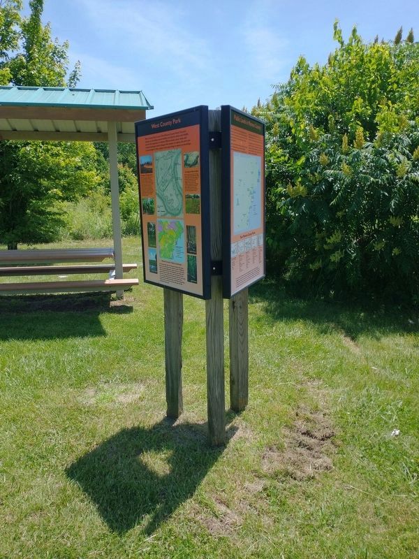
Other nearby markers. At least 8 other markers are within 2 miles of this marker, measured as the crow flies. West County Park (here, next to this marker); The River Raisin (here, next to this marker); Macon Indian Reserve (approx. 1.2 miles away); Macon Reservation Unit (approx. 1˝ miles away); Old Mill Museum (approx. 1˝ miles away); Dundee's Old Mill (approx. 1˝ miles away); The Old Village Jail (approx. 1˝ miles away); The Mill or Grist Stone (approx. 1˝ miles away). Touch for a list and map of all markers in Dundee.
Credits. This page was last revised on December 21, 2022. It was originally submitted on July 8, 2022, by Craig Doda of Napoleon, Ohio. This page has been viewed 250 times since then and 76 times this year. Last updated on December 20, 2022, by J.T. Lambrou of New Boston, Michigan. Photos: 1, 2. submitted on July 8, 2022, by Craig Doda of Napoleon, Ohio. • J. Makali Bruton was the editor who published this page.

