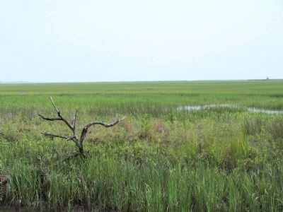
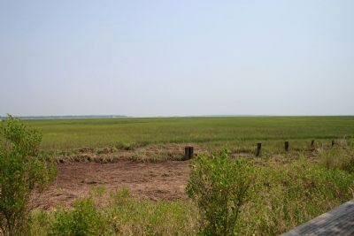
Parris Island in Beaufort County, South Carolina — The American South (South Atlantic)
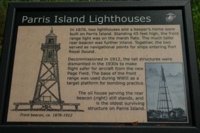
Parris Island Lighthouses
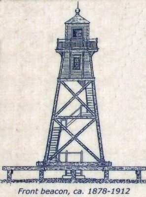
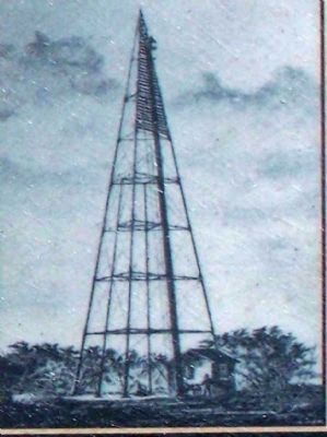
Decommissioned in 1912, the tall structures were dismantled in the 1930s to make flight safer for aircraft from the new Page Field. The base of the front range was used during WWII as the target platform for bombing practice.
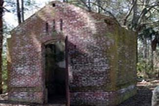
The oil house serving the rear beacon (right) still stands, and is the oldest surving structure on Parris Island.
Erected by U.S. Marine Corps Recruit Depot Parris Island.
Topics and series. This historical marker is listed in these topic lists: Landmarks • War, World II • Waterways & Vessels. In addition, it is included in the Lighthouses series list. A significant historical year for this entry is 1878.
Location. 32° 18.344′ N, 80° 40.542′ W. Marker is on Parris Island, South Carolina, in Beaufort County. Marker can be reached from Balleau Wood Road. Located off Balleau Wood Road Circle, south hiking trail. Touch for map. Marker is in this post office area: Parris Island SC 29905, United States of America. Touch for directions.
Other nearby markers. At least 8 other markers are within walking distance of this marker. A different marker also named Parris Island Lighthouses (a few steps from this marker); Aqui Estuvo España (within shouting distance of this marker); Parris Island Indians (within shouting distance of this marker); The First Inhabitants (within shouting distance of this marker); Battle of Port Royal (within shouting distance of this marker); Jean Ribault Monument (within shouting distance of this marker); Fort San Marcos (within shouting distance of this marker); Parris Island Plantations (within shouting distance of this marker). Touch for a list and map of all markers in Parris Island.
Also see . . .
1. Lighthouse friends. Parris Island, SC Lights (Submitted on July 31, 2009, by Mike Stroud of Bluffton, South Carolina.)
2. The Parris Island Range Lights. (Submitted on July 31, 2009, by Mike Stroud of Bluffton, South Carolina.)
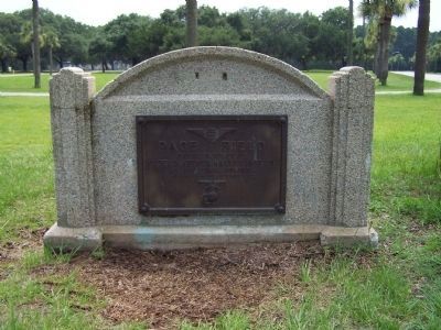
Photographed By Mike Stroud, June 26, 2009
7. Page Field ( marker ) as mentioned
Page Field
Named in honor of
Captain Arthur Hallet Page, Jr.
Marine Corps Aviation
January 16, 1918 to September 1, 1930
A variety of aircraft used Page Field, including Navy dirigibles, Corsairs, Wildcats, and B-25 bombers. It was also home to a glider squadron and a barrage balloon detachment. Deactivated after World War II, the field served as an emergency landing strip for some years. Today, Page Field is part of the Weapons and Field Training Battalion. Since 1996, the former airstip has been the site for Basic Warrior Training and the Crucible.
A variety of aircraft used Page Field, including Navy dirigibles, Corsairs, Wildcats, and B-25 bombers. It was also home to a glider squadron and a barrage balloon detachment. Deactivated after World War II, the field served as an emergency landing strip for some years. Today, Page Field is part of the Weapons and Field Training Battalion. Since 1996, the former airstip has been the site for Basic Warrior Training and the Crucible.
Credits. This page was last revised on June 16, 2016. It was originally submitted on July 31, 2009, by Mike Stroud of Bluffton, South Carolina. This page has been viewed 1,107 times since then and 22 times this year. Photos: 1, 2, 3, 4, 5, 6, 7. submitted on July 31, 2009, by Mike Stroud of Bluffton, South Carolina. • Craig Swain was the editor who published this page.
