
Ocracoke in Hyde County, North Carolina — The American South (South Atlantic)
The Blanche
A Traditional 1934 Ocracoke Fishing Boat
| — | Donated by James Barrie Gaskill | — |
Photographed by Tom Bosse, September 20, 2021
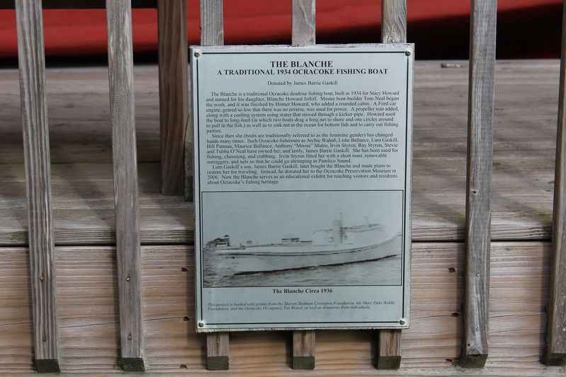
1. The Blanche Marker
Since then she (boats are traditionally referred to as the feminine gender) has changed hands many times such Ocracoke fishermen as Archie Wahab, Lishe Balance, Lum Gaskill, Bill Patman, Maurice Balance, Anthony “Moose” Mutro, Irvin Styron, Ray Styron, Stevie and Tubba O’Neal, have owned her, and lastly, James Barrie Gaskill. She has been used for fishing, clamming, and crabbing. Irvin Styron fitted her with a short mast, removable outriggers, and nets so that he could go shrimping in Pamlico
this page online
Lum Gaskill’s son, James Barrie Gaskill, later bought the Blanche and made plans to restore her for traveling. Instead, he donated her to the Ocracoke Preservation Museum in 2006. Now the Blanche serves as an educational exhibit for teaching visitors and residents about Ocracoke’s fishing heritage.
[Caption]: The Blanche Circa 1936
This project is funded with grants from the Marion Stedman Covington Foundation, the Mary Duke Biddle Foundation, and the Ocracoke occupancy Tax Board, as well as donations from individuals.
Erected by Ocracoke Preservation Society Museum.
Topics. This historical marker is listed in these topic lists: Industry & Commerce • Waterways & Vessels. A significant historical year for this entry is 1934.
Location. 35° 7.008′ N, 75° 59.076′ W. Marker is in Ocracoke, North Carolina, in Hyde County. It is on NPS Road, on the left when traveling north. Marker located on the grounds of the Ocracoke Preservation Society Museum. Touch for map. Marker is in this post office area: Ocracoke NC 27960, United States of America. Touch for directions.

Regionally, this marker is in North Carolina’s
Photographed by Tom Bosse, September 20, 2021
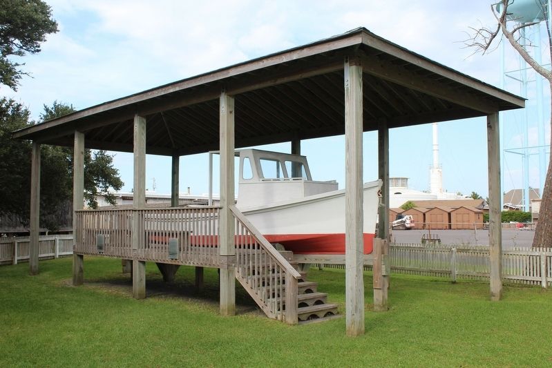
2. The Blanche Marker
The boat pictured is the Blanche. Marker is on the right.
Other nearby markers. At least 8 other markers are within walking distance of this marker: Teach's Hole (here, next to this marker); Ocracoke’s Commercial Fishing Heritage (here, next to this marker); Late 19th Century Cistern (a few steps from this marker); Ocracoke Windmills (a few steps from this marker); Ship's Rudder (a few steps from this marker); Welcome to Ocracoke… (a few steps from this marker); USRC Mercury (about 400 feet away, measured in a direct line); Lt. Robert Maynard (about 400 feet away). Touch for a list and map of all markers in Ocracoke.
Credits. This page was last revised on December 25, 2022. It was originally submitted on December 24, 2022, by Tom Bosse of Jefferson City, Tennessee. This page has been viewed 272 times since then and 15 times this year. Photos: 1, 2. submitted on December 24, 2022, by Tom Bosse of Jefferson City, Tennessee. • Andrew Ruppenstein was the editor who published this page.
