Ocracoke in Hyde County, North Carolina — The American South (South Atlantic)
Ship's Rudder
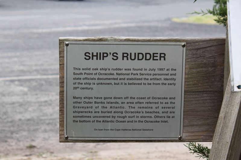
This solid oak ship's rudder was found in July 1997 at the South Point of Ocracoke. National Park Service personnel and state officials documented and stabilized the artifact. Identity of the ship is unknown, but it is believed to be from the early 20th century.
Many ships have gone down off the coast of Ocracoke and other Outer Banks islands, an area often referred to as the Graveyard of the Atlantic. The remains of several shipwrecks are buried along Ocracoke's beaches, and are sometimes uncovered by rough surf in storms. Others lie at the bottom of the Atlantic Ocean and in the Ocracoke Inlet.
On loan from the Cape Hatteras National Seashore.
Erected by Ocracoke Preservation Society Museum.
Topics. This historical marker is listed in this topic list: Waterways & Vessels. A significant historical month for this entry is July 1997.
Location. 35° 6.997′ N, 75° 59.08′ W. Marker is in Ocracoke, North Carolina, in Hyde County. Marker is on NPS Road, on the left when traveling north. The marker is located on the grounds of the Ocracoke Preservation Society Museum. Touch for map. Marker is in this post office area: Ocracoke NC 27960, United States of America. Touch for directions.
Other nearby markers. At least 8 other markers are within walking distance of this marker. Ocracoke Windmills (here, next to this marker); Welcome to Ocracoke… (here, next to this marker); Late 19th Century Cistern (a few steps from this marker); The Blanche (a few steps from this marker); Ocracoke’s Commercial Fishing Heritage (within shouting distance of this marker); USRC Mercury (about 300 feet away, measured in a direct line); Lt. Robert Maynard (about 300 feet away); Harboring Change (about 400 feet away). Touch for a list and map of all markers in Ocracoke.
Credits. This page was last revised on December 24, 2022. It was originally submitted on December 24, 2022, by Tom Bosse of Jefferson City, Tennessee. This page has been viewed 81 times since then and 12 times this year. Photos: 1, 2, 3. submitted on December 24, 2022, by Tom Bosse of Jefferson City, Tennessee. • J. Makali Bruton was the editor who published this page.


