Coal Mountain in Forsyth County, Georgia — The American South (South Atlantic)
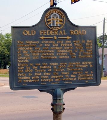
Old Federal Road
<------->
Rights to use the route were granted informally by the Indians in 1803 and formally in the 1805 Treaty of Tellico, Tennessee.
Prior to that time the trace served as a trading path from Augusta to the Cherokees of northwest Georgia and southeast Tennessee.
Erected 1954 by Georgia Historical Commission. (Marker Number 058-1.)
Topics and series. This historical marker is listed in these topic lists: Native Americans • Roads & Vehicles. In addition, it is included in the Georgia Historical Society series list. A significant historical year for this entry is 1803.
Location. 34° 16.295′ N, 84° 6.059′ W. Marker is in Coal Mountain, Georgia, in Forsyth County. Marker is at the intersection of Dahlonega Highway (Georgia Route 9) and Browns Bridge Road (Georgia Route 369), on the left when traveling north on Dahlonega Highway. Touch for map. Marker is in this post office area: Cumming GA 30040, United States of America. Touch for directions.
Other nearby markers. At least 8 other markers are within 9 miles of this marker, measured as the crow flies. Cumming School (approx. 4.9 miles away); Colonel William Cumming (approx. 5 miles away); Forsyth County (approx. 5 miles away); Lynching in America / Lynching in Forsyth County (approx. 5 miles away); Forsyth County Courthouse Cornerstone Removed (approx. 5 miles away); Forsyth County War Memorial (approx. 5 miles away); Cumming Historic Cemetery (approx. 5.1 miles away); Poole's Mill Covered Bridge (approx. 8.2 miles away).
Credits. This page was last revised on January 26, 2020. It was originally submitted on July 31, 2009, by David Seibert of Sandy Springs, Georgia. This page has been viewed 1,566 times since then and 67 times this year. Photo 1. submitted on July 31, 2009, by David Seibert of Sandy Springs, Georgia. • Craig Swain was the editor who published this page.
